Garmin GPSMAP 496 Owner's Manual (for Europe) - Page 147
Learning About GPS, What is EGNOS/WAAS/MSAS? - european
 |
View all Garmin GPSMAP 496 manuals
Add to My Manuals
Save this manual to your list of manuals |
Page 147 highlights
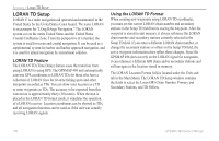
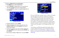
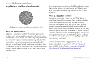
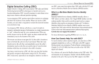
Learning About GPS The Global Positioning System (GPS) is a satellite-based navigation system made up of a network of 24 satellites placed into orbit by the United States Department of Defense. GPS was originally intended for military applications, but in the 1980s, the government made the system available for civilian use. GPS works in any weather conditions, anywhere in the world, 24 hours a day. There are no subscription fees or setup charges to use GPS. For more information refer to the Garmin Web site at www.garmin.com and also read the GPS Guide for Beginners, which can be found on the Web site at www.garmin.com/aboutGPS/ manual.html. Appendix > Learning about GPS What is EGNOS/WAAS/MSAS? The European Geostationary Navigation Overlay System (EGNOS) is European Space Agency developed service to improve the overall integrity of the GPS signal and increase position accuracy for users in Europe. In North America, EGNOS is referred to as WAAS. The system is made up of satellites and network of ground reference stations positioned across Europe that monitor GPS satellite data. All SBAS systems use the same receiver frequency; therefore any operational SBAS system should be capable of providing your GPS unit with increased accuracy at any location in the world. Currently, enabling EGNOS/WAAS on your Garmin GPSMAP 496 in regions that are not supported by ground stations may not improve accuracy, even when receiving signals from an SBAS satellite. In fact, it can degrade the accuracy to less than that provided by GPS satellites alone. For this reason, when you enable EGNOS/WAAS on your Garmin GPS receiver, the receiver automatically uses the method that achieves the best accuracy. To enable EGNOS/WAAS, refer to page 6. GPSMAP 496 Owner's Manual 139
-
 1
1 -
2
-
3
-
4
-
5
-
6
-
7
-
8
-
9
-
10
-
11
-
12
-
13
-
14
-
15
-
16
-
17
-
18
-
19
-
20
-
21
-
22
-
23
-
24
-
25
-
26
-
27
-
28
-
29
-
30
-
31
-
32
-
33
-
34
-
35
-
36
-
37
-
38
-
39
-
40
-
41
-
42
-
43
-
44
-
45
-
46
-
47
-
48
-
49
-
50
-
51
-
52
-
53
-
54
-
55
-
56
-
57
-
58
-
59
-
60
-
61
-
62
-
63
-
64
-
65
-
66
-
67
-
68
-
69
-
70
-
71
-
72
-
73
-
74
-
75
-
76
-
77
-
78
-
79
-
80
-
81
-
82
-
83
-
84
-
85
-
86
-
87
-
88
-
89
-
90
-
91
-
92
-
93
-
94
-
95
-
96
-
97
-
98
-
99
-
100
-
101
-
102
-
103
-
104
-
105
-
106
-
107
-
108
-
109
-
110
-
111
-
112
-
113
-
114
-
115
-
116
-
117
-
118
-
119
-
120
-
121
-
122
-
123
-
124
-
125
-
126
-
127
-
128
-
129
-
130
-
131
-
132
-
133
-
134
-
135
-
136
-
137
-
138
-
139
-
140
-
141
-
 142
142 -
 143
143 -
 144
144 -
 145
145 -
 146
146 -
 147
147 -
 148
148 -
 149
149 -
 150
150 -
 151
151 -
 152
152 -
153
-
154
-
155
-
156
-
157
-
158
-
159
-
160
-
161
-
162
-
163
-
164
 |
 |