Garmin GPSMAP 696 Owner's Manual - Page 183
Additional Features, 5.1 SafeTaxi, SAFETAXI - - americas
 |
View all Garmin GPSMAP 696 manuals
Add to My Manuals
Save this manual to your list of manuals |
Page 183 highlights
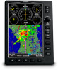
Overview GPS Navigation Additional Features SECTION 5 ADDITIONAL FEATURES NOTE: With the availability of electronic documents/charts (i.e., SafeTaxi, Checklists, FliteCharts®, or ChartView (optional)), it is still advisable to carry another source of charts on board the aircraft. The following additional features are supported depending on the unit (Americas, Atlantic, or Pacific). Unit Feature GPSMAP 696 GPSMAP 695 Americas GPSMAP 695 Atlantic GPSMAP 695 Pacific Flight Planning Hazard Avoidance Additional Features Appendices Airport Directory Data + + ChartView + + FliteCharts® + + SafeTaxi® + + SiriusXM® + Electronic Checklists + + Additional Features ++ ++ ++ 5.1 SAFETAXI SafeTaxi is an enhanced feature that gives greater map detail when viewing airports at close range. When viewing at ranges close enough to show the airport detail, the map reveals taxiways with identifying letters/numbers, runway incursion "Hot Spot", and airport landmarks including ramps, buildings, control towers, and other prominent features. Resolution is greater at lower map ranges. The SafeTaxi feature can be seen on the Map Page and the Waypoint Page 190-00919-00 Rev. G Garmin GPSMAP 695/696 Owner's Manual 167 Index
-
 1
1 -
2
-
3
-
4
-
5
-
6
-
7
-
8
-
9
-
10
-
11
-
12
-
13
-
14
-
15
-
16
-
17
-
18
-
19
-
20
-
21
-
22
-
23
-
24
-
25
-
26
-
27
-
28
-
29
-
30
-
31
-
32
-
33
-
34
-
35
-
36
-
37
-
38
-
39
-
40
-
41
-
42
-
43
-
44
-
45
-
46
-
47
-
48
-
49
-
50
-
51
-
52
-
53
-
54
-
55
-
56
-
57
-
58
-
59
-
60
-
61
-
62
-
63
-
64
-
65
-
66
-
67
-
68
-
69
-
70
-
71
-
72
-
73
-
74
-
75
-
76
-
77
-
78
-
79
-
80
-
81
-
82
-
83
-
84
-
85
-
86
-
87
-
88
-
89
-
90
-
91
-
92
-
93
-
94
-
95
-
96
-
97
-
98
-
99
-
100
-
101
-
102
-
103
-
104
-
105
-
106
-
107
-
108
-
109
-
110
-
111
-
112
-
113
-
114
-
115
-
116
-
117
-
118
-
119
-
120
-
121
-
122
-
123
-
124
-
125
-
126
-
127
-
128
-
129
-
130
-
131
-
132
-
133
-
134
-
135
-
136
-
137
-
138
-
139
-
140
-
141
-
142
-
143
-
144
-
145
-
146
-
147
-
148
-
149
-
150
-
151
-
152
-
153
-
154
-
155
-
156
-
157
-
158
-
159
-
160
-
161
-
162
-
163
-
164
-
165
-
166
-
167
-
168
-
169
-
170
-
171
-
172
-
173
-
174
-
175
-
176
-
177
-
 178
178 -
 179
179 -
 180
180 -
 181
181 -
 182
182 -
 183
183 -
 184
184 -
 185
185 -
 186
186 -
 187
187 -
 188
188 -
189
-
190
-
191
-
192
-
193
-
194
-
195
-
196
-
197
-
198
-
199
-
200
-
201
-
202
-
203
-
204
-
205
-
206
-
207
-
208
-
209
-
210
-
211
-
212
-
213
-
214
-
215
-
216
-
217
-
218
-
219
-
220
-
221
-
222
-
223
-
224
-
225
-
226
-
227
-
228
-
229
-
230
-
231
-
232
-
233
-
234
-
235
-
236
-
237
-
238
-
239
-
240
-
241
-
242
-
243
-
244
-
245
-
246
-
247
-
248
-
249
-
250
-
251
-
252
-
253
-
254
-
255
-
256
-
257
-
258
-
259
-
260
-
261
-
262
-
263
-
264
-
265
-
266
-
267
-
268
-
269
-
270
-
271
-
272
-
273
-
274
-
275
-
276
-
277
-
278
-
279
-
280
 |
 |
