Garmin RV 770 LMT-S Owners Manual - Page 12
Parking, Search Tools, Foursquare
 |
View all Garmin RV 770 LMT-S manuals
Add to My Manuals
Save this manual to your list of manuals |
Page 12 highlights
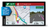
1 Select Where To?. 2 Select . 3 Select an option. Parking Your RV 770 device includes detailed parking data, which can help you find nearby parking based on the likelihood of available parking spots, type of parking area, price, or accepted payment methods. In some areas, live parking data is available while your RV 770 device is connected to Smartphone Link (Pairing with Your Phone and Connecting to Smartphone Link, page 11). While your device is receiving live parking data, you can view real-time parking trends. NOTE: Detailed parking data is not available in all areas or for all parking locations. Garmin is not responsible for the accuracy or timeliness of live parking data. Finding Parking Near Your Current Location 1 Select Where To? > Categories > Parking. 2 Select Filter Parking, and select one or more categories to filter parking by availability, type, price, or payment methods (optional). NOTE: Detailed parking data is not available in all areas or for all parking locations. 3 Select a parking location. 4 Select Go!. Finding Parking Near a Specified Location 1 Search for a location. 2 From the location search results, select a location. 3 Select . A list of parking areas near the selected location appears. 4 Select Filter Parking, and select one or more categories to filter parking by availability, type, price, or payment methods (optional). NOTE: Detailed parking data is not available in all areas or for all parking locations. 5 Select a parking location. 6 Select Go!. Understanding Parking Colors and Symbols Parking locations that include detailed parking data are colorcoded to show the likelihood of finding parking. Symbols indicate the type of parking available (street or lot), relative pricing information, and payment type. You can view the legend for these colors and symbols on the device. From the parking search results, select . Search Tools Search tools allow you to search for specific types of locations by responding to on-screen prompts. Finding an Address NOTE: The order of the steps may change depending on the map data loaded on your device. 1 Select Where To?. 2 If necessary, select Searching near: to change the search area (Changing the Search Area, page 7). 3 Select Address. 4 Follow the on-screen instructions to enter address information. 5 Select the address. Finding an Intersection You can search for an intersection or junction between two streets, highways, or other roads. 1 Select Where To? > Categories > Intersections. 2 Follow the on-screen instructions to enter street information. 3 Select the intersection. Finding a City 1 Select Where To? > Categories > Cities. 2 Select an option: • Select a city from the list of nearby cities. • To search near another location, select Searching near: (Changing the Search Area, page 7). • To search for a city by name, select Enter Search, enter a city name, and select . Finding a Location Using Coordinates You can find a location using latitude and longitude coordinates. This can be helpful when geocaching. 1 Select Where To? > Categories > Coordinates. 2 If necessary, select , and change the coordinate format or datum. 3 Enter the latitude and longitude coordinates. 4 Select View on Map. Foursquare Foursquare is a location-based social network. Your device includes pre-loaded Foursquare points of interest, which are indicated by the Foursquare logo in your location search results. For additional features, you can connect to your Foursquare account using Smartphone Link on your compatible smartphone. When you connect to your Foursquare account using Smartphone Link, you can view Foursquare location details, check in to a location, and search for points of interest in the online Foursquare database. Connecting to Your Foursquare Account 1 Connect your device to Smartphone Link (Pairing with Your Phone and Connecting to Smartphone Link, page 11). 2 On your smartphone, open the Smartphone Link app. 3 Open the Smartphone Link app settings, and select Foursquare® > Login. 4 Enter your Foursquare login information. Searching Foursquare Points of Interest You can search for Foursquare points of interest loaded on your device. When you connect to your Foursquare account using Smartphone Link, the search provides the most up-to-date results from the online Foursquare database and customized results from your Foursquare user account. Select Where To? > Categories > Foursquare®. Viewing Foursquare Location Details Before you can view Foursquare location details, you must connect to a supported phone running Smartphone Link and log in to your Foursquare account. You can view detailed Foursquare location information, such as user ratings, restaurant pricing information, and hours of operation. 1 From the location search results, select a Foursquare point of interest. 2 Select . 8 Finding and Saving Locations
-
 1
1 -
2
-
3
-
4
-
5
-
6
-
 7
7 -
 8
8 -
 9
9 -
 10
10 -
 11
11 -
 12
12 -
 13
13 -
 14
14 -
 15
15 -
 16
16 -
 17
17 -
18
-
19
-
20
-
21
-
22
-
23
-
24
-
25
-
26
-
27
-
28
-
29
-
30
 |
 |
