Garmin aera 560 Aviation Quick Reference Guide - Page 33
Hazard Avoidance, 4.1 XM® Weather (aera 510 & 560), 4.2 Terrain, WEATHER aera 510 & 560 - xm weather
 |
View all Garmin aera 560 manuals
Add to My Manuals
Save this manual to your list of manuals |
Page 33 highlights
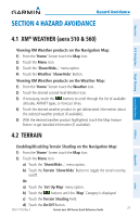
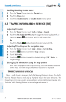
Hazard Avoidance Section 4 Hazard Avoidance Overview GPS Navigation Flight Planning Hazard Avoidance 4.1 XM® Weather (aera 510 & 560) Viewing XM Weather products on the Navigation Map: 1) From the 'Home' Screen touch the Map Icon. 2) Touch the Menu Icon. 3) Touch the 'Show/Hide...' menu option. 4) Touch the Weather 'Show/Hide' Button. Viewing XM Weather products on the Weather Map: 1) From the 'Home' Screen touch the Weather Icon. 2) Touch the desired second-level Weather Icon. 3) If necessary, touch the buttons to scroll through the list of available altitudes, AIRMET types, or forecast times. 4) Touch the desired weather product to get abbreviated information about the selected weather product (if available). 5) With the desired weather product highlighted, touch the Map Feature Button to get detailed information (if available). 4.2 Terrain Enabling/Disabling Terrain Shading on the Navigation Map: 1) From the 'Home' Screen touch the Map Icon. 2) Touch the Menu Icon. a) Touch the 'Show/Hide...' menu option. b) Touch the Terrain 'Show/Hide' Button to toggle the terrain overlay on/off. Or: a) Touch the 'Set Up Map' menu option. b) Touch the buttons until the 'Map' Category is displayed. c) Touch the Terrain Shading Field. d) Touch the On/Off Button. 190-01117-03 Rev. A Garmin aera 500 Series Quick Reference Guide 27 Utilities Appendix Index
-
 1
1 -
2
-
3
-
4
-
5
-
6
-
7
-
8
-
9
-
10
-
11
-
12
-
13
-
14
-
15
-
16
-
17
-
18
-
19
-
20
-
21
-
22
-
23
-
24
-
25
-
26
-
27
-
 28
28 -
 29
29 -
 30
30 -
 31
31 -
 32
32 -
 33
33 -
 34
34 -
 35
35 -
 36
36 -
 37
37 -
 38
38 -
39
-
40
-
41
-
42
-
43
-
44
-
45
-
46
-
47
-
48
 |
 |