Garmin dezl 580 LMT-S Owners Manual - Page 27
Language and Keyboard Settings
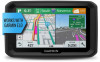 |
View all Garmin dezl 580 LMT-S manuals
Add to My Manuals
Save this manual to your list of manuals |
Page 27 highlights
Setting a Simulated Location If you are indoors or not receiving satellite signals, you can use the GPS simulator to plan routes from a simulated location. 1 Select Settings > Navigation > GPS Simulator. 2 From the main menu, select View Map. 3 Tap the map twice to select an area. The address of the location appears at the bottom of the screen. 4 Select the location description. 5 Select Set Location. Wireless Network Settings The wireless network settings allow you to manage Wi‑Fi® networks, paired Bluetooth devices, and Bluetooth features. Select Settings > Wireless Networks. Bluetooth: Enables Bluetooth wireless technology. Paired Device Name: The names of paired Bluetooth devices appear in the menu. You can select a device name to change Bluetooth feature settings for that device. Search for Devices: Searches for nearby Bluetooth devices. Friendly Name: Allows you to enter a friendly name that identifies your device on other devices with Bluetooth wireless technology. Wi-Fi: Enables the Wi‑Fi radio. Saved Networks: Allows you to edit or remove saved networks. Search for Networks: Searches for nearby Wi‑Fi networks (Connecting to a Wi‑Fi Network, page 22). Driver Assistance Settings Select Settings > Driver Assistance. Audible Driver Alerts: Enables an audible alert for each type of driver alert (Driver Awareness Features and Alerts, page 3). Fatigue Warning: Alerts you when you have been driving for a long period without a break. Proximity Alerts: Alerts you when you are near custom points of interest or red light cameras. NOTE: You must have custom points of interest (POIs) loaded for proximity points alerts to display. This feature is not available in all areas. Backup Camera Settings The backup camera settings allow you to manage paired Garmin backup cameras and camera settings. This menu appears on your navigation device only when the device is connected to a wireless camera receiver cable. See the owner's manual for your backup camera for detailed information about pairing cameras and camera settings. Go to garmin.com /backupcamera to purchase a Garmin backup camera. Select Settings > Backup Camera, and select a paired camera. Unpair: Removes the paired camera. You must pair the camera again before you can view it using this device and cable. Rename: Allows you to rename the paired camera. Guidance Lines: Shows or hides guidance lines and allows you to adjust the position of the guidance lines. Display Settings Select Settings > Display. Orientation: Allows you to set the display to portrait (vertical) or landscape (horizontal). NOTE: This feature is not available on all product models. Color Mode: Allows you to select day or night color mode. If you select the Auto option, the device automatically switches to day or night colors based on the time of day. Brightness: Allows you to adjust the display brightness. Display Timeout: Allows you to set the amount of idle time before your device enters sleep mode while using battery power. Screenshot: Allows you to take a picture of the device screen. Screenshots are saved in the Screenshot folder of the device storage. Traffic Settings From the main menu, select Settings > Traffic. Traffic: Enables traffic. Current Provider: Sets the traffic provider to use for traffic data. The Auto option selects the best available traffic data automatically. Subscriptions: Lists the current traffic subscriptions. Optimize Route: Enables the device to use optimized alternate routes automatically or upon request (Avoiding Traffic Delays on Your Route, page 5). Traffic Alerts: Sets the traffic delay severity for which the device displays a traffic alert. Units and Time Settings To open the Units and Time settings page, from the main menu, select Settings > Units & Time. Current Time: Sets the device time. Time Format: Allows you to select a 12-hour, 24-hour, or UTC display time. Units: Sets the unit of measure used for distances. Position Format: Sets the coordinate format and datum used for geographical coordinates. Setting the Time 1 From the main menu, select the time. 2 Select an option: • To set the time automatically using GPS information, select Automatic. • To set the time manually, drag the numbers up or down. Language and Keyboard Settings To open the Language and Keyboard settings, from the main menu, select Settings > Language & Keyboard. Voice Language: Sets the language for voice prompts. Text Language: Sets all on-screen text to the selected language. NOTE: Changing the text language does not change the language of user-entered data or map data, such as street names. Keyboard Language: Enables keyboard languages. Proximity Alerts Settings NOTE: You must have custom points of interest (POIs) loaded for proximity points alerts to display. NOTE: This feature is not available in all areas. Select Settings > Proximity Alerts. Audio: Sets the style of alert that plays when you approach proximity points. Alerts: Sets the type of proximity points for which alerts are played. dēzl Settings 21
-
 1
1 -
2
-
3
-
4
-
5
-
6
-
7
-
8
-
9
-
10
-
11
-
12
-
13
-
14
-
15
-
16
-
17
-
18
-
19
-
20
-
21
-
 22
22 -
 23
23 -
 24
24 -
 25
25 -
 26
26 -
 27
27 -
 28
28 -
 29
29 -
 30
30 -
 31
31 -
 32
32 -
33
-
34
 |
 |