Garmin nuvi 58LMT Owners Manual - Page 11
Avoiding Road Features, About Custom Avoidances, Customizing the Map, Safety Cameras, Receiving
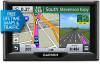 |
View all Garmin nuvi 58LMT manuals
Add to My Manuals
Save this manual to your list of manuals |
Page 11 highlights
1 From the map, select the vehicle. 2 Select > Directions to Me. 3 Select a starting location. 4 Select Select. Avoiding Road Features 1 Select Settings > Navigation > Avoidances. 2 Select the road features to avoid on your routes, and select Save. About Custom Avoidances Custom avoidances allow you to avoid specific areas and sections of road. You can enable and disable custom avoidances as needed. Avoiding an Area 1 Select Settings > Navigation > Custom Avoidances. 2 If necessary, select Add Avoidance. 3 Select Add Avoid Area. 4 Select the upper-left corner of the area to avoid, and select Next. 5 Select the lower-right corner of the area to avoid, and select Next. The selected area is shaded on the map. 6 Select Done. Avoiding a Road 1 Select Settings > Navigation > Custom Avoidances. 2 Select Add Avoid Road. 3 Select the starting point of the section of road to avoid, and select Next. 4 Select the ending point of the road section, and select Next. 5 Select Done. Disabling a Custom Avoidance You can disable a custom avoidance without deleting it. 1 Select Settings > Navigation > Custom Avoidances. 2 Select an avoidance. 3 Select > Disable. Deleting Custom Avoidances 1 Select Settings > Navigation > Custom Avoidances. 2 Select an option: • To delete all custom avoidances, select . • To delete one custom avoidance, select the avoidance, and select > Delete. Customizing the Map Customizing the Map Tools You can select the shortcuts that appear in the map tools menu. 1 Select Settings > Map & Vehicle > Map Tools. 2 Select the map tools to include in the menu. 3 Select Save. Customizing the Map Layers You can customize which data appear on the map, such as icons for points of interest and road conditions. 1 Select Settings > Map & Vehicle > Map Layers. 2 Select the layers to include on the map, and select Save. Changing the Map Data Field 1 From the map, select a data field. NOTE: You cannot customize Speed. Traffic 2 Select a type of data to display. Changing the Map Perspective 1 Select Settings > Map & Vehicle > Driving Map View. 2 Select an option: • Select Track Up to display the map in two dimensions (2D), with your direction of travel at the top. • Select North Up to display the map in 2-D with north at the top. • Select 3-D to display the map in three dimensions. 3 Select Save. Safety Cameras NOTICE Garmin is not responsible for the accuracy of or the consequences of using a custom point of interest or a safety camera database. NOTE: This feature is not available for all regions or product models. Information about safety camera locations and speed limits is available in some areas for some product models. Go to www.garmin.com/ safetycameras to check availability and compatibility, or to purchase a subscription or one-time update. You can purchase a new region or extend an existing subscription at any time. You can update safety cameras for an existing safety camera subscription by going to http: / / my .garmin .com. You should update your device frequently to receive the most up-to-date safety camera information. For some devices and regions, basic safety camera data may be included with your device. Included data does not include updates or a subscription. Traffic NOTICE Garmin is not responsible for the accuracy or timeliness of the traffic information. NOTE: This feature is not available on devices that do not include lifetime traffic (Lifetime Subscriptions). Traffic information may not be available in all areas or countries. For information about traffic receivers and coverage areas, go to www.garmin.com/ traffic. A traffic receiver is included in some packages, built into the device. • Traffic alerts appear on the map when there are traffic incidents along your route or in your area. • The device must be connected to vehicle power to receive traffic information through a traffic receiver. • The powered traffic receiver in the device may need to be in data range of a station transmitting traffic data to receive traffic information. • You do not need to activate the subscription included with your device or traffic receiver. Receiving Traffic Data Using a Traffic Receiver NOTICE Heated (metallized) windshields could degrade the performance of the traffic receiver. Before you can receive traffic data, you must have a device model that includes lifetime traffic and you must use the vehicle 7
-
 1
1 -
2
-
3
-
4
-
5
-
 6
6 -
 7
7 -
 8
8 -
 9
9 -
 10
10 -
 11
11 -
 12
12 -
 13
13 -
 14
14 -
 15
15 -
 16
16 -
17
-
18
-
19
-
20
 |
 |
