Macrom M-NV iGo Primo - Page 13
Position markers
 |
View all Macrom M-NV manuals
Add to My Manuals
Save this manual to your list of manuals |
Page 13 highlights
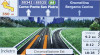
Shows the current time corrected with time zone offset. The accurate time comes from the GPS satellites, and the time zone information comes from the map or it can be set manually in Regional settings. (The current time is always displayed in the top left corner of menu screens.) Default data fields when navigating a route (tap and hold any of the fields to change its value): Field Description Shows the distance you need to travel on the route before reaching your final destination. Shows the time needed to reach the final destination of the route based on information available for the remaining segments of the route. If your device is capable of receiving live traffic information, the calculation takes into account traffic delays affecting your route if they are received. However, this calculation is rarely accurate. Shows the estimated arrival time at the final destination of the route based on information available for the remaining segments of the route. If your device is capable of receiving live traffic information, the calculation takes into account traffic delays affecting your route if they are received. However, this calculation is rarely accurate. 2.3.2 Position markers 2.3.2.1 Vehimarker and Lock-on-Road When your GPS position is available, iGO primo marks your current position with the Vehimarker. By default, this marker is a blue arrow, but you can change this icon in Settings. The exact location of the Vehimarker depends on the vehicle type used for route calculation and the navigation mode. Both can be set in Route settings (page 72). If you choose pedestrian and/or off-road navigation: The Vehimarker is at your exact GPS position. The direction of the icon shows your current heading. In all other cases: The Vehimarker may not show your exact GPS position and heading. If roads are near, it is aligned to the nearest road to suppress GPS position errors, and the direction of the icon is aligned to the direction of the road. 2.3.2.2 Selected map location (Cursor) and selected map object You can mark a map location in the following ways: Tap the map when navigating, Tap the map when you are asked to confirm the destination at the end of a search, or 13
-
 1
1 -
2
-
3
-
4
-
5
-
6
-
7
-
 8
8 -
 9
9 -
 10
10 -
 11
11 -
 12
12 -
 13
13 -
 14
14 -
 15
15 -
 16
16 -
 17
17 -
 18
18 -
19
-
20
-
21
-
22
-
23
-
24
-
25
-
26
-
27
-
28
-
29
-
30
-
31
-
32
-
33
-
34
-
35
-
36
-
37
-
38
-
39
-
40
-
41
-
42
-
43
-
44
-
45
-
46
-
47
-
48
-
49
-
50
-
51
-
52
-
53
-
54
-
55
-
56
-
57
-
58
-
59
-
60
-
61
-
62
-
63
-
64
-
65
-
66
-
67
-
68
-
69
-
70
-
71
-
72
-
73
-
74
-
75
-
76
-
77
-
78
-
79
-
80
-
81
 |
 |
