Table of Contents
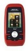
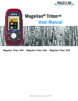
Magellan Triton
2
Resetting Maximum Speed
...............................................................................
14
The Compass Screen
............................................................................................
15
The Strip Compass Screen
....................................................................................
15
The Road Compass Screen
....................................................................................
15
Turning on the Strip and Road Compass Screens
................................................
15
The Altimeter / Barometer Screen (Magellan Triton 500)
..........................................
16
The Satellite Status Screen
...................................................................................
16
Explanation of Data Field Types
.............................................................................
17
Map Screen
..........................................................................................................................
19
Map Screen Overview
...........................................................................................
19
Customizing the Map Screen Data Fields
...........................................................
20
Saving Your Current Position as a Waypoint
........................................................
20
Saving a Position as a Waypoint using Pan
.........................................................
20
Displaying Best Fishing and Hunting Times
........................................................
21
Displaying Solar and Lunar Rise and Set Times
..................................................
21
Creating a Go To Route from the Map Screen
.....................................................
22
Viewing Waypoint Details from the Map Screen
..................................................
22
Creating a Backtrack Route
..............................................................................
23
Changing Map Options
.....................................................................................
23
Changing Map Units of Measure
.......................................................................
24
Changing Map Units of Measure
.......................................................................
25
Using the Keyboard
...............................................................................................................
26
Date Entry
...........................................................................................................
29
Text Size Limitations
............................................................................................
29
Page Selection
.....................................................................................................
29
Profiles
.................................................................................................................................
30
Activating a Profile
..........................................................................................
30
Editing a Profile
..............................................................................................
30
Information Page
(assigns which navigation screens are displayed)
......................
30
Display Page
...................................................................................................
30
Map Page
.......................................................................................................
30
Sensors Page
(Magellan Triton 500)
.................................................................
31
Alarms Page
....................................................................................................
31
Waypoints
.............................................................................................................................
32
Waypoint Detail Screen Overview
...........................................................................
32
Creating Waypoints
...............................................................................................
33
Creating a Current Location Waypoint from the Map Screen
.................................
33
 1
1 2
2 3
3 4
4 5
5 6
6 7
7 8
8 9
9 10
10 11
11 12
12