Navigon 10000140 User Guide - Page 68
Navigation, Calculating and displaying routes, Viewing the Route Profile
 |
UPC - 898110001051
View all Navigon 10000140 manuals
Add to My Manuals
Save this manual to your list of manuals |
Page 68 highlights
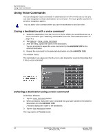
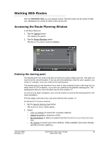
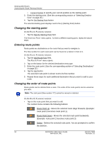
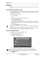
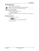
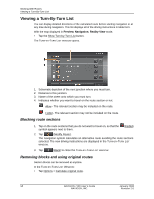
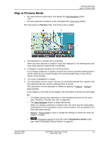
Working With Routes Navigation Navigation The route must first be calculated, then you can begin navigation or view a simulation of the route. Calculating and displaying routes You can calculate and display a several versions of a planned route to determine which route you wish to take. To calculate and display a route, the starting point and at least one route point must be entered. On the ROUTE PLANNING WINDOW: 1. Load a saved route. - OR 1. Create a starting point and at least one route point. 2. Tap the Show Route button. The map opens in Preview mode. The starting point and the route points are marked by flags. For each stage, the distance and the estimated trip time is given. This information is also displayed for the entire route. 3. Tap the Start Navigation button or start driving. If GPS reception is impaired, navigation is interrupted. The navigation software remains active. As soon as GPS reception is restored, the navigation system calculates any change of position which has occurred in the meantime. Navigation can continue. Viewing the Route Profile The calculation of a route is based on route options. 1. Create a new or load a saved route. 2. Tap Options > Route Profile. The ROUTE PROFILE WINDOW opens. 3. When finished, press Done to return to the map in Preview mode. Note: If you change the route options, these remain valid for subsequent navigation. You can get information regarding changing individual route profiles by tapping the corresponding Help button. 56 NAVIGON 7100 User's Guide January 2008 NAVIGON, INC. Revision 2.0
-
 1
1 -
2
-
3
-
4
-
5
-
6
-
7
-
8
-
9
-
10
-
11
-
12
-
13
-
14
-
15
-
16
-
17
-
18
-
19
-
20
-
21
-
22
-
23
-
24
-
25
-
26
-
27
-
28
-
29
-
30
-
31
-
32
-
33
-
34
-
35
-
36
-
37
-
38
-
39
-
40
-
41
-
42
-
43
-
44
-
45
-
46
-
47
-
48
-
49
-
50
-
51
-
52
-
53
-
54
-
55
-
56
-
57
-
58
-
59
-
60
-
61
-
62
-
 63
63 -
 64
64 -
 65
65 -
 66
66 -
 67
67 -
 68
68 -
 69
69 -
 70
70 -
 71
71 -
 72
72 -
 73
73 -
74
-
75
-
76
-
77
-
78
-
79
-
80
-
81
-
82
-
83
-
84
-
85
-
86
-
87
-
88
-
89
-
90
-
91
-
92
-
93
-
94
-
95
-
96
-
97
-
98
-
99
-
100
-
101
-
102
-
103
-
104
-
105
-
106
-
107
-
108
-
109
-
110
 |
 |