Garmin GPSMAP 396 Owner's Manual - Page 157
TIS Symbology, Waiting For Data, Data Available, Lost Connection
 |
View all Garmin GPSMAP 396 manuals
Add to My Manuals
Save this manual to your list of manuals |
Page 157 highlights
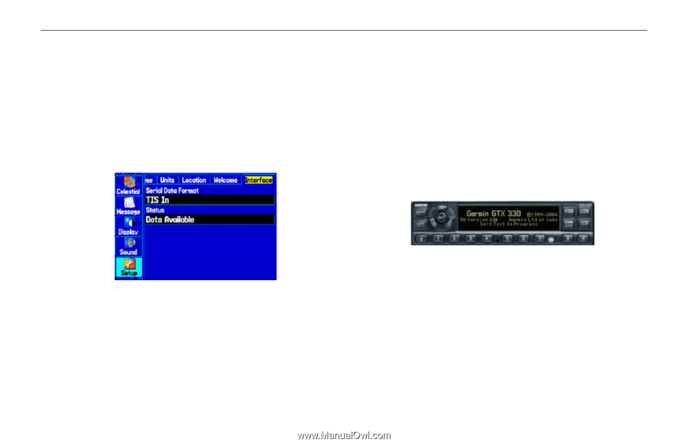
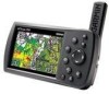
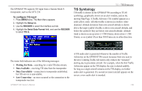
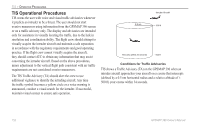
The GPSMAP 396 supports TIS input from a Garmin Mode S transponder, such as the GTX 330. To configure TIS input: 1. Press MENU twice. The Main Menu appears. 2. Highlight the Setup tab. 3. Use the ROCKER to select the Interface sub tab. 4. Highlight the Serial Data Format field, and use the ROCKER to select TIS In. TIS > TIS Symbology TIS Symbology TIS traffic is shown on the GPSMAP 396 according to TCAS symbology, graphically shown on an alert window, and on the moving Map Page. A Traffic Advisory (TA) symbol appears as a solid yellow circle. All other traffic is shown as a hollow white diamond. Altitude deviation from own aircraft altitude is shown above the target symbol if traffic is above own aircraft altitude, and below the symbol if they are below own aircraft altitude. Altitude trend is shown as an up arrow (>+500 ft/min), down arrow (
-
 1
1 -
2
-
3
-
4
-
5
-
6
-
7
-
8
-
9
-
10
-
11
-
12
-
13
-
14
-
15
-
16
-
17
-
18
-
19
-
20
-
21
-
22
-
23
-
24
-
25
-
26
-
27
-
28
-
29
-
30
-
31
-
32
-
33
-
34
-
35
-
36
-
37
-
38
-
39
-
40
-
41
-
42
-
43
-
44
-
45
-
46
-
47
-
48
-
49
-
50
-
51
-
52
-
53
-
54
-
55
-
56
-
57
-
58
-
59
-
60
-
61
-
62
-
63
-
64
-
65
-
66
-
67
-
68
-
69
-
70
-
71
-
72
-
73
-
74
-
75
-
76
-
77
-
78
-
79
-
80
-
81
-
82
-
83
-
84
-
85
-
86
-
87
-
88
-
89
-
90
-
91
-
92
-
93
-
94
-
95
-
96
-
97
-
98
-
99
-
100
-
101
-
102
-
103
-
104
-
105
-
106
-
107
-
108
-
109
-
110
-
111
-
112
-
113
-
114
-
115
-
116
-
117
-
118
-
119
-
120
-
121
-
122
-
123
-
124
-
125
-
126
-
127
-
128
-
129
-
130
-
131
-
132
-
133
-
134
-
135
-
136
-
137
-
138
-
139
-
140
-
141
-
142
-
143
-
144
-
145
-
146
-
147
-
148
-
149
-
150
-
151
-
 152
152 -
 153
153 -
 154
154 -
 155
155 -
 156
156 -
 157
157 -
 158
158 -
 159
159 -
 160
160 -
 161
161 -
 162
162 -
163
-
164
-
165
-
166
-
167
-
168
-
169
-
170
-
171
-
172
-
173
-
174
-
175
-
176
-
177
-
178
-
179
-
180
-
181
-
182
-
183
-
184
-
185
-
186
-
187
-
188
-
189
-
190
-
191
-
192
 |
 |