Garmin GPSMAP 496 Owner's Manual (for North America) - Page 137
Surface Winds, Surface Pressure, Fronts, Visibility, County, Warnings, Water Temperature, Wave Period
 |
View all Garmin GPSMAP 496 manuals
Add to My Manuals
Save this manual to your list of manuals |
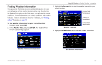
Page 137 highlights
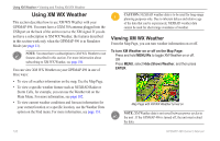
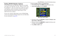
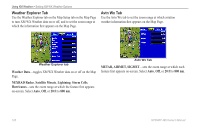
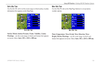
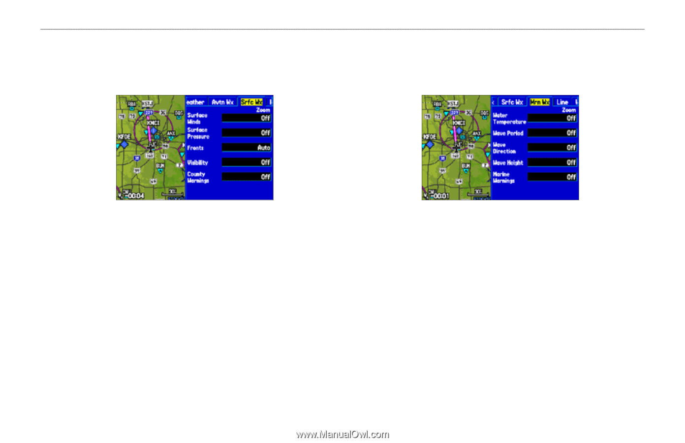
Srfc Wx Tab Use the Srfc Wx tab to set the zoom range at which surface weather information first appears on the Map Page. Using XM Weather > Setting XM WX Weather Options Mrn Wx Tab Use the Mrn Wx tab on the Map Page Options to set up marine weather options. Srfc Wx Tab Surface Winds, Surface Pressure, Fronts, Visibility, County Warnings-sets the zoom range at which each feature first appears on-screen. Select Auto, Off, or 20 ft to 800 nm. Mrn Wx Tab Water Temperature, Wave Period, Wave Direction, Wave Height, Marine Warnings-sets the zoom range at which each feature first appears on-screen. Select Auto, Off, or 20 ft to 800 nm. GPSMAP 496 Owner's Manual 129
-
 1
1 -
2
-
3
-
4
-
5
-
6
-
7
-
8
-
9
-
10
-
11
-
12
-
13
-
14
-
15
-
16
-
17
-
18
-
19
-
20
-
21
-
22
-
23
-
24
-
25
-
26
-
27
-
28
-
29
-
30
-
31
-
32
-
33
-
34
-
35
-
36
-
37
-
38
-
39
-
40
-
41
-
42
-
43
-
44
-
45
-
46
-
47
-
48
-
49
-
50
-
51
-
52
-
53
-
54
-
55
-
56
-
57
-
58
-
59
-
60
-
61
-
62
-
63
-
64
-
65
-
66
-
67
-
68
-
69
-
70
-
71
-
72
-
73
-
74
-
75
-
76
-
77
-
78
-
79
-
80
-
81
-
82
-
83
-
84
-
85
-
86
-
87
-
88
-
89
-
90
-
91
-
92
-
93
-
94
-
95
-
96
-
97
-
98
-
99
-
100
-
101
-
102
-
103
-
104
-
105
-
106
-
107
-
108
-
109
-
110
-
111
-
112
-
113
-
114
-
115
-
116
-
117
-
118
-
119
-
120
-
121
-
122
-
123
-
124
-
125
-
126
-
127
-
128
-
129
-
130
-
131
-
 132
132 -
 133
133 -
 134
134 -
 135
135 -
 136
136 -
 137
137 -
 138
138 -
 139
139 -
 140
140 -
 141
141 -
 142
142 -
143
-
144
-
145
-
146
-
147
-
148
-
149
-
150
-
151
-
152
-
153
-
154
-
155
-
156
-
157
-
158
-
159
-
160
-
161
-
162
-
163
-
164
-
165
-
166
-
167
-
168
-
169
-
170
-
171
-
172
-
173
-
174
-
175
-
176
-
177
-
178
-
179
-
180
-
181
-
182
-
183
-
184
-
185
-
186
-
187
-
188
-
189
-
190
-
191
-
192
-
193
-
194
 |
 |
GPSMAP 496 Owner’s Manual
²29
Using XM Weather >
Setting XM WX Weather Options
Srfc Wx Tab
Use the Srfc Wx tab to set the zoom range at which surface weather
information first appears on the Map Page.
Srfc Wx Tab
Surface Winds
,
Surface Pressure
,
Fronts
,
Visibility
,
County
Warnings
—sets the zoom range at which each feature first appears
on-screen. Select
Auto
,
Off
, or
20 ft
to
800 nm
.
Mrn Wx Tab
Use the Mrn Wx tab on the Map Page Options to set up marine
weather options.
Mrn Wx Tab
Water Temperature
,
Wave Period
,
Wave Direction
,
Wave
Height,
Marine Warnings
—sets the zoom range at which each
feature first appears on-screen. Select
Auto
,
Off
, or
20 ft
to
800 nm.