Garmin aera 550 Pilot's Guide - Page 59
WPT Info, Search by Identifier, Search by, Facility Name, Search by City, Flight Plan Waypoints
 |
View all Garmin aera 550 manuals
Add to My Manuals
Save this manual to your list of manuals |
Page 59 highlights
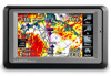
GPS Navigation Overview GPS Navigation Flight Planning Hazard Avoidance Additional Features The following descriptions and abbreviations are used: • Usage type: Public, Military, or Private • Runway surface type: Hard, Turf, Sealed, Gravel, Dirt, Soft, Unknown, or Water • Runway lighting type: No Lights, Part Time, Full Time, Unknown, or PCL Freq (for pilot-controlled lighting) • COM Availability: TX (transmit only), RX (receive only), PT (part time), * (additional information available) Selecting an airport for review by identifier, facility name, or city: 1) From the 'Home' Screen, touch WPT Info > Info Tab (if necessary). 2) Touch the Waypoint Identifier Button. 3) Enter the desired waypoint: a) Touch the buttons to 'Search by Identifier', 'Search by Facility Name', or 'Search by City' using the keypad. b) Enter the desired waypoint. c) Touch the OK Icon. Or: a) Touch the buttons to cycle through the waypoint categories ('Flight Plan Waypoints', 'Nearest Airports', or 'Recent Waypoints'.) b) Touch the desired waypoint from the list. 4) If duplicate entries exist for the entered facility name or location, duplicate waypoints are displayed. Touch the desired waypoint from the list. Selecting a runway: 1) From the 'Home' Screen, touch WPT Info > Runway Tab. 2) Touch the Waypoint Identifier Button. 3) Enter the desired waypoint: a) Touch the buttons to 'Search by Identifier', 'Search by Facility Name', or 'Search by City' using the keypad. b) Enter the desired waypoint. c) Touch the OK Icon. Or: 190-01117-02 Rev. A Garmin aera 500 Series Pilot's Guide 47 Appendices Index
-
 1
1 -
2
-
3
-
4
-
5
-
6
-
7
-
8
-
9
-
10
-
11
-
12
-
13
-
14
-
15
-
16
-
17
-
18
-
19
-
20
-
21
-
22
-
23
-
24
-
25
-
26
-
27
-
28
-
29
-
30
-
31
-
32
-
33
-
34
-
35
-
36
-
37
-
38
-
39
-
40
-
41
-
42
-
43
-
44
-
45
-
46
-
47
-
48
-
49
-
50
-
51
-
52
-
53
-
 54
54 -
 55
55 -
 56
56 -
 57
57 -
 58
58 -
 59
59 -
 60
60 -
 61
61 -
 62
62 -
 63
63 -
 64
64 -
65
-
66
-
67
-
68
-
69
-
70
-
71
-
72
-
73
-
74
-
75
-
76
-
77
-
78
-
79
-
80
-
81
-
82
-
83
-
84
-
85
-
86
-
87
-
88
-
89
-
90
-
91
-
92
-
93
-
94
-
95
-
96
-
97
-
98
-
99
-
100
-
101
-
102
-
103
-
104
-
105
-
106
-
107
-
108
-
109
-
110
-
111
-
112
-
113
-
114
-
115
-
116
-
117
-
118
-
119
-
120
-
121
-
122
-
123
-
124
-
125
-
126
-
127
-
128
-
129
-
130
-
131
-
132
-
133
-
134
-
135
-
136
-
137
-
138
-
139
-
140
-
141
-
142
-
143
-
144
-
145
-
146
-
147
-
148
-
149
-
150
-
151
-
152
-
153
-
154
-
155
-
156
-
157
-
158
-
159
-
160
-
161
-
162
-
163
-
164
-
165
-
166
-
167
-
168
-
169
-
170
-
171
-
172
-
173
-
174
-
175
-
176
-
177
-
178
-
179
-
180
-
181
-
182
-
183
-
184
-
185
-
186
-
187
-
188
-
189
-
190
-
191
-
192
-
193
-
194
-
195
-
196
-
197
-
198
-
199
-
200
-
201
-
202
 |
 |
