Autodesk 15606-011408-9320 User Guide - Page 5
Working with Data in Autodesk MapGuide, Working with Other Types of Spatial Data
 |
UPC - 606121429586
View all Autodesk 15606-011408-9320 manuals
Add to My Manuals
Save this manual to your list of manuals |
Page 5 highlights
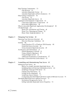
Setting General Server Properties 74 Setting Up Your Data Sources 74 Managing Your Data Sources 75 Managing Server Security 76 Access Keys Versus User IDs and Passwords 76 Choosing the Best Security Method 77 Creating and Modifying Users and Groups 78 Assigning Users to the Authors Group 79 Creating and Modifying Access Keys 80 Restricting Access to Resources 81 Taking Data Sources Offline 82 Tracking Server Requests 83 Log Files 83 Usage Reports 84 Renaming Log Files 85 Rotating the Log Files 85 Customizing the Access Log 86 Customizing the Map Layer Access Log 86 Adding Geocoding Data 87 Chapter 5 Working with Data in Autodesk MapGuide 89 Basic Steps for Working with Data 90 Working with Spatial Data 90 Map Features 91 Creating a Spatial Data File 92 Working with Attribute Data 93 Linking Attribute Data to SDFs 93 Linking Attribute Data to Another Database 94 Preparing Attribute Data for Themes 94 Setting Up Your Attribute Database 95 Zoom Goto Data 96 Working with Raster Images 97 Raster Image File Formats 97 Tiled TIFFs 98 Raster Image Catalog Files 98 Georeference File Formats 100 Exporting from ER Mapper 104 Adding Raster Images to Your Map 104 Working with Symbols 104 Working with Other Types of Spatial Data 105 Spatial Data Providers 105 VISION* Theme Data 105 Contents | v
-
 1
1 -
 2
2 -
 3
3 -
 4
4 -
 5
5 -
 6
6 -
 7
7 -
 8
8 -
 9
9 -
 10
10 -
 11
11 -
12
-
13
-
14
-
15
-
16
-
17
-
18
-
19
-
20
-
21
-
22
-
23
-
24
-
25
-
26
-
27
-
28
-
29
-
30
-
31
-
32
-
33
-
34
-
35
-
36
-
37
-
38
-
39
-
40
-
41
-
42
-
43
-
44
-
45
-
46
-
47
-
48
-
49
-
50
-
51
-
52
-
53
-
54
-
55
-
56
-
57
-
58
-
59
-
60
-
61
-
62
-
63
-
64
-
65
-
66
-
67
-
68
-
69
-
70
-
71
-
72
-
73
-
74
-
75
-
76
-
77
-
78
-
79
-
80
-
81
-
82
-
83
-
84
-
85
-
86
-
87
-
88
-
89
-
90
-
91
-
92
-
93
-
94
-
95
-
96
-
97
-
98
-
99
-
100
-
101
-
102
-
103
-
104
-
105
-
106
-
107
-
108
-
109
-
110
-
111
-
112
-
113
-
114
-
115
-
116
-
117
-
118
-
119
-
120
-
121
-
122
-
123
-
124
-
125
-
126
-
127
-
128
-
129
-
130
-
131
-
132
-
133
-
134
-
135
-
136
-
137
-
138
-
139
-
140
-
141
-
142
-
143
-
144
-
145
-
146
-
147
-
148
-
149
-
150
-
151
-
152
-
153
-
154
-
155
-
156
-
157
-
158
-
159
-
160
-
161
-
162
-
163
-
164
-
165
-
166
-
167
-
168
-
169
-
170
-
171
-
172
-
173
-
174
-
175
-
176
-
177
-
178
-
179
-
180
-
181
-
182
-
183
-
184
-
185
-
186
-
187
-
188
-
189
-
190
 |
 |
