Garmin Alpha 200i/T 5 Dog Tracking Bundle Owners Manual - Page 9
Changing the Length of the Dog's Track
|
View all Garmin Alpha 200i/T 5 Dog Tracking Bundle manuals
Add to My Manuals
Save this manual to your list of manuals |
Page 9 highlights
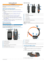
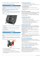
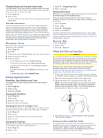
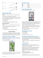
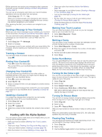
Best Good Poor Dog Status Icons Sitting Running On point Treed Unknown1 Dog Tracking Compass To open the dog tracking compass, select . Entering Sleep Mode NOTE: This feature is not available with all dog collar device models. Before you can enter sleep mode, you must track your dog's location using the compatible dog collar device. When connected with the handheld device, the dog collar device can be put into sleep mode to conserve the battery when you are not actively tracking your dog. 1 Select Dog List. 2 Select a dog. 3 Select > Adjust Collar Sleep Mode > Sleep. Exiting Sleep Mode NOTE: This feature is not available with all dog collar device models. You can exit sleep mode on the compatible dog collar device while you are not actively tracking your dog. 1 Select Dog List. 2 Select a dog. 3 Select > Adjust Collar Sleep Mode > Wake. You can use the dog tracking compass to view the direction and distance to your dog, your vehicle, and any paired devices. The dog tracking compass also shows the dog's status, such as running or on point (Dog Status Icons, page 5). The color of the pointer corresponds to the color of the track. The dog tracking compass is most accurate when the dog, vehicle, or paired device is more than 9.1 m (30 ft.) away. When the dog, vehicle, or paired device is less than 9.1 m (30 ft.) away, "Near" appears. TIP: You can open an alternative view of the compass by selecting > Pro View. Dog Tracking The handheld device allows you to track your dog or multiple dogs, using the tracking compass or map. The map displays your location and your dog's location and tracks. The compass pointer indicates the direction of the dog's current location. Tracking Your Dog on the Map Before you can track a dog on the map, you must add it to the handheld device (Adding a Dog to the Alpha Handheld Using Wireless Pairing, page 3). You can view the dog's location on the map. 1 From the home screen, select . Navigating to Your Dog 1 Select Dog List. 2 Select the dog. 3 Select > Go. 4 Follow the colored line to the dog. Changing the Length of the Dog's Track You can adjust the length of time the dog track appears on the map. Reducing the duration of the track can reduce the clutter on the map. Changing the map does not affect the tracks stored in the handheld device. 1 Select Setup > Map > Tracked Devices > Dog Tracks on Map. 2 Select a time frame. 2 If necessary, select and to zoom in and out of the map. TIP: You can select to track the dog using the dog tracking compass (Dog Tracking Compass, page 5). Location Alerts Location alerts notify you when your dogs enter or exit a particular location. You can create a custom geofence or use a radius around your current location. A geofence is an invisible boundary around an area and is created using points on the map. The virtual boundaries of a geofence are accurate up to approximately 3 m (10 ft.). Geofences perform best when sized to cover an area encompassing an average sized backyard (approximately ¼ acre). Setting Location Alerts 1 Select Location Alerts > Add Alert. 1 The unknown status icon indicates that the collar has not acquired a satellite signal and that the handheld device cannot determine the location of the dog. Dog Tracking 5
-
 1
1 -
2
-
3
-
 4
4 -
 5
5 -
 6
6 -
 7
7 -
 8
8 -
 9
9 -
 10
10 -
 11
11 -
 12
12 -
 13
13 -
 14
14 -
15
-
16
-
17
-
18
-
19
-
20
-
21
-
22
-
23
-
24
-
25
-
26
-
27
-
28
 |
 |
