Garmin Drive Owners Manual - Page 20
Viewing Previous Routes and Destinations, Map and Vehicle Settings, Navigation Settings, Wireless
 |
View all Garmin Drive manuals
Add to My Manuals
Save this manual to your list of manuals |
Page 20 highlights
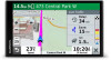
A preview of the live image from the camera appears next to a map of the camera's location. You can select the image preview to view the full-sized image. 5 Select Save to save the camera (optional). A thumbnail image preview of the camera is added to the main screen of the photoLive app. Viewing photoLive Traffic Cameras on the Map The photoLive map tool shows traffic cameras from the road ahead of you. 1 From the map, select > photoLive. The device shows the live image from the nearest traffic camera on the road ahead, along with the distance to the camera. When you pass the camera, the device loads the live image of the next camera on the road. 2 If no cameras are found for the road, select Find Cameras to view or save nearby traffic cameras (optional). Saving a Traffic Camera 1 Select Apps > photoLive. 2 Select Touch to Add. 3 Select a road. 4 Select an intersection. 5 Select Save. Viewing Previous Routes and Destinations Before you can use this feature, you must enable the travel history feature (Device and Privacy Settings, page 17). You can view your previous routes and places you have stopped on the map. Select Apps > Where I've Been. Garmin DriveSmart Settings Map and Vehicle Settings Select Settings > Map & Vehicle. Vehicle: Sets the vehicle icon that represents your position on the map. Driving Map View: Sets the perspective on the map. Map Detail: Sets the level of detail on the map. More detail may cause the map to draw slower. Map Theme: Changes the color of the map data. Map Layers: Sets the data that appears on the map page (Customizing the Map Layers, page 10). Auto Zoom: Automatically selects the zoom level for optimal use of your map. When disabled, you must zoom in or out manually. myMaps: Sets which installed maps the device uses. Enabling Maps You can enable map products installed on your device. TIP: To purchase additional map products, go to http://buy.garmin.com. 1 Select Settings > Map & Vehicle > myMaps. 2 Select a map. Navigation Settings Select Settings. Route Preview: Shows a preview of the major roads in your route when you start navigation. Calculation Mode: Sets the route calculation method. Avoidances: Sets road features to avoid on a route. Custom Avoidances: Allows you to avoid specific roads or areas. Toll Roads: Sets preferences for avoiding toll roads. Tolls and Fees: Sets preferences for avoiding toll roads and toll stickers. NOTE: This feature is not available in all areas. Environmental Zones: Sets the avoidance preferences for areas with environmental or emissions restrictions that may apply to your vehicle. Restricted Mode: Disables all functions that require significant operator attention. GPS Simulator: Stops the device from receiving a GPS signal, and saves battery power. Calculation Mode Settings Select Settings > Navigation > Calculation Mode. The route calculation is based on road speeds and vehicle acceleration data for a given route. Faster Time: Calculates routes that are faster to drive but can be longer in distance. Shorter Distance: Calculates routes that are shorter in distance but can take more time to drive. Off Road: Calculates a direct line from your location to your destination. Setting a Simulated Location If you are indoors or not receiving satellite signals, you can use the GPS simulator to plan routes from a simulated location. 1 Select Settings > Navigation > GPS Simulator. 2 From the main menu, select View Map. 3 Tap the map twice to select an area. The address of the location appears at the bottom of the screen. 4 Select the location description. 5 Select Set Location. Wireless Network Settings The wireless network settings allow you to manage Wi‑Fi® networks, paired Bluetooth devices, and Bluetooth features. Select Settings > Wireless Networks. Bluetooth: Enables Bluetooth wireless technology. Paired Device Name: The names of paired Bluetooth devices appear in the menu. You can select a device name to change Bluetooth feature settings for that device. Search for Devices: Searches for nearby Bluetooth devices. Friendly Name: Allows you to enter a friendly name that identifies your device on other devices with Bluetooth wireless technology. Wi-Fi: Enables the Wi‑Fi radio. Saved Networks: Allows you to edit or remove saved networks. Search for Networks: Searches for nearby Wi‑Fi networks (Connecting to a Wi‑Fi Network, page 18). Driver Assistance Settings Select Settings > Driver Assistance. Driver Alerts: Allows you to enable or disable alerts for upcoming zones or road conditions (Driver Awareness Features and Alerts, page 2). Speeding Alert: Alerts you when you are exceeding the speed limit. Break Planning: Reminds you to take a break and shows upcoming services after you drive for an extended time. You 16 Garmin DriveSmart Settings
-
 1
1 -
2
-
3
-
4
-
5
-
6
-
7
-
8
-
9
-
10
-
11
-
12
-
13
-
14
-
 15
15 -
 16
16 -
 17
17 -
 18
18 -
 19
19 -
 20
20 -
 21
21 -
 22
22 -
 23
23 -
 24
24 -
 25
25 -
26
-
27
-
28
 |
 |
