Garmin GPSMAP 5015 Owner's Manual - Page 15
Using Perspective 3D, Perspective 3D Settings
 |
View all Garmin GPSMAP 5015 manuals
Add to My Manuals
Save this manual to your list of manuals |
Page 15 highlights
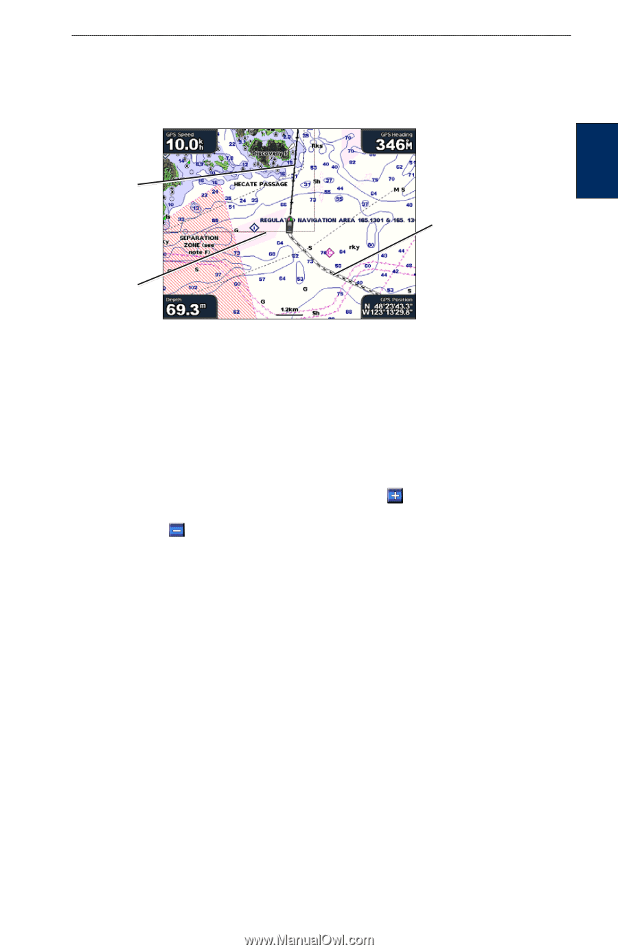
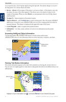
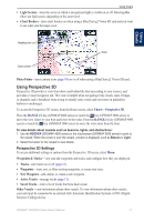
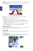
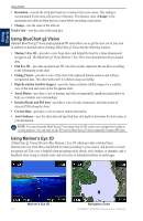
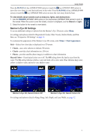
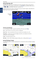
Using Charts • Light Sectors-turns the sector in which a navigational light is visible on or off. Selecting On filters out light sectors depending on the zoom level. • Chart Borders-turns chart borders on when using a BlueChart g2 Vision SD card and you want to see what area the maps cover. Using Charts Heading line Track Chart border Photo Points-turns camera icons (page 18) on or off when using a BlueChart g2 Vision SD card. Using Perspective 3D Perspective 3D provides a view from above and behind the boat (according to your course), and provides a visual navigation aid. This view is helpful when navigating tricky shoals, reefs, bridges, or channels, and is beneficial when trying to identify entry routes and exit routes in unfamiliar harbors or anchorages. To access the Perspective 3D screen, from the Home screen, select Charts > Perspective 3D. Press the RANGE (+) key (GPSMAP 4000 series) or touch the key (GPSMAP 5000 series) to move the view closer to your boat and lower to the water. Press the RANGE (-) key (GPSMAP 4000 series) or touch the key (GPSMAP 5000 series) to move the view away from the boat. To view details about navaids such as beacons, lights, and obstructions: 1. Use the ROCKER (GPSMAP 4000 series) or the touchscreen (GPSMAP 5000 series) to point to the navaid. When the cursor is over the navaid, a button is displayed, such as Beacon or Light. 2. Select the button for the navaid to view details. Perspective 3D Settings To access additional settings or options from the Perspective 3D screen, select Menu. Waypoints & Tracks-view and add waypoints and tracks, and configure how they are displayed. • Tracks-turn tracks on or off (page 12). • Waypoints-view, sort, or filter existing waypoints, or create new ones. • New Waypoint-edit, delete, or create a new waypoint. • Active Tracks-manage tracks (page 12). • Saved Tracks-view a list of tracks that have been saved. Other Vessels-view information about other vessels. To view information about other vessels, your unit must be connected to an external AIS (Automatic Identification System) or DSC (Digital Selective Calling) device. GPSMAP® 4000/5000 Series Owner's Manual 11
-
 1
1 -
2
-
3
-
4
-
5
-
6
-
7
-
8
-
9
-
 10
10 -
 11
11 -
 12
12 -
 13
13 -
 14
14 -
 15
15 -
 16
16 -
 17
17 -
 18
18 -
 19
19 -
 20
20 -
21
-
22
-
23
-
24
-
25
-
26
-
27
-
28
-
29
-
30
-
31
-
32
-
33
-
34
-
35
-
36
-
37
-
38
-
39
-
40
-
41
-
42
-
43
-
44
-
45
-
46
-
47
-
48
-
49
-
50
-
51
-
52
-
53
-
54
-
55
-
56
-
57
-
58
-
59
-
60
-
61
-
62
-
63
-
64
-
65
-
66
-
67
-
68
 |
 |