Garmin GPSMAP 520s Owner's Manual - Page 21
Using Perspective 3D, Using Mariner’s Eye 3D, Perspective 3D Settings
 |
UPC - 753759065935
View all Garmin GPSMAP 520s manuals
Add to My Manuals
Save this manual to your list of manuals |
Page 21 highlights
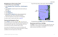
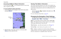
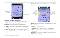
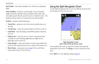
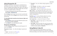
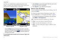
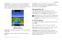
Using Charts Using Perspective 3D Perspective 3D provides a view from above and behind the boat (according to your course), and provides a visual navigation aid. This view is helpful when navigating tricky shoals, reefs, bridges, or channels, and is beneficial when trying to identify entry routes and exit routes in unfamiliar harbors or anchorages. To access the Perspective 3D screen from the Home screen, select Charts > Perspective 3D. Press the Range (+) key to move the view closer to your boat and lower to the water. Press the Range (-) key to move the view away from the boat. To view details about navaids such as beacons, lights, and obstructions: 1. Use the Rocker to point to the navaid. When the cursor is over the navaid, the navaid is highlighted. 2. Press SELECT to view details about the navaid. Perspective 3D Settings To access additional settings or options from the Perspective 3D screen, select MENU. Waypoints & Tracks-view, add, and configure waypoints and tracks. • Tracks-turn tracks on or off (page 26). • Waypoints-view, sort, or filter existing waypoints, or create new ones. • New Waypoint-edit, delete, or create a new waypoint. • Active Tracks-manage tracks (page 26). • Saved Tracks-view a list of tracks that have been saved. Other Vessels-view information about other vessels. To view information about other vessels, your unit must be connected to an external AIS (Automatic Identification System) or DSC (Digital Selective Calling) device. Data Bars (page 9)-show or hide the numbers for cruising, navigation, fishing, fuel, sailing, or the compass tape. Chart Appearance-customize the Perspective 3D chart. • Range Rings-toggles the range rings on or off to provide distance measurement. • Lane Width-adjusts the width of the course line drawn when navigating. This setting also affects routes (Route To), but does not affect automatic guidance (Guide To). Using Mariner's Eye 3D A BlueChart g2 Vision SD card offers Mariner's Eye 3D that provides a detailed three-dimensional view from above and behind the boat (according to your course), and provides a visual navigation GPSMAP 400/500 Series Owner's Manual 15
-
 1
1 -
2
-
3
-
4
-
5
-
6
-
7
-
8
-
9
-
10
-
11
-
12
-
13
-
14
-
15
-
 16
16 -
 17
17 -
 18
18 -
 19
19 -
 20
20 -
 21
21 -
 22
22 -
 23
23 -
 24
24 -
 25
25 -
 26
26 -
27
-
28
-
29
-
30
-
31
-
32
-
33
-
34
-
35
-
36
-
37
-
38
-
39
-
40
-
41
-
42
-
43
-
44
-
45
-
46
-
47
-
48
-
49
-
50
-
51
-
52
-
53
-
54
-
55
-
56
-
57
-
58
-
59
-
60
-
61
-
62
-
63
-
64
-
65
-
66
-
67
-
68
-
69
-
70
-
71
-
72
 |
 |