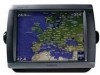
Garmin GPSMAP 5212 Owner's Manual - Page 42
Configuring Communications Settings
 |
UPC - 753759066109
View all Garmin GPSMAP 5212 manuals
Add to My Manuals
Save this manual to your list of manuals |
Page 42 highlights
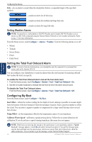
Configuring the Device Map Datum-set the coordinate system in which the map is structured. The default setting is WGS 84. Do not change the map datum unless you are using a map or chart that specifies a different position format. Time-set the time options. • Time Format-select 12-hour, 24-hour, or UTC time format. • Time Zone-set the time zone displayed for time readings. • Daylight Saving Time-select Off, On, or Auto. The Auto setting automatically turns daylight saving time on or off, depending on the time of year. Configuring the Device Configuring Communications Settings From the Home screen, touch Configure > Communications. NMEA 0183 Setup-enable or disable NMEA 0183 output sentences for sounder, route, system, and Garmin NMEA settings. • Port Types-configure the input/output format for each port to use when connecting your chartplotter to external NMEA devices, a computer, or other Garmin devices. NMEA Std. supports the input or output of standard NMEA 0183 data, DSC, and sonar NMEA input support for the DPT, MTW, and VHW sentences. NMEA High Speed supports the input or output of standard 0183 data for most AIS receivers. The Garmin option supports the input or output of Garmin-proprietary data for interfacing with Garmin software. • Output Sentences-configure how the chartplotter sees NMEA 0183 output sentences. See page 69 for information on configuring these sentences. • Posn. Precision-adjust the number of digits (Two Digits, Three Digits, or Four Digits) to the right of the decimal point for transmission of NMEA output. • Waypoint IDs-determine how the chartplotter outputs waypoint identifiers (Names or Numbers). • Defaults-reset NMEA 0183 settings to their default settings. • Diagnostics-a tool used by installers to verify that NMEA 0183 data is being sent across the system. NMEA 2000 Setup-View and configure the devices connected to the NMEA 2000 network and set bridging to On, Off, or Auto. • Device List-lists the NMEA 2000 devices on your network. If a NMEA 2000 device has configuration options or settings, select the device for a list of options. • Output Bridging-Output bridging occurs when a chartplotter takes NMEA 0183 data it receives from any source, formats it into NMEA 2000 data, and then sends it over the NMEA 2000 bus. Touch On or Off to enable or disable this function for the chartplotter. Touch Auto to allow the chartplotters on the network to negotiate with each other to determine which chartplotter will perform this function. Only one chartplotter on the network will bridge NMEA 0183 data over the NMEA 2000 bus at a time. Marine Network-Review all connected Garmin Marine Network devices (page 43). Wireless Devices-Allow wireless devices, such as a remote control or optical mouse to communicate with the chartplotter. Preferred Sources-Assign a preferred device when more than one source is available for the same function. 38 GPSMAP 5000 Series Owner's Manual
-
 1
1 -
2
-
3
-
4
-
5
-
6
-
7
-
8
-
9
-
10
-
11
-
12
-
13
-
14
-
15
-
16
-
17
-
18
-
19
-
20
-
21
-
22
-
23
-
24
-
25
-
26
-
27
-
28
-
29
-
30
-
31
-
32
-
33
-
34
-
35
-
36
-
 37
37 -
 38
38 -
 39
39 -
 40
40 -
 41
41 -
 42
42 -
 43
43 -
 44
44 -
 45
45 -
 46
46 -
 47
47 -
48
-
49
-
50
-
51
-
52
-
53
-
54
-
55
-
56
-
57
-
58
-
59
-
60
-
61
-
62
-
63
-
64
-
65
-
66
-
67
-
68
-
69
-
70
-
71
-
72
-
73
-
74
-
75
-
76
-
77
-
78
-
79
-
80
-
81
-
82
-
83
-
84
 |
 |
