Garmin GPSMAP 5212 Owner's Manual - Page 80
Index - 12 1 color
 |
UPC - 753759066109
View all Garmin GPSMAP 5212 manuals
Add to My Manuals
Save this manual to your list of manuals |
Page 80 highlights
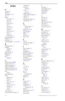
Index Index A A-scope 53 add turn 27 aerial photos 15, 19 AIS 41 alarms anchor drag 39 arrival 39 battery 39 deep water 39 fish 39 messages 70 safe zone 50 setting 39 shallow water 39 sonar 39 system 39 water temp 39 anchor drag alarm 39 appearance 18 auto mag var 37 automatic guidance 15, 20, 28, 40 B backing up data 33 backlight adjusting 3 sensor 1 beeper options 36 BlueChart 15 bridging 38 buoy 6 reports 65 C calibrate water speed 40 category (XM) 42, 66 celestial information 31 change combination 22 channel entry (XM) 42, 66 channel guide (XM) 42, 66 chart fishing 6 chart appearance 11 charts appearance 11 borders 12 detail 11 fish eye 3D 6, 15 fishing 15 mariner's eye 6, 15 navigation 6 settings 11 using 6 clear user data 34 coastal observation stations 65 76 cold front 62 color mode adjusting 3 colors 17 sonar 53 combinations 21 communications settings 38 configure 36 course up 11 cruising screen (radar) 46 current stations 30 D data clear user data 34 transfer 32 data bars 11, 13, 18 default settings 2 depth 37, 53 detail 11 device list 38 DSC 41, 55 E EBL 49 elevation unit settings 37 event log 36 F factory settings 2, 4 fishing 63 fish symbols 53 flash flood warning 61 flood warning 61 forecasts (weather) 61 front panel 1 fronts (weather) 62 fuel gauges 34 G gain sonar 54 gauges 34 fuel 34 go to 23 GPS 36 performance 67 grid north 37 guide to 23 H hazard colors 17 heading 37 Heading Line 12 heading line 12 cruising screen 50 Head Up 11 high pressure center 62 home screen 5 hurricanes 60 I ID number 4 initializing the unit 67 initial settings 2 inset map 12 isobars 64 L land only 18 lane width 13 lightning 60 lightning bolt icons 60 light sectors 12 look-ahd spd 50 low-pressure center 62 M Man Overboard 25 map datum 38 MapSource data 32 marine network 43 Mariner's Eye 3D 16 mariner's eye 6 mariner's eye 3D colors 17 MARPA 48 measure units 37 measure distance 10 messages 70 MOB 25 moon phase 31 moon rise/set 31 my boat 40 N National Weather Service 61 Navaid Type 12 navigation 23 stop 24 navigation chart 6 nearby stations 30 network 43 New Waypoint 13 NMEA 69 0183 69 2000 69 NMEA 0183 38 NMEA 2000 38 north up 11 numbers viewing 30 O occluded front 62 orientation 50 other boats 34, 41 overlay numbers 53 GPSMAP 5000 Series Owner's Manual
-
 1
1 -
2
-
3
-
4
-
5
-
6
-
7
-
8
-
9
-
10
-
11
-
12
-
13
-
14
-
15
-
16
-
17
-
18
-
19
-
20
-
21
-
22
-
23
-
24
-
25
-
26
-
27
-
28
-
29
-
30
-
31
-
32
-
33
-
34
-
35
-
36
-
37
-
38
-
39
-
40
-
41
-
42
-
43
-
44
-
45
-
46
-
47
-
48
-
49
-
50
-
51
-
52
-
53
-
54
-
55
-
56
-
57
-
58
-
59
-
60
-
61
-
62
-
63
-
64
-
65
-
66
-
67
-
68
-
69
-
70
-
71
-
72
-
73
-
74
-
 75
75 -
 76
76 -
 77
77 -
 78
78 -
 79
79 -
 80
80 -
 81
81 -
 82
82 -
 83
83 -
 84
84
 |
 |
