Table of Contents
Introduction
....................................................................
1
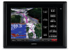
GPSMAP 8000 Series Front View
.............................................
1
Inserting a Memory Card
...........................................................
1
Using the Touchscreen
..............................................................
1
Locking the Touchscreen
......................................................
1
Tips and Shortcuts
.....................................................................
1
GPS Satellite Signals
.................................................................
1
Stations and Station Layouts
.....................................................
1
Customizing the Home Screen
.............................................
1
Customizing the Layout of a Page
........................................
1
Resetting the Station Layouts
...............................................
2
Adjusting the Backlight
...............................................................
2
Adjusting the Color Mode
...........................................................
2
Charts and 3D Chart Views
...........................................
2
Chart Symbols
...........................................................................
2
Showing a Different Chart
..........................................................
2
Zooming In and Out Using the Touchscreen
.............................
2
Viewing Location and Object Information on a Chart
.................
2
Navigating to a Point on the Chart
.............................................
3
Viewing Details about Navaids
..................................................
3
Premium Charts
.........................................................................
3
Viewing Tide Station Information
..........................................
3
Animated Tide and Current Indicators
..............................
3
Showing and Configuring Tides and Currents
..................
4
Showing Satellite Imagery on the Navigation Chart
..............
4
Viewing Aerial Photos of Landmarks
....................................
4
Automatic Identification System
.................................................
4
AIS Targeting Symbols
.........................................................
4
Heading and Projected Course of Activated AIS Targets
.....
4
Showing AIS and MARPA Vessels on a Chart or on a 3D
Chart View
.............................................................................
4
Activating a Target for an AIS Vessel
...................................
5
Viewing Information about a Targeted AIS Vessel
...........
5
Deactivating a Target for an AIS Vessel
..........................
5
Viewing a List of AIS and MARPA Threats
...........................
5
Setting the Safe-Zone Collision Alarm
..................................
5
AIS Distress Signals
..............................................................
5
Navigating to a Distress Signal Transmission
..................
5
AIS Distress Signal Device Targeting Symbols
................
5
Enabling AIS Transmission Test Alerts
............................
5
Turning Off AIS Reception
....................................................
5
Chart and 3D Chart View Settings
.............................................
5
Navigation and Fishing Chart Setup
.....................................
6
Waypoints and Tracks Settings on the Charts and Chart
Views
.....................................................................................
6
Chart Appearance Settings
...................................................
6
Other Vessels Settings on the Charts and Chart Views
........
6
Fish Eye 3D Settings
.............................................................
6
Navigation with a Chartplotter
......................................
6
Basic Navigation Questions
.......................................................
7
Destinations
...............................................................................
7
Searching for a Destination by Name
...................................
7
Selecting a Destination Using the Navigation Chart
.............
7
Searching for a Marine Services Destination
........................
7
Courses
......................................................................................
7
Setting and Following a Direct Course Using Go To
.............
7
Setting and Following a Course Using Auto Guidance
.........
7
Autopilot Navigation
..............................................................
7
Recalculating the Auto Guidance Route
..........................
7
Stopping Navigation
...................................................................
7
Waypoints
..................................................................................
8
Marking Your Present Location as a Waypoint
.....................
8
Creating a Waypoint at a Different Location
.........................
8
Marking and Navigating to an MOB Location
........................
8
Viewing a List of all Waypoints
..............................................
8
Editing a Saved Waypoint
.....................................................
8
Moving a Saved Waypoint
....................................................
8
Browsing for and Navigating to a Saved Waypoint
...............
8
Deleting a Waypoint or an MOB
............................................
8
Deleting All Waypoints
..........................................................
8
Routes
........................................................................................
8
Creating and Navigating a Route From Your Present
Location
.................................................................................
8
Creating and Saving a Route
................................................
8
Viewing a List of Routes
........................................................
9
Editing a Saved Route
..........................................................
9
Browsing for and Navigating a Saved Route
........................
9
Browsing for and Navigating Parallel to a Saved Route
.......
9
Deleting a Saved Route
........................................................
9
Deleting All Saved Routes
....................................................
9
Tracks
........................................................................................
9
Showing Tracks
.....................................................................
9
Setting the Color of the Active Track
.....................................
9
Saving the Active Track
........................................................
9
Viewing a List of Saved Tracks
.............................................
9
Editing a Saved Track
...........................................................
9
Saving a Track as a Route
....................................................
9
Browsing for and Navigating a Recorded Track
....................
9
Deleting a Saved Track
.......................................................
10
Deleting All Saved Tracks
...................................................
10
Retracing the Active Track
..................................................
10
Clearing the Active Track
....................................................
10
Managing the Track Log Memory During Recording
..........
10
Configuring the Recording Interval of the Track Log
...........
10
Deleting All Saved Waypoints, Routes, and Tracks
.................
10
Sonar
.............................................................................
10
Changing the Sonar View
........................................................
10
Pausing the Sonar Display
.......................................................
10
Creating a Waypoint on the Sonar Screen
..............................
10
Adjusting the Gain on the Sonar Screen
..................................
10
Adjusting the Range of the Depth Scale
..................................
10
Setting the Zoom Level on the Sonar Screen
..........................
10
Selecting Frequencies
.............................................................
10
Turning On the A-Scope
..........................................................
11
Sonar Setup
............................................................................
11
Sonar Settings
.....................................................................
11
Sonar Noise Rejection Settings
..........................................
11
Sonar Appearance Settings
................................................
11
Sonar Alarm Settings
..........................................................
11
Advanced Sonar Settings
....................................................
11
Transducer Installation Settings
..........................................
11
Radar
.............................................................................
11
Radar Display Modes
...............................................................
12
Changing the Radar Mode
.......................................................
12
Transmitting Radar Signals
......................................................
12
Adjusting the Zoom Scale on the Radar Screen
......................
12
Tips for Selecting a Radar Zoom Scale
..............................
12
Marking a Waypoint on the Radar Screen
...............................
12
Sentry Mode
.............................................................................
12
Enabling Timed Transmit
....................................................
12
Setting the Standby and Transmit Times
............................
12
Enabling a Guard Zone
.......................................................
12
Defining a Circular Guard Zone
..........................................
12
Defining a Partial Guard Zone
.............................................
13
Radar Targeting and MARPA
..................................................
13
MARPA Targeting Symbols
................................................
13
Assigning a MARPA Tag to an Object
................................
13
Viewing Information about a MARPA-tagged Object
.....
13
Table of Contents
i
 1
1 2
2 3
3 4
4 5
5 6
6 7
7 8
8 9
9

