Garmin GTN 650 STC GTN 6XX/7XX AFMS - Page 14
System Use - install
 |
View all Garmin GTN 650 manuals
Add to My Manuals
Save this manual to your list of manuals |
Page 14 highlights
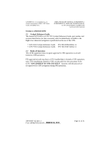
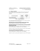
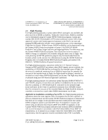
GARMIN Ltd. or its Subsidiaries, c/o Garmin International 1200 E. 151st Street Olathe, KS 66062 USA AIRPLANE FLIGHT MANUAL SUPPLEMENT or SUPPLEMENTAL AIRPLANE FLIGHT MANUAL for STC SA02019SE-D GARMIN GTN NAVIGATION SYSTEM Both Garmin GPS navigation receivers must be operating and providing GPS navigation guidance for operations requiring RNP-4 performance. Applicable to installations consisting of two GTNs: North Atlantic (NAT) Minimum Navigational Performance Specifications (MNPS) Airspace operations per AC 91-49 and AC 120-33 require both GPS/SBAS receivers to be operating and receiving usable signals except for routes requiring only one Long Range Navigation sensor. Each display computes an independent navigation solution based on its GPS sensor. Whenever possible, RNP and RNAV routes including Standard Instrument Departures (SIDs) and Obstacle Departure Procedures (ODPs), Standard Terminal Arrival (STAR), and enroute RNAV "Q" and RNAV "T" routes should be loaded into the flight plan from the database in their entirety, rather than loading route waypoints from the database into the flight plan individually. Selecting and inserting individual named fixes from the database is permitted, provided all fixes along the published route to be flown are inserted. Manual entry of waypoints using latitude/longitude or place/bearing is prohibited. It is not acceptable to flight plan a required alternate airport based on RNAV(GPS) LP/LPV or LNAV/VNAV approach minimums. The required alternate airport must be flight planned using an LNAV approach minimums or available ground-based approach aid. Navigation information is referenced to the WGS-84 reference system, and should only be used where the Aeronautical Information Publication (including electronic data and aeronautical charts) conform to WGS-84 or equivalent. 2.5 System Use In installations with two GTNs and an external GPS annunciator (See Table 1) the GTN connected to the external GPS annunciator must be used as the navigation source for all operations. The only approved sources of course guidance are on the external CDI, HSI, or EHSI display. The moving map and CDI depiction on the GTN display are for situational awareness only and are not approved for course guidance. 190-01007-A2 Rev. 1 FAA APPROVED DATE: _M__A_R_C_H__1_8__,_2_0_1_1__ Page 14 of 31
-
 1
1 -
2
-
3
-
4
-
5
-
6
-
7
-
8
-
 9
9 -
 10
10 -
 11
11 -
 12
12 -
 13
13 -
 14
14 -
 15
15 -
 16
16 -
 17
17 -
 18
18 -
 19
19 -
20
-
21
-
22
-
23
-
24
-
25
-
26
-
27
-
28
-
29
-
30
-
31
 |
 |