Garmin aera 795 Pilot's Guide - Page 71
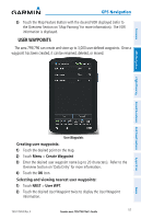
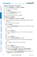
USER WAYPOINTS, Creating user waypoints, Selecting and viewing nearest user waypoints
 |
View all Garmin aera 795 manuals
Add to My Manuals
Save this manual to your list of manuals |
Page 71 highlights
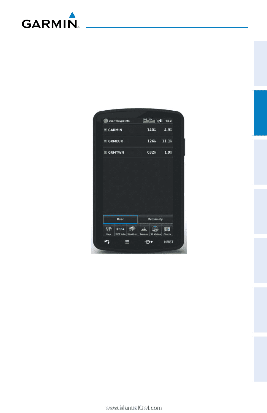
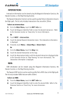
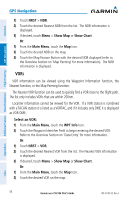
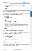
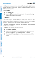
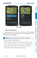
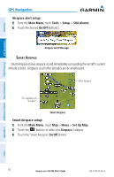
Overview GPS Navigation 3) Touch the Map Feature Button with the desired VOR displayed (refer to the Overview Section on 'Map Panning' for more information). The VOR information is displayed. USER WAYPOINTS The aera 795/796 can create and store up to 3,000 user-defined waypoints. Once a waypoint has been created, it can be renamed, deleted, or moved. GPS Navigation Flight Planning Hazard Avoidance Additional Features Appendices User Waypoints Creating user waypoints: 1) Touch the desired point on the map. 2) Touch Menu > Create Waypoint 3) Enter the desired user waypoint name (up to 20 characters). Refer to the Overview Section on 'Data Entry' for more information. 4) Touch the OK Icon. Selecting and viewing nearest user waypoints: 1) Touch NRST > User WPT. 2) Touch the desired User Waypoint twice to display the User Waypoint information. 190-01194-00 Rev. A Garmin aera 795/796 Pilot's Guide 57 Index
-
 1
1 -
2
-
3
-
4
-
5
-
6
-
7
-
8
-
9
-
10
-
11
-
12
-
13
-
14
-
15
-
16
-
17
-
18
-
19
-
20
-
21
-
22
-
23
-
24
-
25
-
26
-
27
-
28
-
29
-
30
-
31
-
32
-
33
-
34
-
35
-
36
-
37
-
38
-
39
-
40
-
41
-
42
-
43
-
44
-
45
-
46
-
47
-
48
-
49
-
50
-
51
-
52
-
53
-
54
-
55
-
56
-
57
-
58
-
59
-
60
-
61
-
62
-
63
-
64
-
65
-
 66
66 -
 67
67 -
 68
68 -
 69
69 -
 70
70 -
 71
71 -
 72
72 -
 73
73 -
 74
74 -
 75
75 -
 76
76 -
77
-
78
-
79
-
80
-
81
-
82
-
83
-
84
-
85
-
86
-
87
-
88
-
89
-
90
-
91
-
92
-
93
-
94
-
95
-
96
-
97
-
98
-
99
-
100
-
101
-
102
-
103
-
104
-
105
-
106
-
107
-
108
-
109
-
110
-
111
-
112
-
113
-
114
-
115
-
116
-
117
-
118
-
119
-
120
-
121
-
122
-
123
-
124
-
125
-
126
-
127
-
128
-
129
-
130
-
131
-
132
-
133
-
134
-
135
-
136
-
137
-
138
-
139
-
140
-
141
-
142
-
143
-
144
-
145
-
146
-
147
-
148
-
149
-
150
-
151
-
152
-
153
-
154
-
155
-
156
-
157
-
158
-
159
-
160
-
161
-
162
-
163
-
164
-
165
-
166
-
167
-
168
-
169
-
170
-
171
-
172
-
173
-
174
-
175
-
176
-
177
-
178
-
179
-
180
-
181
-
182
-
183
-
184
-
185
-
186
-
187
-
188
-
189
-
190
-
191
-
192
-
193
-
194
-
195
-
196
-
197
-
198
-
199
-
200
-
201
-
202
-
203
-
204
-
205
-
206
-
207
-
208
-
209
-
210
 |
 |