Meade LX200-ACF 12 inch User Manual - Page 22
Global Positioning System, Detecting True Level, Finding True North
 |
View all Meade LX200-ACF 12 inch manuals
Add to My Manuals
Save this manual to your list of manuals |
Page 22 highlights
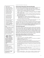
5. Press MODE to return to the Tour list. Press the Scroll keys to scroll through the list. Press ENTER when you find the next object you wish to observe. 6. Press and hold down MODE for two seconds to leave the Guided Tour menu. Other Guided Tours are available, such as "How Far is Far" and "A Star's Life". If you have programming skills, you may wish to create a custom Guided Tour. See CREATE YOUR OWN GUIDED TOUR, page 59. GPS Receiver Fig. 12: LX200-ACF GPS Receiver. - 22 - LX200-ACF INFO The Global Positioning System The Global Positioning System (GPS) is comprised of 24 satellites orbiting the Earth that are constantly transmitting their precise position and time. The system provides highly accurate, worldwide positioning and navigation information for any number of applications. GPS receivers on the Earth acquire signals from three to twelve satellites to determine the precise latitude, longitude, and time of the receiver. (Accuracy of the receiver's position may be within 10 to 15 feet.) As AutoStar II uses latitude, longitude, and time information to calculate the positions of celestial objects, GPS is an ideal tool for aligning your LX200ACF telescope. Detecting True Level To detect level of the base of the telescope, AutoStar II must calculate the tip and tilt of the telescope at three compass points and then compensate for it. Finding level involves the geometric calculations of a "plane". In order to define a plane, three positions are necessary. This is not unlike building a table: For a table to stand level and solid, it must have a minimum of three legs. AutoStar II makes gravitational measurements to make a precise determination of true level. Finding True North Locating True North is one of the most important ingredients in the alignment of a telescope. True North is the axis-the pole-which the Earth spins about and is a key reference for the motion of the Earth. As you look at the night sky, the stars seem to move; in fact, if you watched long enough or took a long time-exposure photograph, you'd realize that the stars seem to revolve around one point-the pole or True North. When AutoStar II knows where True North is and also knows the time, it can calculate the location of all the other objects in the sky. One traditional way to find True North is to locate the North Star, Polaris, which lies very close to True North. Another way to calculate True North is to use gyroscopes or accelerometers. The LX200-ACF determines True North by using a magnetic North sensor. The sensor locates magnetic North. Magnetic North is not True North, but a measurement of the magnetic lines of the Earth. Magnetic North may deviate several degrees from True North. But AutoStar II, using the observation site location determined by the GPS and magnetic North information, can calculate the position of True North. Some areas are subject to magnetic disturbances, and the magnetic field of the Earth changes slightly from year to year. AutoStar II allows you to adjust for discrepancies in the local magnetic field using the "Calibrate Sensors" option in the Telescope menu. See page 30 for more information.
-
 1
1 -
2
-
3
-
4
-
5
-
6
-
7
-
8
-
9
-
10
-
11
-
12
-
13
-
14
-
15
-
16
-
 17
17 -
 18
18 -
 19
19 -
 20
20 -
 21
21 -
 22
22 -
 23
23 -
 24
24 -
 25
25 -
 26
26 -
 27
27 -
28
-
29
-
30
-
31
-
32
-
33
-
34
-
35
-
36
-
37
-
38
-
39
-
40
-
41
-
42
-
43
-
44
-
45
-
46
-
47
-
48
-
49
-
50
-
51
-
52
-
53
-
54
-
55
-
56
-
57
-
58
-
59
-
60
-
61
-
62
-
63
-
64
-
65
-
66
-
67
-
68
-
69
-
70
-
71
-
72
-
73
-
74
-
75
-
76
 |
 |