Pioneer F900BT Owner's Manual - Page 125
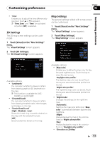
D Settings, Map Settings - avic maps
 |
UPC - 012562890265
View all Pioneer F900BT manuals
Add to My Manuals
Save this manual to your list of manuals |
Page 125 highlights
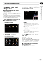
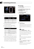
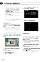
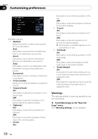
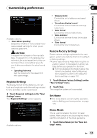
Customizing preferences Chapter 25 Customizing preferences ! "Time" Enables you to adjust the time difference by one hour. Touch a or b to adjust it. p "Time Zone" and "Time" are activated only when [Off] is selected. 3D Settings The 3D map screen settings can be customized. 1 Touch [Visual] on the "Navi Settings" menu. The "Visual Settings" screen appears. 2 Touch [3D Settings]. The "3D Visual Settings" screen appears. Map Settings The general settings related with a map screen can be customized. 1 Touch [Visual] on the "Navi Settings" menu. The "Visual Settings" screen appears. 2 Touch [Map Settings]. The "Map Settings" screen appears. Available options; ! "Landmarks" You can select whether to draws or refrain from drawing graphical 3D landmarks on the map. p This function is available for AVICF900BT and AVIC-F90BT. ! "Elevated Roads" You can select whether to draws or refrain from drawing elevated roads, interchanges, and bridges on the map. ! "Terrain Detail Level" [High], [Medium], [Low]: Draws the terrain (e.g. mountain chains) on the map with the selected fineness. [Off]: Does not draw the terrain on the map. Available options; ! [Map color] Enables you to define the map color for daytime and nighttime use. Touch this key to show the next screen. "Daylight color profile:" The daytime map color can be set. Touch the key and select the desired profile from the list. "Night color profile:" The nighttime map color can be set. Touch the key and select the desired profile from the list. ! "Night mode" Changes the settings for the nighttime map. [Automatic]: Switches the map color defined on "Map color" automatically between daytime and nighttime. [Night]: Always displays the map in the color defined on "Night color profile:". [Day]: Always displays the map in the color defined on "Daylight color profile:". ! "Elevation on 2D Map" En 125
-
 1
1 -
2
-
3
-
4
-
5
-
6
-
7
-
8
-
9
-
10
-
11
-
12
-
13
-
14
-
15
-
16
-
17
-
18
-
19
-
20
-
21
-
22
-
23
-
24
-
25
-
26
-
27
-
28
-
29
-
30
-
31
-
32
-
33
-
34
-
35
-
36
-
37
-
38
-
39
-
40
-
41
-
42
-
43
-
44
-
45
-
46
-
47
-
48
-
49
-
50
-
51
-
52
-
53
-
54
-
55
-
56
-
57
-
58
-
59
-
60
-
61
-
62
-
63
-
64
-
65
-
66
-
67
-
68
-
69
-
70
-
71
-
72
-
73
-
74
-
75
-
76
-
77
-
78
-
79
-
80
-
81
-
82
-
83
-
84
-
85
-
86
-
87
-
88
-
89
-
90
-
91
-
92
-
93
-
94
-
95
-
96
-
97
-
98
-
99
-
100
-
101
-
102
-
103
-
104
-
105
-
106
-
107
-
108
-
109
-
110
-
111
-
112
-
113
-
114
-
115
-
116
-
117
-
118
-
119
-
 120
120 -
 121
121 -
 122
122 -
 123
123 -
 124
124 -
 125
125 -
 126
126 -
 127
127 -
 128
128 -
 129
129 -
 130
130 -
131
-
132
-
133
-
134
-
135
-
136
-
137
-
138
-
139
-
140
-
141
-
142
-
143
-
144
-
145
-
146
-
147
-
148
-
149
-
150
-
151
-
152
-
153
-
154
-
155
-
156
-
157
-
158
-
159
-
160
-
161
-
162
-
163
-
164
-
165
-
166
-
167
-
168
-
169
-
170
-
171
-
172
-
173
-
174
-
175
-
176
-
177
-
178
-
179
-
180
-
181
-
182
-
183
-
184
-
185
-
186
-
187
-
188
-
189
 |
 |
