Sony HDR-TD20V Operating Guide - Page 50
If data on your current location, cannot be obtained
 |
View all Sony HDR-TD20V manuals
Add to My Manuals
Save this manual to your list of manuals |
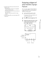
Page 50 highlights
On the satellite map and triangulating gauge The center of the satellite map shows your current location. You can check the direction (north/south/east/west) of the satellites with the satellite icons () that appear on the satellite map. When the camcorder succeeds in triagulating your location, the triangulating gauge turns to green. How to check the GPS satellite icons/ triangulating gauge The color of the GPS satellite icons and the triangulating gauge change according to the current status triangulation. GPS satellite icons/ triangulating gauge / (black) / (gray) / (brown) / (ocher) / (green) Status No signal, but orbit information for the satellite is available. Part of the satellite orbit information has been obtained. About a half of the satellite orbit information has been obtained. Most of the satellite orbit information has been obtained. Triangulating is completed and the satellite is currently being used. US 50 If data on your current location cannot be obtained A display that allows you to triangulate the location again appears. In this case, follow the instructions that appears on the LCD screen. Hints for better reception Use the GPS function outdoors and in open areas. For details on locations or situations where radio signals cannot be received, refer to the "Handycam" User Guide. Rotate the LCD panel to direct the GPS antenna towards the sky. Do not place your hand on the GPS antenna. Select [Your Location] in the menu to use the triangulating priority mode (p. 49). Use GPS Assist Data. If you import GPS Assist Data from your computer to your camcorder using the built-in "PlayMemories Home" software, the time it takes the camcorder to acquire your location information can be shortened. Connect the camcorder to a computer that is connected to the Internet. The GPS Assist Data will be updated automatically. Notes In the following situations, the current location of the camcorder shown on the map may be different from the actual location. The margin of error can be as wide as several hundred meters. When the camcorder receives GPS signals that have been reflected off the surrounding buildings When the GPS signal is too weak
-
 1
1 -
2
-
3
-
4
-
5
-
6
-
7
-
8
-
9
-
10
-
11
-
12
-
13
-
14
-
15
-
16
-
17
-
18
-
19
-
20
-
21
-
22
-
23
-
24
-
25
-
26
-
27
-
28
-
29
-
30
-
31
-
32
-
33
-
34
-
35
-
36
-
37
-
38
-
39
-
40
-
41
-
42
-
43
-
44
-
 45
45 -
 46
46 -
 47
47 -
 48
48 -
 49
49 -
 50
50 -
 51
51 -
 52
52 -
 53
53 -
 54
54 -
 55
55 -
56
-
57
-
58
-
59
-
60
-
61
-
62
-
63
-
64
-
65
-
66
-
67
-
68
-
69
-
70
-
71
-
72
-
73
-
74
-
75
-
76
-
77
-
78
-
79
-
80
-
81
-
82
-
83
-
84
-
85
-
86
-
87
-
88
-
89
-
90
-
91
-
92
-
93
-
94
-
95
-
96
-
97
-
98
-
99
-
100
-
101
-
102
-
103
-
104
-
105
-
106
-
107
-
108
-
109
-
110
-
111
-
112
-
113
-
114
-
115
-
116
-
117
-
118
-
119
-
120
-
121
-
122
-
123
-
124
-
125
-
126
-
127
-
128
-
129
-
130
-
131
-
132
-
133
-
134
-
135
-
136
-
137
-
138
-
139
-
140
-
141
-
142
-
143
-
144
-
145
-
146
-
147
-
148
-
149
-
150
-
151
-
152
-
153
-
154
-
155
-
156
-
157
-
158
-
159
-
160
-
161
-
162
-
163
-
164
-
165
-
166
-
167
-
168
-
169
-
170
-
171
-
172
-
173
-
174
-
175
-
176
-
177
-
178
-
179
-
180
-
181
-
182
-
183
-
184
-
185
-
186
-
187
-
188
-
189
-
190
-
191
 |
 |
