Sony NV-U70 Quick Start Guide - Page 5
On installation, On GPS, On the software, GPS Global Positioning System satellites - maps
 |
UPC - 027242687875
View all Sony NV-U70 manuals
Add to My Manuals
Save this manual to your list of manuals |
Page 5 highlights
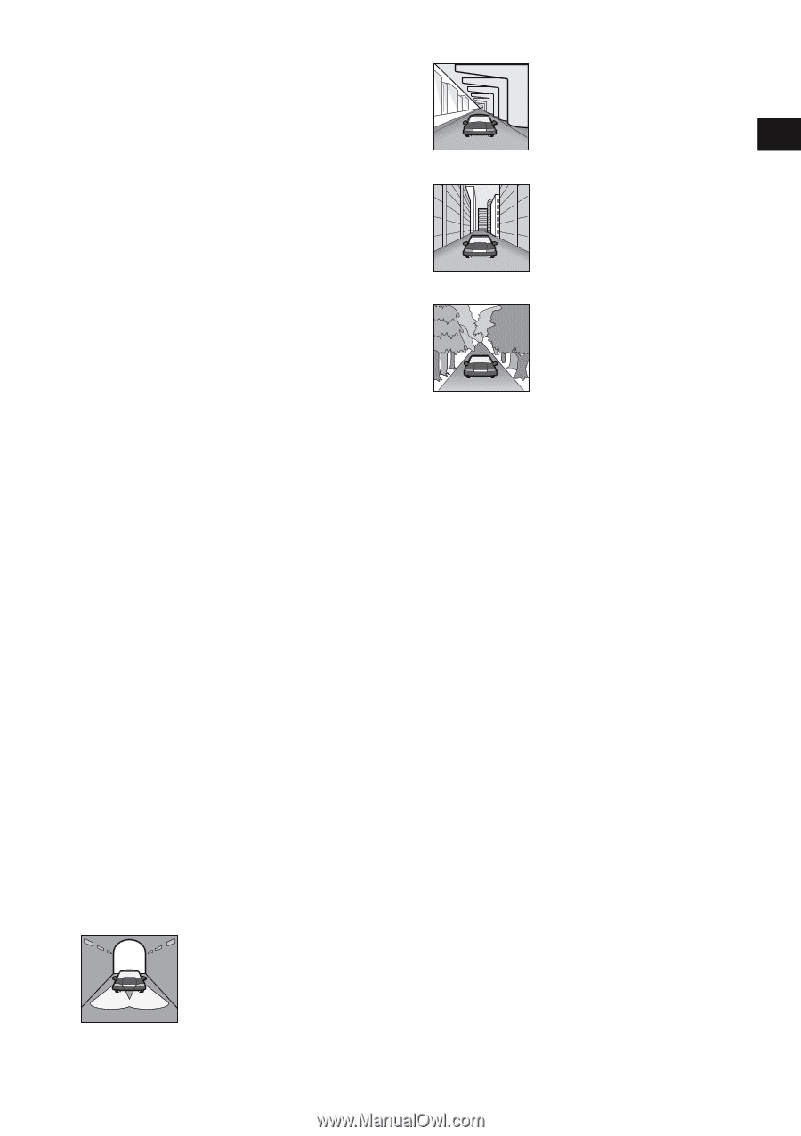
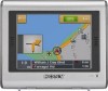
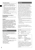
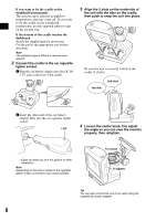
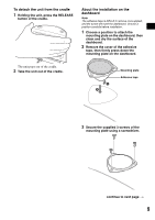
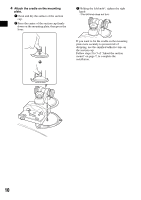
On installation • Before installing the unit, check your local traffic laws and regulations. • Make sure you install the unit properly according to the installation instructions. Improper installation may result in fire or electric shock. • Before installation, be sure to turn the ignition switch to the OFF position or take out the key. Installing the unit with the ignition on may cause the car battery to drain or short circuit. • For information about the polarity, battery voltage and location of the airbag in your car, please consult your car dealer. • When installing the unit, use only the hardware provided and avoid mounting to any critical components of the vehicle. • Take care to prevent cords or wires from getting tangled or crimped in the moving portion of a seat rail. Mounting location • Do not install the cradle where: - it will obstruct the driver's view when the cradle is mounted in the car, or the unit is in the cradle. - it will obstruct the operation of the airbag system. - it will obstruct the operation of the car, especially the steering wheel, shift lever, or brake pedal. - it will be subjected to heat/high temperature. • Please consult a qualified technician or service personnel if you cannot attach the cradle to the car securely. On GPS GPS (Global Positioning System) satellites continuously emit signals for positioning anywhere on the earth. As a GPS antenna receives these signals, users can be informed of their location (latitude, longitude and altitude). Information must be received from 3 satellites in order to obtain twodimensional fixes (latitude and longitude), and 4 satellites are required for three-dimensional positioning (latitude, longitude and altitude). As GPS satellites are controlled by the U.S. Department of Defense, a deliberate margin of error between a few meters (a few feet) and 10 meters (32.8 feet) exists. As a result, the GPS navigation system may include an error of between 10 meters (32.8 feet) and about 200 meters (656.2 feet), depending on the circumstances. As GPS information is obtained using signal from satellites, it may be impossible or difficult to obtain the information in the following locations: • Tunnel or underground • Under a highway • Between high buildings • Between tall trees with dense foliage After the initial installation, park your car in a safe, open place (no high buildings, etc.) for up to 20 minutes to allow for GPS signals to be received before using the navigation system. The system requires signals from a minimum of 3 GPS satellites to calculate the current car position properly. Note It takes time to receive a GPS signal when switching the unit ON after switching OFF the main power, after the built-in battery is fully discharged, or after resetting the unit. On the software Read the following conditions carefully before use. • Copyright laws prohibit reproducing the software or the software manual in whole or in part or renting the software without the permission of the copyright holder. • In the event a problem occurs with this software as a result of defective manufacturing, Sony will replace it at Sony's option or issue a refund. However, Sony bears no other responsibility. • The software provided with this product cannot be used with equipment other than that which it is designated for use with. • Please note that, due to continued efforts to improve quality, the software specifications may be changed without notice. • Roads and names on the map may differ from actual roads and names. • The warranty does not extend to an exchange or refund due to some typographical errors and omissions, or any other discrepancy in layout found in the software. • In no way may the map data be copied and used, in whole or in part, without permission of the copyright holder. • Contents are subject to change without notice. By using the unit, you are agreeing to be bound by the above. 5
-
 1
1 -
 2
2 -
 3
3 -
 4
4 -
 5
5 -
 6
6 -
 7
7 -
 8
8 -
 9
9 -
 10
10 -
 11
11 -
12
-
13
-
14
-
15
-
16
-
17
-
18
-
19
-
20
-
21
-
22
-
23
-
24
-
25
-
26
-
27
-
28
-
29
-
30
-
31
-
32
-
33
-
34
-
35
-
36
-
37
-
38
-
39
-
40
-
41
-
42
-
43
-
44
-
45
-
46
-
47
-
48
-
49
-
50
-
51
-
52
-
53
-
54
-
55
-
56
-
57
-
58
-
59
-
60
-
61
-
62
-
63
-
64
-
65
-
66
-
67
-
68
 |
 |