Garmin aera 795 Pilot's Guide - Page 106
Using SiriusXM Satellite Weather Products, USING S
 |
View all Garmin aera 795 manuals
Add to My Manuals
Save this manual to your list of manuals |
Page 106 highlights
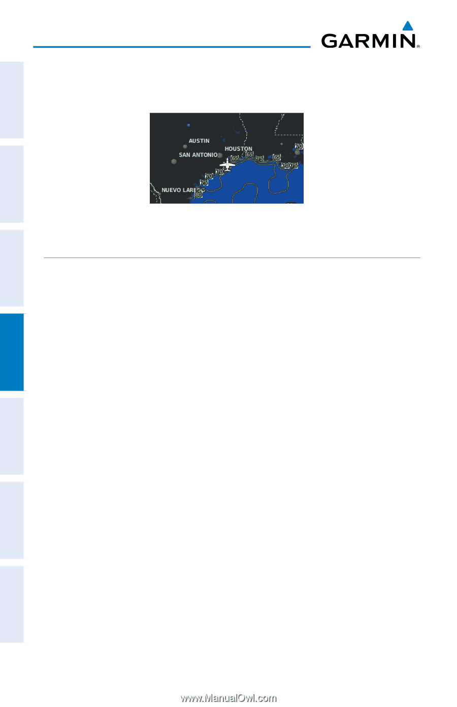
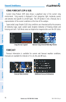
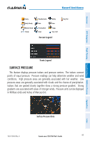
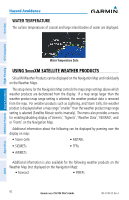
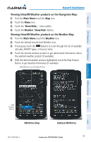
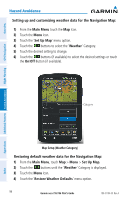
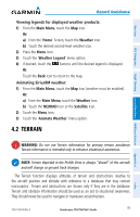
Hazard Avoidance WATER TEMPERATURE The surface temperatures of coastal and large inland bodies of water are displayed. Overview GPS Navigation Additional Features Hazard Avoidance Flight Planning Water Temperature Data USING SiriusXM SATELLITE WEATHER PRODUCTS SiriusXM Weather Products can be displayed on the Navigation Map and individually on the Weather Maps. The setup menu for the Navigation Map controls the map range settings above which weather products are decluttered from the display. If a map range larger than the weather product map range setting is selected, the weather product data is removed from the map. For weather products such as Lightning, and Storm Cells, the weather product is displayed when a map range "smaller" than the weather product map range setting is selected (Satellite Mosaic works inversely). The menu also provides a means for enabling/disabling display of 'Airmets', 'Sigmets', 'Weather Data', 'NEXRAD', and/ or 'Fronts' on the Navigation Map. Additional information about the following can be displayed by panning over the display on map: • Storm Cells • METARs • SIGMETs • TFRs • AIRMETs Additional information is also available for the following weather products on the Weather Map (not displayed on the Navigation Map): • Forecast • PIREPs 92 Garmin aera 795/796 Pilot's Guide 190-01194-00 Rev. A Appendices Index
-
 1
1 -
2
-
3
-
4
-
5
-
6
-
7
-
8
-
9
-
10
-
11
-
12
-
13
-
14
-
15
-
16
-
17
-
18
-
19
-
20
-
21
-
22
-
23
-
24
-
25
-
26
-
27
-
28
-
29
-
30
-
31
-
32
-
33
-
34
-
35
-
36
-
37
-
38
-
39
-
40
-
41
-
42
-
43
-
44
-
45
-
46
-
47
-
48
-
49
-
50
-
51
-
52
-
53
-
54
-
55
-
56
-
57
-
58
-
59
-
60
-
61
-
62
-
63
-
64
-
65
-
66
-
67
-
68
-
69
-
70
-
71
-
72
-
73
-
74
-
75
-
76
-
77
-
78
-
79
-
80
-
81
-
82
-
83
-
84
-
85
-
86
-
87
-
88
-
89
-
90
-
91
-
92
-
93
-
94
-
95
-
96
-
97
-
98
-
99
-
100
-
 101
101 -
 102
102 -
 103
103 -
 104
104 -
 105
105 -
 106
106 -
 107
107 -
 108
108 -
 109
109 -
 110
110 -
 111
111 -
112
-
113
-
114
-
115
-
116
-
117
-
118
-
119
-
120
-
121
-
122
-
123
-
124
-
125
-
126
-
127
-
128
-
129
-
130
-
131
-
132
-
133
-
134
-
135
-
136
-
137
-
138
-
139
-
140
-
141
-
142
-
143
-
144
-
145
-
146
-
147
-
148
-
149
-
150
-
151
-
152
-
153
-
154
-
155
-
156
-
157
-
158
-
159
-
160
-
161
-
162
-
163
-
164
-
165
-
166
-
167
-
168
-
169
-
170
-
171
-
172
-
173
-
174
-
175
-
176
-
177
-
178
-
179
-
180
-
181
-
182
-
183
-
184
-
185
-
186
-
187
-
188
-
189
-
190
-
191
-
192
-
193
-
194
-
195
-
196
-
197
-
198
-
199
-
200
-
201
-
202
-
203
-
204
-
205
-
206
-
207
-
208
-
209
-
210
 |
 |