Garmin dezl 780 LMT-S Owners Manual - Page 14
Changing the Search Area, Custom Points of Interest, Parking, Search Tools, Foursquare
 |
View all Garmin dezl 780 LMT-S manuals
Add to My Manuals
Save this manual to your list of manuals |
Page 14 highlights
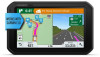
Location Search Results on the Map You can view the results of a location search on the map instead of in a list. From the location search results, select . The nearest location appears at the center of the map, and basic information about the selected location appears at the bottom of the map. Drag the map to view additional search results. Additional search results. Select to view another location. Selected location summary. Select to view detailed information about the selected location. Go! Select to start navigating to the location using the recommended route. Select to view the search results in a list. Changing the Search Area By default, the device searches near your current location. You can also search other areas, such as near your destination, near another city, or along your active route. 1 Select Where To?. 2 Select . 3 Select an option. Custom Points of Interest Custom POIs are customized points on the map. They can contain alerts that let you know if you are near a designated point or if you are traveling faster than a specified speed. Installing POI Loader You can create or download custom POI lists on your computer and install them on your device using POI Loader software. 1 Go to www.garmin.com/poiloader. 2 Follow the on-screen instructions. Finding Custom POIs Before you can find custom POIs, you must load custom POIs on your device using the POI Loader software (Installing POI Loader, page 8). 1 Select Where To? > Categories. 2 Scroll to the Other Categories section, and select a category. Finding Truck Parking 1 Select Where To? > Truck Locations > Parking Lots. 2 Select a parking location. 3 Select Go!. Finding Parking Near Your Current Location 1 Select Where To? > Categories > Parking. 2 Select Filter Parking, and select one or more categories to filter parking by availability, type, price, or payment methods (optional). NOTE: Detailed parking data is not available in all areas or for all parking locations. 3 Select a parking location. 4 Select Go!. Understanding Parking Colors and Symbols Parking locations that include detailed parking data are colorcoded to show the likelihood of finding parking. Symbols indicate the type of parking available (street or lot), relative pricing information, and payment type. You can view the legend for these colors and symbols on the device. From the parking search results, select . Search Tools Search tools allow you to search for specific types of locations by responding to on-screen prompts. Finding an Intersection You can search for an intersection or junction between two streets, highways, or other roads. 1 Select Where To? > Categories > Intersections. 2 Follow the on-screen instructions to enter street information. 3 Select the intersection. Finding a City 1 Select Where To? > Categories > Cities. 2 Select an option: • Select a city from the list of nearby cities. • To search near another location, select Searching near: (Changing the Search Area, page 8). • To search for a city by name, select Enter Search, enter a city name, and select . Finding a Location Using Coordinates You can find a location using latitude and longitude coordinates. This can be helpful when geocaching. 1 Select Where To? > Categories > Coordinates. 2 If necessary, select , and change the coordinate format or datum. 3 Enter the latitude and longitude coordinates. 4 Select View on Map. Parking Your dēzl device includes detailed parking data, which can help you find nearby parking based on the likelihood of available parking spots, type of parking area, price, or accepted payment methods. In some areas, live parking data is available while your dēzl device is connected to Smartphone Link. While your device is receiving live parking data, you can view real-time parking trends. NOTE: Detailed parking data is not available in all areas or for all parking locations. Garmin is not responsible for the accuracy or timeliness of live parking data. Foursquare Foursquare is a location-based social network. Your device includes pre-loaded Foursquare points of interest, which are indicated by the Foursquare logo in your location search results. For additional features, you can connect to your Foursquare account using Smartphone Link on your compatible smartphone. When you connect to your Foursquare account using Smartphone Link, you can view Foursquare location details, check in to a location, and search for points of interest in the online Foursquare database. Connecting to Your Foursquare Account 1 Connect your device to Smartphone Link. 8 Finding and Saving Locations
-
 1
1 -
2
-
3
-
4
-
5
-
6
-
7
-
8
-
 9
9 -
 10
10 -
 11
11 -
 12
12 -
 13
13 -
 14
14 -
 15
15 -
 16
16 -
 17
17 -
 18
18 -
 19
19 -
20
-
21
-
22
-
23
-
24
-
25
-
26
-
27
-
28
-
29
-
30
-
31
-
32
-
33
-
34
-
35
-
36
-
37
-
38
 |
 |
