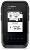
Garmin eTrex Solar Owners Manual - Page 24
System Settings, Solar Auto Wake
 |
View all Garmin eTrex Solar manuals
Add to My Manuals
Save this manual to your list of manuals |
Page 24 highlights
System Settings From the main menu, press or to scroll through the apps on the navigator. Select Settings > System. Expedition Mode: Allows you to customize settings for expedition mode. The Auto option automatically turns on expedition mode after two minutes of inactivity. The Manual option allows you to turn on expedition mode using the power menu (Turning On Expedition Mode, page 5). The Interval option determines how often GPS track points are recorded. Satellite: Allows you to change the satellite system. The GPS Only option enables the GPS satellite system. The Multi-GNSS option enables multiple Global Navigation Satellite Systems (GNSS). The Demo Mode option turns GPS off. NOTE: Using multiple GNSS systems offers increased performance in challenging environments and faster position acquisition than using GPS only. However, this can reduce battery life more quickly than using GPS only. The Multi-Band option enables the use of multi-band systems on the eTrex Solar navigator. NOTE: Multi-band systems use multiple frequency bands and allow for more consistent track logs and improved positioning when using the device in challenging environments. However, this can reduce battery life more quickly than using GPS only. Solar Auto Wake: Displays a screen with solar charging statistics when the device is turned off and detects sunlight. NOTE: This setting is available only on the eTrex Solar navigator. Battery Percent: Displays the remaining battery life as a percentage. NOTE: This setting is available only on the eTrex Solar navigator. Display: Sets the backlight brightness and the length of time before the backlight turns off. Language: Sets the text language on the navigator. NOTE: Changing the text language does not change the language of user-entered data or map data. Waypoints: Allows you to change the automatic name type for waypoints, and enter a custom prefix for automatically named waypoints. Menus: Allows you to customize the main menu (Customizing the Main Menu, page 18) and glance loop (Customizing the Glance Loop, page 6). Battery Type: Allows you to change the type of AA batteries you are using in the eTrex SE navigator (Selecting the Battery Type, page 3). Units: Sets the units of measure for the navigator. Time: Sets the time format and time zone (Time Settings, page 21). Compass: Allows you to customize the compass heading settings (Compass Settings, page 21). Position Format: Sets the geographical position format and datum options (Position Format Settings, page 21). Course Trans.: Sets how the navigator routes you from one point in the course to the next. The Auto option automatically routes you to the next point in the course, the Distance option routes you to the next point in the course when you are within a specified distance of your current point, and the Manual option allows you to select the next point in the course (Changing the Active Course Point, page 15). Course Trns. Dist.: Sets how close to the active course point you must be before the navigator transitions to next point in the course, when Distance is selected for the Course Trans. settings. USB Mode: Sets the device to use MTP (media transfer protocol) or Garmin® mode when connected to a computer. Software Updates: Allows you to install software updates downloaded to your navigator. Reset: Allows you to reset user data and settings (Resetting Data and Settings, page 21). 20 Customizing the Device
-
 1
1 -
2
-
3
-
4
-
5
-
6
-
7
-
8
-
9
-
10
-
11
-
12
-
13
-
14
-
15
-
16
-
17
-
18
-
 19
19 -
 20
20 -
 21
21 -
 22
22 -
 23
23 -
 24
24 -
 25
25 -
 26
26 -
 27
27 -
 28
28 -
 29
29 -
30
-
31
-
32
 |
 |
