2013 Nissan Altima Navigation System Owner's Manual - Page 277
2013 Nissan Altima Manual

Page 277 highlights
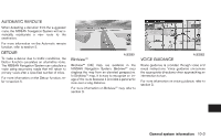
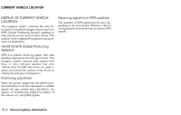
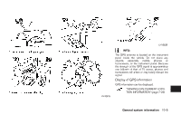
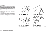
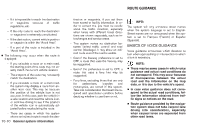
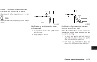
DETAILED MAP COVERAGE AREAS (MCA) FOR THE NAVIGATION SYSTEM This system is designed to help guiding to the destination, and it also performs other functions as outlined in this manual. However, the system must be used safely and properly. Information concerning road conditions, traffic signs and the availability of services may not always be up-todate. The system is not a substitute for safe, proper and legal driving. Map data covers select metropolitan areas in the United States and Canada. Map data includes two types of areas: "Detailed coverage areas" providing all detailed road data and other areas showing "Main roads only". NOTE: Detailed map data is not available in many areas and is generally limited to select major metropolitan areas. WHEN A GRAY ROAD IS DISPLAYED ON THE MAP ● When you are driving on a road displayed in gray after the vehicle has deviated from the suggested route during route guidance, automatic rerouting may not start immediately. ● The navigation system does not provide route guidance for roads displayed in dark green. Therefore, if the destination is set on a road displayed in dark green, the enlarged map display will return to the ordinary map screen at some point on a suggested route that is near the destination. Also, voice guidance will stop at some point on a suggested route that is near the destination. ● Places information and street names near roads displayed in gray may not be contained in the map data. LNV0518 INFO: ● The vehicle icon may be misaligned when starting the vehicle just after starting the engine. ● The vehicle icon may also be misaligned if different sized tires or tire chains are installed. ● The system has a function that automatically corrects the vehicle icon position when it is misaligned from the actual position. ● Vehicle position correction by GPS may not function when the vehicle is stopped. ● If the vehicle icon position does not return to normal even after driving for a while, correct the vehicle icon position manually. "Adjusting the current vehicle location" (page 8-13) 10-8 General system information
-
 1
1 -
2
-
3
-
4
-
5
-
6
-
7
-
8
-
9
-
10
-
11
-
12
-
13
-
14
-
15
-
16
-
17
-
18
-
19
-
20
-
21
-
22
-
23
-
24
-
25
-
26
-
27
-
28
-
29
-
30
-
31
-
32
-
33
-
34
-
35
-
36
-
37
-
38
-
39
-
40
-
41
-
42
-
43
-
44
-
45
-
46
-
47
-
48
-
49
-
50
-
51
-
52
-
53
-
54
-
55
-
56
-
57
-
58
-
59
-
60
-
61
-
62
-
63
-
64
-
65
-
66
-
67
-
68
-
69
-
70
-
71
-
72
-
73
-
74
-
75
-
76
-
77
-
78
-
79
-
80
-
81
-
82
-
83
-
84
-
85
-
86
-
87
-
88
-
89
-
90
-
91
-
92
-
93
-
94
-
95
-
96
-
97
-
98
-
99
-
100
-
101
-
102
-
103
-
104
-
105
-
106
-
107
-
108
-
109
-
110
-
111
-
112
-
113
-
114
-
115
-
116
-
117
-
118
-
119
-
120
-
121
-
122
-
123
-
124
-
125
-
126
-
127
-
128
-
129
-
130
-
131
-
132
-
133
-
134
-
135
-
136
-
137
-
138
-
139
-
140
-
141
-
142
-
143
-
144
-
145
-
146
-
147
-
148
-
149
-
150
-
151
-
152
-
153
-
154
-
155
-
156
-
157
-
158
-
159
-
160
-
161
-
162
-
163
-
164
-
165
-
166
-
167
-
168
-
169
-
170
-
171
-
172
-
173
-
174
-
175
-
176
-
177
-
178
-
179
-
180
-
181
-
182
-
183
-
184
-
185
-
186
-
187
-
188
-
189
-
190
-
191
-
192
-
193
-
194
-
195
-
196
-
197
-
198
-
199
-
200
-
201
-
202
-
203
-
204
-
205
-
206
-
207
-
208
-
209
-
210
-
211
-
212
-
213
-
214
-
215
-
216
-
217
-
218
-
219
-
220
-
221
-
222
-
223
-
224
-
225
-
226
-
227
-
228
-
229
-
230
-
231
-
232
-
233
-
234
-
235
-
236
-
237
-
238
-
239
-
240
-
241
-
242
-
243
-
244
-
245
-
246
-
247
-
248
-
249
-
250
-
251
-
252
-
253
-
254
-
255
-
256
-
257
-
258
-
259
-
260
-
261
-
262
-
263
-
264
-
265
-
266
-
267
-
268
-
269
-
270
-
271
-
 272
272 -
 273
273 -
 274
274 -
 275
275 -
 276
276 -
 277
277 -
 278
278 -
 279
279 -
 280
280 -
 281
281 -
 282
282 -
283
-
284
-
285
-
286
-
287
-
288
-
289
-
290
-
291
-
292
-
293
-
294
-
295
-
296
-
297
-
298
-
299
-
300
-
301
-
302
-
303
-
304
-
305
-
306
-
307
-
308
-
309
-
310
 |
 |