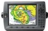
Garmin GPSMAP 3010c Owners Manual - Page 78
Labels Sub Tab, Nav Sub Tab, Lat/Lon Grid
 |
UPC - 753759045548
View all Garmin GPSMAP 3010c manuals
Add to My Manuals
Save this manual to your list of manuals |
Page 78 highlights
Main Menu > Map Tab Labels Sub Tab Use the Labels sub tab to select the screen size of the text for a given map item. Nav Sub Tab Use the Nav sub tab to show or hide certain navigational features on the Map Page and the scale at which they appear. Main Menu Chart, Waypoints, Active Route, Tide Stations, Services, Spot Soundings, Lat/Lon Grid-controls the screen size of the text for a given map item. Select None, Small, Medium, or Large. 70 The Nav sub tab contains the following options: • AutoZoom-toggles the automatic zoom on or off. When On, the map automatically adjusts the map to a lower range as you approach your destination point. • Accuracy Circle-toggles the circle on or off. The circle represents the approximate accuracy of the GPS position based on EPE (Estimated Position Error) and map data quality. Your actual location is somewhere within the circle. • Bearing Line-sets the maximum scale at which the feature appears on the screen and toggles the red/yellow line that continually points to the current navigation point. Select Off, All Ranges, Auto, or
-
 1
1 -
2
-
3
-
4
-
5
-
6
-
7
-
8
-
9
-
10
-
11
-
12
-
13
-
14
-
15
-
16
-
17
-
18
-
19
-
20
-
21
-
22
-
23
-
24
-
25
-
26
-
27
-
28
-
29
-
30
-
31
-
32
-
33
-
34
-
35
-
36
-
37
-
38
-
39
-
40
-
41
-
42
-
43
-
44
-
45
-
46
-
47
-
48
-
49
-
50
-
51
-
52
-
53
-
54
-
55
-
56
-
57
-
58
-
59
-
60
-
61
-
62
-
63
-
64
-
65
-
66
-
67
-
68
-
69
-
70
-
71
-
72
-
 73
73 -
 74
74 -
 75
75 -
 76
76 -
 77
77 -
 78
78 -
 79
79 -
 80
80 -
 81
81 -
 82
82 -
 83
83 -
84
-
85
-
86
-
87
-
88
-
89
-
90
-
91
-
92
-
93
-
94
-
95
-
96
-
97
-
98
-
99
-
100
-
101
-
102
-
103
-
104
-
105
-
106
-
107
-
108
-
109
-
110
-
111
-
112
-
113
-
114
-
115
-
116
-
117
-
118
-
119
-
120
-
121
-
122
-
123
-
124
-
125
-
126
-
127
-
128
-
129
-
130
 |
 |
