Garmin GPSMAP 64csx Owners Manual - Page 8
Elevation Plot, Restoring Default Settings, Waypoints, Routes - review
 |
View all Garmin GPSMAP 64csx manuals
Add to My Manuals
Save this manual to your list of manuals |
Page 8 highlights
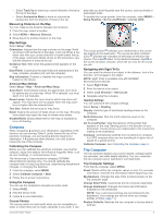
Elevation Plot NOTE: The elevation plot is available only with GPSMAP 64s/sc/st/sx/csx devices. By default, the elevation plot displays the elevation over the distance traveled. You can customize elevation plot settings (Elevation Plot Settings, page 4). You can select any point on the plot to view details about that point. Elevation Plot Settings From the elevation plot, select MENU. Change Plot Type: Sets the type of data shown on the elevation plot. Elevation/Time: Records elevation changes over a period of time. Elevation/Distance: Records elevation changes over a distance. Barometric Pressure: Records barometric pressure changes over a period of time. Ambient Pressure: Records ambient pressure changes over a period of time. Adjust Zoom Ranges: Adjusts the zoom ranges shown on the elevation plot page. Change Data Fields: Customizes the elevation plot data fields. Reset: Resets the elevation plot data, including waypoint, track, and trip data. Calibrate Altimeter: See (Calibrating the Barometric Altimeter, page 4). Restore Defaults: Restores the elevation plot to factory default settings. Calibrating the Barometric Altimeter You can manually calibrate the barometric altimeter if you know the correct elevation or the correct barometric pressure. NOTE: The barometric altimeter is available only with GPSMAP 64s/sc/st/sx/csx devices. 1 Go to a location where the elevation or barometric pressure is known. 2 Select PAGE > Elevation Plot > MENU > Calibrate Altimeter. 3 Follow the on-screen instructions. Restoring Default Page Settings 1 Open a page for which you will restore the settings. 2 Select MENU > Restore Defaults. Waypoints, Routes, and Tracks Waypoints Waypoints are locations you record and store in the device. Waypoints can mark where you are, where you are going, or where you have been. You can add details about the location, such as name, elevation, and depth. You can add a .gpx file that contains waypoints by transferring the file to the GPX folder (Transferring Files to Your Device, page 12). Creating a Waypoint You can save your current location as a waypoint. 1 Select MARK. 2 If necessary, select a field to make changes to the waypoint. 3 Select Done. Projecting a Waypoint You can create a new location by projecting the distance and bearing from a marked location to a new location. 1 Select Waypoint Manager. 2 Select a waypoint. 3 Select MENU > Project Waypoint. 4 Enter the bearing, and select Done. 5 Select a unit of measure. 6 Enter the distance, and select Done. 7 Select Save. Navigating to a Waypoint 1 Select FIND > Waypoints. 2 Select a waypoint. 3 Select Go. Editing a Waypoint 1 Select Waypoint Manager. 2 Select a waypoint. 3 Select an item to edit, such as the name. 4 Enter the new information, and select Go. Deleting a Waypoint 1 Select Waypoint Manager. 2 Select a waypoint. 3 Select MENU > Delete. Routes A route is a sequence of waypoints or locations that leads you to your final destination. Creating a Route 1 Select Route Planner > Create Route > Select First Point. 2 Select a category. 3 Select the first point in the route. 4 Select Use. 5 Select Select Next Point to add additional points to the route. 6 Select QUIT to save the route. Editing the Name of a Route 1 Select Route Planner. 2 Select a route. 3 Select Change Name. 4 Enter the new name. Editing a Route 1 Select Route Planner. 2 Select a route. 3 Select Edit Route. 4 Select a point. 5 Select an option: • To view the point on the map, select Review. • To change the order of the points on the route, select Move Up or Move Down. • To insert an additional point on the route, select Insert. The additional point is inserted before the point you are editing. • To remove the point from the route, select Remove. 6 Select QUIT to save the route. 4 Waypoints, Routes, and Tracks
-
 1
1 -
2
-
 3
3 -
 4
4 -
 5
5 -
 6
6 -
 7
7 -
 8
8 -
 9
9 -
 10
10 -
 11
11 -
 12
12 -
 13
13 -
14
-
15
-
16
-
17
-
18
-
19
-
20
 |
 |