Garmin STRIKER 5cv Owner s Manual PDF - Page 7
Creating a Waypoint on the Sonar Screen - transducer
 |
View all Garmin STRIKER 5cv manuals
Add to My Manuals
Save this manual to your list of manuals |
Page 7 highlights
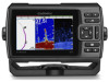
SideVü Sonar View NOTE: Not all models support SideVü sonar and scanning transducers. NOTE: To receive SideVü scanning sonar, you need a compatible transducer and fishfinder. SideVü scanning sonar technology shows you a picture of what lies to the sides of the boat. You can use this as a search tool to find structures and fish. Depth at your present location À Depth scale Á Split-Zoom View On the split-zoom page, you can see a full-view graph of sonar readings on the right side of the screen, and a magnified portion of that graph on the left side of the screen. From a sonar screen, select > Split Zoom. Left side of the vessel À Right side of the vessel Á The transducer on your vessel  Trees à Old tires Ä Logs Å Distance from the side of the vessel Æ Water between the vessel and the bottom Ç Split-Screen Frequency You can view two frequencies from the split frequency screen. Flasher The flasher shows sonar information on a circular depth scale, indicating what is beneath your boat. It is organized as a ring that starts at the top and progresses clockwise. Depth is indicated by the scale inside the ring. Sonar information flashes on the ring when it is received at the depth indicated. The colors indicate different strengths of the sonar return. Select Flasher. Sonar Zoomed depth scale À Zoom window Á Depth range  Pausing the Sonar Not all options are available on all models. Select an option: • From the Traditional or ClearVü sonar screen, select or . • From the SideVü sonar screen, select or . Creating a Waypoint on the Sonar Screen Using Your Present Location 1 From a sonar view, select . 2 If necessary, edit the waypoint information. Creating a Waypoint on the Sonar Screen Using a Different Location 1 From a sonar view, pause the sonar. 2 Select a location. 3 Select . 4 If necessary, edit the waypoint information. Adjusting the Zoom You can adjust the zoom manually by specifying the span and a fixed starting depth. For example, when the depth is 15 m and the starting depth is 5 m, the device displays a magnified area from 5 to 20 m deep. You also can allow the device to adjust the zoom automatically by specifying a span. The device calculates the zoom area from the bottom of the water. For example, if you select a span of 3
-
 1
1 -
 2
2 -
 3
3 -
 4
4 -
 5
5 -
 6
6 -
 7
7 -
 8
8 -
 9
9 -
 10
10 -
 11
11 -
 12
12 -
13
-
14
-
15
-
16
 |
 |
