Garmin dezl Owners Manual - Page 16
Map Tools, Up Ahead, Warning and Alert Symbols
 |
View all Garmin dezl manuals
Add to My Manuals
Save this manual to your list of manuals |
Page 16 highlights
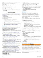
5 Enter one or more category names, separated by commas. 6 If necessary, select a suggested category. 7 Select Done. Deleting a Saved Location NOTE: Deleted locations cannot be recovered. 1 Select Where To? > Saved. 2 Select > Delete Saved Places. 3 Select the box next to the saved locations to delete, and select Delete. Using the Map You can use the map to navigate a route (Your Route on the Map, page 4) or to view a map of your surroundings when no route is active. 1 Select View Map. 2 Touch anywhere on the map. 3 Select an option: • Drag the map to pan left, right, up, or down. • To zoom in or out, select or . • To switch between North Up and 3-D views, select . • To filter the displayed points of interest by category, select . • To start a route, select a location on the map, and select Go! (Starting a Route by Using the Map, page 4). Map Tools Map tools provide quick access to information and device functions while you view the map. When you activate a map tool, it appears in a panel at the edge of the map. Stop: Stops navigation of the active route. Change Route: Allows you to take a detour or skip locations in your route. Up Ahead: Displays upcoming locations along the route or the road on which you are traveling (Up Ahead, page 10). Turns: Displays a list of upcoming turns in your route (Viewing Turns and Directions, page 4). Trip Data: Displays customizable trip data, such as speed or mileage (Viewing Trip Data from the Map, page 11). Volume: Adjusts the master audio volume. Brightness: Adjusts the screen brightness. Phone: Displays a list of recent phone calls from your connected phone, and displays in-call options while a phone call is active (Using In-Call Options, page 13). Dispatch and Track: Allows you to start and stop Dispatch and Track sharing (Dispatch and Track, page 16). Traffic: Displays traffic conditions along your route or in your area (Viewing Upcoming Traffic, page 11). Weather: Displays weather conditions for your area. photoLive: Displays live traffic cameras from your photoLive subscription (photoLive Traffic Cameras, page 20). Report Camera: Allows you to report a speed or red light camera. This tool is available only when you have speed or red light camera data on your device and you have an active connection to the Smartphone Link app (Pairing with Your Phone and Connecting to Smartphone Link, page 12). Elevation: Displays elevation changes ahead. Break Planner: Displays break reminders and suggested stops. Viewing a Map Tool 1 From the map, select . 2 Select a map tool. The map tool appears in a panel at the edge of the map. 3 When you are done using the map tool, select . Enabling Map Tools By default, only the most commonly used map tools are enabled in the map tools menu. You can add up to 12 tools to the menu. 1 From the map, select > . 2 Select the check box next to each tool to add. 3 Select Save. Up Ahead The Up Ahead tool provides information about upcoming locations along your route or the road on which you are traveling. You can view upcoming points of interest, such as restaurants, fuel stations, or rest areas. When traveling on a highway, you can also view information and available services for upcoming exits and cities, similar to the information on highway road signs. You can customize three categories to show in the Up Ahead tool. Viewing Upcoming Locations 1 From the map, select > Up Ahead. 2 Select an option: • To view the next upcoming location in each category, select , if necessary. • To view information and available services for upcoming highway exits or cities, select . NOTE: This option is available only while you are traveling on a highway or when your route includes a highway. 3 Select an item to view a list of locations for that category, exit, or city. Customizing the Up Ahead Categories You can change the location categories that appear in the Up Ahead tool. 1 From the map, select > Up Ahead. 2 Select a category. 3 Select . 4 Select an option: • To move a category up or down in the list, select and drag the arrow next to the category name. • To change a category, select the category. • To create a custom category, select a category, select Custom Search, and enter the name of a business or category. 5 Select Done. Warning and Alert Symbols WARNING Entering your vehicle profile characteristics does not guarantee that your vehicle's characteristics will be accounted for in all route suggestions or that you will receive the warning icons in all cases. Limitations may exist in the map data such that your device cannot account for these restrictions or road conditions in all cases. Always defer to all posted road signs and road conditions when making driving decisions. Warning and alert symbols may appear on the map or in route directions to alert you to potential hazards, road conditions, and upcoming weigh stations. 10 Using the Map
-
 1
1 -
2
-
3
-
4
-
5
-
6
-
7
-
8
-
9
-
10
-
 11
11 -
 12
12 -
 13
13 -
 14
14 -
 15
15 -
 16
16 -
 17
17 -
 18
18 -
 19
19 -
 20
20 -
 21
21 -
22
-
23
-
24
-
25
-
26
-
27
-
28
-
29
-
30
-
31
-
32
-
33
-
34
 |
 |
