Garmin eTrex Legend C Owner's Manual - Page 20
an optional GARMIN MapSource CD-ROM. When using - maps downloads
 |
UPC - 753759045555
View all Garmin eTrex Legend C manuals
Add to My Manuals
Save this manual to your list of manuals |
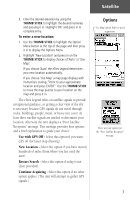
Page 20 highlights
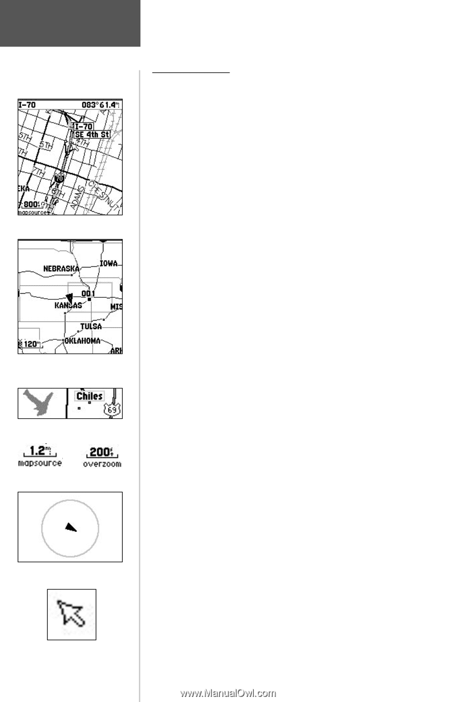
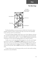
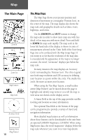
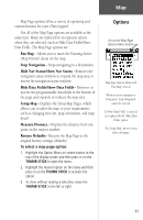
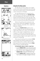
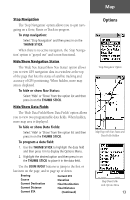
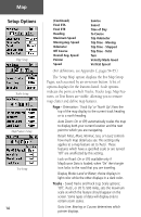
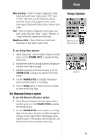
Map The Main Page Zoom In Zoom Out Map Features Map Scales Accuracy Circle Panning Arrow (Map Pointer) 10 The Map Page The Map Page shows your present position and direction of movement as a triangular 'Position Icon', in the center of the map. The map display also shows the map scale and geographic details such as lakes, rivers, highways, and towns. Use the ZOOM IN and OUT buttons to change the map scale in order to show more map area with less detail or less map area with more detail. Press and hold to ZOOM the map scale rapidly. The map scale in the lower left hand side of the display is shown in units of measurement selected in the 'Units' field of the Unit Setup Page (not to be confused with the Map Setup Page). If you zoom in so far that the resolution of the map data is exceeded and the appearance of the map is no longer accurate, the word, "overzoom" displays just below the map scale. In many instances the map displays an 'Accuracy Circle' surrounding the 'Position Icon'. The eTrex Legend uses both map resolution and GPS accuracy in defining your location to a point within the circle. The smaller the circle, the more accurate your location. When using the 'Pan Map' feature, a small outline arrow (Map Pointer) can be moved about the page to highlight and identify map items or to scroll the map to view areas not shown on the display screen. A Status Field at the top of the page provides satellite tracking and location accuracy information. Two optional Data fields at the bottom of the page can be programmed to provide a variety of travel and navigation information. More detailed map features as well as information about those features can be downloaded to the unit from an optional GARMIN MapSource CD-ROM. When using MapSource data, the word 'mapsource' displays below the map scale whenever you zoom in to view map details.
-
 1
1 -
2
-
3
-
4
-
5
-
6
-
7
-
8
-
9
-
10
-
11
-
12
-
13
-
14
-
 15
15 -
 16
16 -
 17
17 -
 18
18 -
 19
19 -
 20
20 -
 21
21 -
 22
22 -
 23
23 -
 24
24 -
 25
25 -
26
-
27
-
28
-
29
-
30
-
31
-
32
-
33
-
34
-
35
-
36
-
37
-
38
-
39
-
40
-
41
-
42
-
43
-
44
-
45
-
46
-
47
-
48
-
49
-
50
-
51
-
52
-
53
-
54
-
55
-
56
-
57
-
58
-
59
-
60
-
61
-
62
-
63
-
64
-
65
-
66
-
67
-
68
-
69
-
70
-
71
-
72
-
73
-
74
-
75
-
76
 |
 |