Garmin eTrex Vista HCx Owner's Manual - Page 44
Lock On Road, Saved Tracks, Track Log, Track Points, Go To Line, Tracks, and Go To Line.
 |
UPC - 753759071134
View all Garmin eTrex Vista HCx manuals
Add to My Manuals
Save this manual to your list of manuals |
Page 44 highlights
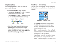
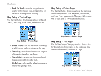
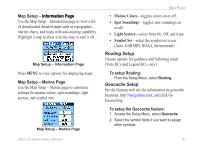
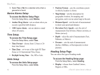
Main Pages • Lock On Road-locks the map pointer to display on the nearest road, compensating for variances in map position accuracy. Map Setup - Tracks Page Use the Map Setup -Tracks page settings for Saved Tracks, Track Log, Track Points, and Go To Line. Map Setup - Points Page Use the Map Setup - Points page to set the map scale at which Map Points, User Waypoints, Street Label, and Land Cover appear on the Map page. Select Auto, Off, or from 20 ft to 500 mi (5 m to 800 km). Map Setup - Tracks Page • Saved Tracks-sets the maximum zoom range at which saved tracks are shown on the map. • Track Log-sets the maximum zoom range at which active track logs are shown. • Track Points-sets the maximum number of track points used to record a track. • Go To Line-selects either a bearing or course line for navigating a track. 40 Map Setup - Points Page Map Setup - Text Page Use the Map Setup - Text page to select the text size for descriptions of map items on the Map page. You can select from Small, Medium, or Large. Map Setup - Text Page eTrex HC series Owner's Manual
-
 1
1 -
2
-
3
-
4
-
5
-
6
-
7
-
8
-
9
-
10
-
11
-
12
-
13
-
14
-
15
-
16
-
17
-
18
-
19
-
20
-
21
-
22
-
23
-
24
-
25
-
26
-
27
-
28
-
29
-
30
-
31
-
32
-
33
-
34
-
35
-
36
-
37
-
38
-
 39
39 -
 40
40 -
 41
41 -
 42
42 -
 43
43 -
 44
44 -
 45
45 -
 46
46 -
 47
47 -
 48
48 -
 49
49 -
50
-
51
-
52
-
53
-
54
 |
 |
