Garmin GPSMAP 4012 Owner's Manual - Page 22
Viewing Aerial Photos, Viewing Current Station Information, Detailed Road and POI Data - review
 |
UPC - 753759066055
View all Garmin GPSMAP 4012 manuals
Add to My Manuals
Save this manual to your list of manuals |
Page 22 highlights
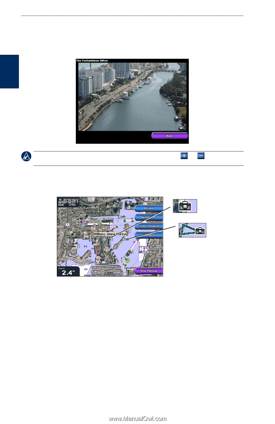
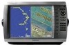
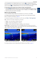
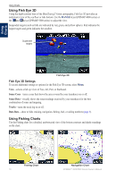
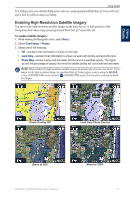
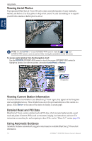
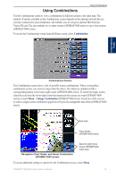
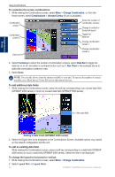
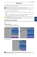
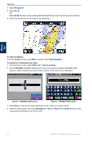
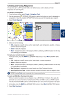
Using Charts Viewing Aerial Photos Preprogrammed BlueChart g2 Vision SD cards contain aerial photographs of many landmarks, marinas, and harbors. Use these photos to help orient yourself to your surroundings or to acquaint yourself with a marina or harbor prior to arrival. Using Charts Note: Use the RANGE (+/-) keys (GPSMAP 4000 series) or touch the and keys (GPSMAP 5000 series) to zoom in and out while viewing the aerial photo on the full screen. To access aerial photos from the Navigation chart: Use the ROCKER (GPSMAP 4000 series) or touch the screen (GPSMAP 5000 series) to highlight a camera icon with the pointer, and select Aerial Photo or Review. Overhead Perspective Viewing Current Station Information If current stations are available in your BlueChart g2 Vision region, they appear on the Navigation chart as highlighted arrows. These detailed icons show the speed and direction of the current at a glance. Select Review or the name of the station to display a current graph. Detailed Road and POI Data BlueChart g2 Vision contains detailed road and POI data, which includes highly detailed coastal roads and points of interest (POIs) such as restaurants, lodging, local attractions, and more. For instructions on searching for, and navigating to, these POIs, see the "Where To?" section (page 21). Using Automatic Guidance Automatic Guidance automatically suggests routes based on available BlueChart g2 Vision chart information. 18 GPSMAP® 4000/5000 Series Owner's Manual
-
 1
1 -
2
-
3
-
4
-
5
-
6
-
7
-
8
-
9
-
10
-
11
-
12
-
13
-
14
-
15
-
16
-
 17
17 -
 18
18 -
 19
19 -
 20
20 -
 21
21 -
 22
22 -
 23
23 -
 24
24 -
 25
25 -
 26
26 -
 27
27 -
28
-
29
-
30
-
31
-
32
-
33
-
34
-
35
-
36
-
37
-
38
-
39
-
40
-
41
-
42
-
43
-
44
-
45
-
46
-
47
-
48
-
49
-
50
-
51
-
52
-
53
-
54
-
55
-
56
-
57
-
58
-
59
-
60
-
61
-
62
-
63
-
64
-
65
-
66
-
67
-
68
 |
 |