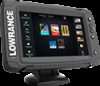
Lowrance Elite-7 Ti Operators Manual EN
Lowrance Elite-7 Ti Manual
 |
View all Lowrance Elite-7 Ti manuals
Add to My Manuals
Save this manual to your list of manuals |
Lowrance Elite-7 Ti manual content summary:
- Lowrance Elite-7 Ti | Operators Manual EN - Page 1
ELITE Ti Operator Manual ENGLISH lowrance.com - Lowrance Elite-7 Ti | Operators Manual EN - Page 2
- Lowrance Elite-7 Ti | Operators Manual EN - Page 3
Hot Spots Inc. Copyright© 2012 Fishing Hot Spots. C-MAP is a trademark of Jeppesen. SD™ and microSD™ are trademarks or registered trademarks of SD-3C, LLC in the United States, other countries or both. Wi-Fi® is a registered trademark of the Wi-Fi Alliance®. Preface | ELITE Ti Operator Manual 3 - Lowrance Elite-7 Ti | Operators Manual EN - Page 4
of Bluetooth SIG, Inc. Power-Pole® is a registered trademark of JL Marine Systems, Inc. C-Monster™ is a trademark of JL Marine Systems, Inc. Navico product references This manual can refer to the following Navico products: • Broadband Sounder™ (Broadband Sounder) • DownScan Imaging™ (DownScan - Lowrance Elite-7 Ti | Operators Manual EN - Page 5
of conformity is available on the following website: lowrance.com. About this manual This manual is a reference guide for operating the ELITE Ti. It assumes that all equipment is installed and configured, and that the system is ready to use. The manual assumes that the user has basic knowledge of - Lowrance Elite-7 Ti | Operators Manual EN - Page 6
Use the menu options or the keys and on-screen buttons to maneuver in the PDF file the page Drag finger on the screen in any direction. • Zoom In/Out Key operation: Use the + and - keys. • Exit the PDF viewer Select the X in the upper right corner of the panel. 6 Preface | ELITE Ti Operator Manual - Lowrance Elite-7 Ti | Operators Manual EN - Page 7
The software version currently on this unit can be found in the About dialog. The About dialog is available in the System Settings. For more information, refer to "About" on page 110. For upgrading your software, refer to "Software upgrades" on page 115. Preface | ELITE Ti Operator Manual 7 - Lowrance Elite-7 Ti | Operators Manual EN - Page 8
8 Preface | ELITE Ti Operator Manual - Lowrance Elite-7 Ti | Operators Manual EN - Page 9
Vessel symbol 29 Chart scale 30 Panning the chart 30 Positioning the vessel on the chart panel 31 Displaying information about chart items 31 Using the cursor on the chart panel 32 Creating routes 32 Find objects on chart panels 32 3D charts 33 Chart overlay Contents | ELITE Ti Operator Manual 9 - Lowrance Elite-7 Ti | Operators Manual EN - Page 10
settings 71 StructureScan 71 The StructureScan image 72 Zooming the StructureScan image 72 Using the cursor on the StructureScan panel 73 Viewing StructureScan history 73 Setting up the StructureScan image 74 Stop sonar 75 Advanced StructureScan settings 10 Contents | ELITE Ti Operator Manual - Lowrance Elite-7 Ti | Operators Manual EN - Page 11
files to Insight Genesis 94 Bluetooth wireless technology 95 Wireless settings 98 AIS 98 AIS target symbols 99 Searching for AIS items 99 Viewing information about single AIS targets 100 Calling an AIS vessel 100 AIS SART 102 Vessel alarms 103 Vessel settings Contents | ELITE Ti Operator Manual 11 - Lowrance Elite-7 Ti | Operators Manual EN - Page 12
Waypoints/routes/trails 108 Tides 108 Alarms 108 Settings 111 Vessels 111 Sun, Moon 112 Trip Software upgrades 116 Backing up your system data 119 Simulator 119 Demo mode 119 Simulator source files 120 Advanced simulator settings 121 Touchscreen operation 12 Contents | ELITE Ti Operator Manual - Lowrance Elite-7 Ti | Operators Manual EN - Page 13
3 4 5 6 1 Touch screen 2 Pages 3 Zoom out / Zoom in (combined press = MOB) 4 New waypoint (long press = Find dialogue) 5 Power button Press and hold to turn the unit ON/OFF. Press once to display the System Controls dialog. 6 Card reader (behind logo) Introduction | ELITE Ti Operator Manual 13 - Lowrance Elite-7 Ti | Operators Manual EN - Page 14
any operation by a short press on the Pages key. 1 Tools Select a button to access dialogs used for carrying out a task, or for browsing stored information. 2 Local time and Water depth 3 Applications button to enter edit mode for the Favorites panel. 14 Introduction | ELITE Ti Operator Manual - Lowrance Elite-7 Ti | Operators Manual EN - Page 15
by a short press on the Power key. 4 Dialog Information to or input from the user. 5 Alarm message Displayed if dangerous situations or system faults occur. Split pages You can have up to 4 panels on each page. 2 panels page 3 panels page Introduction | ELITE Ti Operator Manual 4 panels page 15 - Lowrance Elite-7 Ti | Operators Manual EN - Page 16
, which can be controlled by the C-Monster Control System installed on your boat, can be controlled from the ELITE Ti. To control the Power-Poles, you 'pair' the Power-Poles with the ELITE Ti using Bluetooth wireless technology available in both products. 16 Introduction | ELITE Ti Operator Manual - Lowrance Elite-7 Ti | Operators Manual EN - Page 17
are paired with the ELITE Ti, the Power-Pole button becomes available in the System Controls dialog. Select it to display the Power-Pole controller. For pairing Bluetooth devices, refer to "Pairing Bluetooth devices" on page 94. If you are pairing dual Power-Poles, also review "Pairing with dual - Lowrance Elite-7 Ti | Operators Manual EN - Page 18
connected to all paired Power-Pole anchors. Ú Note: Selecting to Stay connected speeds up access to the controls, but the anchors cannot be controlled from another display when it is selected. Turn off this option to allow connection from other displays. 18 Introduction | ELITE Ti Operator Manual - Lowrance Elite-7 Ti | Operators Manual EN - Page 19
and the backlight for screen and keys are turned off to save power. The system continues to run in the background. You select Standby mode from the System Controls dialog. Switch from Standby mode to normal operation by a short press on the Power key. Basic operation | ELITE Ti Operator Manual 19 - Lowrance Elite-7 Ti | Operators Manual EN - Page 20
When the touch lock is active you can only operate the unit from the keys. You lock the touchscreen from the System Controls dialog. You remove the lock function by a short press on the Power key. Using menus and dialogs Menus The menu is used to operate the system and to adjust settings. • Activate - Lowrance Elite-7 Ti | Operators Manual EN - Page 21
. The active panel is outlined with a border. You can only access the page menu of an active panel. You activate a panel by tapping it. Using the cursor on the panel The cursor can be used to measure a distance, to mark a position, and to select items. Basic operation | ELITE Ti Operator Manual 21 - Lowrance Elite-7 Ti | Operators Manual EN - Page 22
cursor can be used to measure the distance between your vessel and a selected position, or between 2 points on the chart panel. 1. Position the cursor on the point from where you want to measure the distance. Start the measure function from the menu 22 Basic operation | ELITE Ti Operator Manual - Lowrance Elite-7 Ti | Operators Manual EN - Page 23
to the initial MOB waypoint. Navigation to subsequent MOB waypoints needs to be done manually. Cancel navigation to MOB The system continues to display navigational information towards the MOB waypoint the MOB waypoint and then the MOB waypoint pop-up. Basic operation | ELITE Ti Operator Manual 23 - Lowrance Elite-7 Ti | Operators Manual EN - Page 24
waypoint menu option When an MOB waypoint is activated, you can use the Waypoint MOB menu option to: • Move it on the and Power keys to take a screen capture. Screen captures are saved to internal memory. To view files, refer to "Files" on page 112. 24 Basic operation | ELITE Ti Operator Manual - Lowrance Elite-7 Ti | Operators Manual EN - Page 25
wallpaper can be customized. You can select one of the pictures included with the system, or you can use your own picture in .jpg or .png format. The images can be available on any location that can or selecting the save option in the menu. Customizing your system | ELITE Ti Operator Manual 25 - Lowrance Elite-7 Ti | Operators Manual EN - Page 26
System Controls dialog. When Data overlay is on, an orange bar appears above the icon. Edit overlay data Use the Edit overlay option on the System Controls dialog to access edit menu options to: • Add a new data to open the page editor dialog 26 Customizing your system | ELITE Ti Operator Manual - Lowrance Elite-7 Ti | Operators Manual EN - Page 27
2. Drag and drop page icons to set up a new page 3. Change the panel arrangement (only possible for 2 or 3 panels), if required 4. Save the page layout. in the page editor dialog 3. Save or discard your changes to leave the favorite edit mode. Customizing your system | ELITE Ti Operator Manual 27 - Lowrance Elite-7 Ti | Operators Manual EN - Page 28
a StructureScan image. The Chart panel 1 Waypoint* 2 Vessel with extension line (extension line is optional) 3 Route* 4 North indicator 5 Grid lines* 6 Range rings* 7 Trail* 8 Chart range scale 9 Range rings interval (only displayed when Range rings are turned on) 28 Charts | ELITE Ti Operator - Lowrance Elite-7 Ti | Operators Manual EN - Page 29
All units support Insight charts from Navico including Insight Genesis. The system also supports charts from Navionics and Jeppesen using COG (Course over Ground). Chart scale You zoom in and out on the chart by using the zoom (+ or -) buttons or the + and - keys. Charts | ELITE Ti Operator Manual - Lowrance Elite-7 Ti | Operators Manual EN - Page 30
heading is not available, then the COG from the GPS is used. Course up Rotates the chart in the direction of the next waypoint when navigating a route or navigating to a waypoint. If not navigating the heading up orientation is used until navigation is started. 30 Charts | ELITE Ti Operator Manual - Lowrance Elite-7 Ti | Operators Manual EN - Page 31
the vessel position. Select the Restore cursor menu option to display the cursor in its previous location. The Clear cursor and Restore cursor options are useful features for toggling between the vessel's current location and the cursor position. Charts | ELITE Ti Operator Manual 31 - Lowrance Elite-7 Ti | Operators Manual EN - Page 32
graphical view of land and sea contours. Ú Note: All chart types work in 3D mode, but without 3D cartography for the appropriate area the chart appears flat. When the 3D chart option is selected, the Pan and the Rotate icons appear on the chart panel. 32 Charts | ELITE Ti Operator Manual - Lowrance Elite-7 Ti | Operators Manual EN - Page 33
setting. See "Positioning the vessel on the chart panel" on page 30. Zooming a 3D chart You zoom in and out on a 3D chart by using the zoom (+ or -) buttons or by using the + and - keys. Chart overlay Structure sonar , refer to "Structure options" on page 80. Charts | ELITE Ti Operator Manual 33 - Lowrance Elite-7 Ti | Operators Manual EN - Page 34
specific chart options Orientation, Look ahead, 3D, and change Chart source (previously described view options Chart detail • Full All available information for the chart in use. • Medium Minimum information sufficient for navigation. • Low Basic level see. 34 Charts | ELITE Ti Operator Manual - Lowrance Elite-7 Ti | Operators Manual EN - Page 35
website: www.navionics.com. Navionics chart settings Colored seabed areas Used for displaying different depth areas in different shades of blue. Annotation Determines what area information, such as names of locations and notes of areas, is available to display. Charts | ELITE Ti Operator Manual 35 - Lowrance Elite-7 Ti | Operators Manual EN - Page 36
of the diamond icons used for static tides and current information. The tide and current data available in Navionics charts are related to a specific date and time. The system animates the arrows and/or gauges to show the tides and currents evolution over time. 36 Charts | ELITE Ti Operator Manual - Lowrance Elite-7 Ti | Operators Manual EN - Page 37
symbol. The red symbol is used when current speed is increasing, and the blue symbol is used when current speed is decreasing. Tide height The gauge has 8 labels and is set according to absolute max/min value You can view photo overlays in either 2D or 3D modes. Charts | ELITE Ti Operator Manual 37 - Lowrance Elite-7 Ti | Operators Manual EN - Page 38
to highlight a specific range of depths for fishing purposes. The range is only as accurate as the underlying chart data, meaning that if the chart only contains 5 meter intervals for contour lines, the shading is rounded to the nearest available contour line. 38 Charts | ELITE Ti Operator Manual - Lowrance Elite-7 Ti | Operators Manual EN - Page 39
the letter T (Tides) or C (Current). When you select one of the icons, tidal or current information for that location are displayed. Dynamic current data can be viewed by zooming inside a 1-nautical mile zoom range. At that range, the Current icon changes to an Charts | ELITE Ti Operator Manual 39 - Lowrance Elite-7 Ti | Operators Manual EN - Page 40
icons Jeppesen specific chart options Orientation, Look ahead, 3D, and change Chart source (previously described in this section) are common for all chart types. Presentation The charts can be displayed in different imagery styles. Shaded relief No contours 40 Charts | ELITE Ti Operator Manual - Lowrance Elite-7 Ti | Operators Manual EN - Page 41
lines. Jeppesen view options Chart detail • Full All available information for the chart in use. • Medium Minimum information sufficient for navigation. • Low Basic level of information that cannot off individually depending on which information you want to see. Charts | ELITE Ti Operator Manual 41 - Lowrance Elite-7 Ti | Operators Manual EN - Page 42
Photo overlay, land only Full Photo overlay Photo transparency The Photo transparency sets the opaqueness of the photo overlay. With minimum transparency settings the chart details are almost hidden by the photo. Minimum transparency Transparency at 80 42 Charts | ELITE Ti Operator Manual - Lowrance Elite-7 Ti | Operators Manual EN - Page 43
the map to a paper chart style. Safety depth Jeppesen charts use different shades of blue to distinguish between shallow (lighter shades) depth, specify the desired safety depth limit. The Safety depth sets the limit at which depths will be drawn without blue 2. Charts | ELITE Ti Operator Manual 43 - Lowrance Elite-7 Ti | Operators Manual EN - Page 44
to make them look taller or deeper. Ú Note: This option is grayed out if the data is not available in the map card inserted. Chart settings Settings and display options made in the Chart settings page are common for all chart panels. 44 Charts | ELITE Ti Operator Manual - Lowrance Elite-7 Ti | Operators Manual EN - Page 45
on the other chart when a 2D and a 3D chart are shown side by side. Pop-up information Selects whether basic information for chart items is displayed when you select the item. Grid lines Turns on/off viewing of longitude and latitude grid lines on the chart. Charts | ELITE Ti Operator Manual 45 - Lowrance Elite-7 Ti | Operators Manual EN - Page 46
Hide chart If the option is set to ON when viewing a Lowrance chart, the chart (background) is not displayed and only the vessel, extensions, waypoints, and items on chart panels. Also opens the Waypoints, Routes and Trails dialogs you can use to manage them. 46 Charts | ELITE Ti Operator Manual - Lowrance Elite-7 Ti | Operators Manual EN - Page 47
functions and settings for these items Sonar image has a depth value, in addition to position information. A waypoint is used to mark a position you later may want to return to. Two or more waypoints can also be combined to create a route. Waypoints, Routes, and Trails | ELITE Ti Operator Manual - Lowrance Elite-7 Ti | Operators Manual EN - Page 48
a waypoint from the Edit Waypoint dialog. The dialog can also be accessed from the Waypoints tool on the Home page. 48 Waypoints, Routes, and Trails | ELITE Ti Operator Manual - Lowrance Elite-7 Ti | Operators Manual EN - Page 49
. You can delete MOB waypoints the same way. Waypoint alarm settings You can set an alarm radius for each individual waypoint you create. The alarm is set in the Edit Waypoint dialog. Ú Note: The waypoint radius save option in the menu. Waypoints, Routes, and Trails | ELITE Ti Operator Manual 49 - Lowrance Elite-7 Ti | Operators Manual EN - Page 50
routes from the Routes tool on the Home page. Creating routes using existing waypoints You can create a new route by combining existing waypoints from the Routes dialog. The dialog is activated by using the Routes tool on the Home page. 50 Waypoints, Routes, and Trails | ELITE Ti Operator Manual - Lowrance Elite-7 Ti | Operators Manual EN - Page 51
Edit Route dialog. This dialog is activated by selecting an active route's pop-up or from the menu. The dialog can also be accessed by using the Routes tool on the Home page. Waypoints, Routes, and Trails | ELITE Ti Operator Manual 51 - Lowrance Elite-7 Ti | Operators Manual EN - Page 52
position trail points based on time settings, distance, or by letting the system position a waypoint automatically when a course change is registered. Ú Note: The Trails option must also be turned ON in the chart settings to be visible. 52 Waypoints, Routes, and Trails | ELITE Ti Operator Manual - Lowrance Elite-7 Ti | Operators Manual EN - Page 53
can be set to automatically used to display information when you are navigating. It is activated from the Home page, either as a full page panel or as part of a multiple panel page. 1 Data fields 2 Vessel heading 3 Bearing to waypoint 4 Destination point Navigating | ELITE Ti Operator Manual - Lowrance Elite-7 Ti | Operators Manual EN - Page 54
started, the menu expands and shows options for canceling the navigation, for skipping a waypoint, and for restarting the route from current vessel position. 54 Navigating | ELITE Ti Operator Manual - Lowrance Elite-7 Ti | Operators Manual EN - Page 55
. When you start navigation on a system with autopilot functionality, you are prompted to set the autopilot to navigation mode. If you choose not to engage the autopilot, the autopilot can be set to navigation mode from the Autopilot Controller later on. Navigating | ELITE Ti Operator Manual 55 - Lowrance Elite-7 Ti | Operators Manual EN - Page 56
an alarm is activated. XTE alarm (Cross track error) Turns on/off the XTE alarm. Trails Opens the Trails dialog where trails settings can be adjusted and trails can be converted into routes for navigation. Refer to "Converting Trails to Routes" on page 51. 56 Navigating | ELITE Ti Operator Manual - Lowrance Elite-7 Ti | Operators Manual EN - Page 57
settings Defines Loran chains (GRI) and preferred station for waypoint entry, cursor position and position panel. The graphic example shows a cursor position window with Loran position information. For more information refer to your Loran system documentation. Navigating | ELITE Ti Operator Manual - Lowrance Elite-7 Ti | Operators Manual EN - Page 58
Sonar image 1 Fish arches 2 History preview* 3 Temperature graph* 4 Depth at cursor 5 Amplitude scope* 6 Zoom (range) buttons 7 Water depth and Water temperature at cursor location 8 Range scale 9 Bottom * Optional Sonar items that you turn on/off individually. 58 Sonar | ELITE Ti Operator Manual - Lowrance Elite-7 Ti | Operators Manual EN - Page 59
using the zoom (+ or -) buttons • using the +/- keys Zoom level is shown on the bottom left side of the image. When zooming in, the sea floor is kept near the bottom of the screen, irrespective of whether it is in auto-range or manual range. If the range is set . Sonar | ELITE Ti Operator Manual 59 - Lowrance Elite-7 Ti | Operators Manual EN - Page 60
is the preferred setting for most fish finding sonar use. Preset range levels Allows for the selection of a specific depth range that is not tied to the depth of the water. Custom range This option allows you to manually set both upper and lower range limits. 60 Sonar | ELITE Ti Operator Manual - Lowrance Elite-7 Ti | Operators Manual EN - Page 61
The unit supports several transducer frequencies. Available frequencies depend on the transducer model that is connected. Ú Note: This unit cannot operate CHIRP frequencies and SideScan at the same time. If you turn on StructureScan Left/Right view, you will not be able to use the CHIRP sonar. You - Lowrance Elite-7 Ti | Operators Manual EN - Page 62
moving. Ping speed Ping speed controls the rate the transducer transmits the Sonar signal into the water. By default, the ping speed is set to max. It may be necessary to adjust the ping speed to limit interference or to adjust for specific fishing conditions. 62 Sonar | ELITE Ti Operator Manual - Lowrance Elite-7 Ti | Operators Manual EN - Page 63
the Advanced menu option, or from the Sonar Settings dialog. When the data is being recorded, there is a flashing red symbol in the top left corner and a message appears periodically at the bottom of the screen. Filename Specify the name of the recording (log). Sonar | ELITE Ti Operator Manual 63 - Lowrance Elite-7 Ti | Operators Manual EN - Page 64
setting the recorded log files as Private or Public at Insight Genesis. Time remaining Shows the remaining allocated space available for recordings. Stop recording log data Select Stop in the Logging Sonar dialog to fully stop the recording of all sonar log data. 64 Sonar | ELITE Ti Operator - Lowrance Elite-7 Ti | Operators Manual EN - Page 65
Both internally and externally stored sounder records may be reviewed when the view sonar log option is selected in the Sonar settings dialog. Refer to "Sonar settings" on page 68. The log file is displayed X symbol in the upper right corner of the replay image. Sonar | ELITE Ti Operator Manual 65 - Lowrance Elite-7 Ti | Operators Manual EN - Page 66
image on the left side of the panel. By default the zoom level is set to 2x. You can select up to 8x zoom from the drop-down menu, using the +/- keys, or the zoom (+ or -) buttons. The range zoom side of the panel is adjusted as described for the Zoom option. 66 Sonar | ELITE Ti Operator Manual - Lowrance Elite-7 Ti | Operators Manual EN - Page 67
the actual echo is indicated by both width and color intensity. Preview You can have all available sonar history shown at the top of the sonar screen. The Preview bar is a snapshot of available sonar history. You can scroll through sonar history by dragging the Sonar | ELITE Ti Operator Manual 67 - Lowrance Elite-7 Ti | Operators Manual EN - Page 68
fish echoes Fish symbols Fish symbols and depth indication Ú Note: Not all fish symbols are actual fish. Sonar settings Overlay downscan When a DownScan source is connected to your system, you can overlay DownScan images on the regular Sonar image. 68 Sonar | ELITE Ti Operator Manual - Lowrance Elite-7 Ti | Operators Manual EN - Page 69
settings adjustments made while using a fishing mode. Log sonar Select to start and stop recording of Sonar data. For more information, refer to "Start recording log data" on page 63. This option is also available from the Advanced option in the Sonar menu. Sonar | ELITE Ti Operator Manual 69 - Lowrance Elite-7 Ti | Operators Manual EN - Page 70
one channel was recorded in the selected Sonar file, you can select which channel to display. You exit the view function by selecting the X in the upper right corner. Installation Used for installation and setup. See the separate ELITE Ti Installation manual. 70 Sonar | ELITE Ti Operator Manual - Lowrance Elite-7 Ti | Operators Manual EN - Page 71
will not be able to use the CHIRP sonar. The StructureScan image The view The StructureScan panel can be set up as a DownScan image, or showing left/right side scanning. The DownScan image can also be added as an overlay to the traditional Sonar image. StructureScan | ELITE Ti Operator Manual 71 - Lowrance Elite-7 Ti | Operators Manual EN - Page 72
left side of the panel. Using the cursor on the StructureScan panel By default, the cursor is not shown on the StructureScan image. When you position the cursor on a DownScan image, the screen pauses, the from the panel, select the Clear cursor option. 72 StructureScan | ELITE Ti Operator Manual - Lowrance Elite-7 Ti | Operators Manual EN - Page 73
Clear cursor to return to the normal menu. Range The range setting determines the water depth and SideScan range that is visible on the screen. Auto range When the range is set to Auto the system automatically sets the range depending on the water depth. StructureScan | ELITE Ti Operator Manual 73 - Lowrance Elite-7 Ti | Operators Manual EN - Page 74
of fishing conditions. View You can set up the StructureScan page as a DownScan image, left only, right only, or left/right side scanning. Stop sonar Use the Stop sonar menu option when you want to turn off the StructureScan transducer, but not turn off the unit. 74 StructureScan | ELITE Ti - Lowrance Elite-7 Ti | Operators Manual EN - Page 75
default, the sonar history preview appears when the cursor is active. Recording StructureScan data You can record StructureScan data and save the file internally in the unit, or onto a memory card as described in "Start recording sonar data" on page 63. StructureScan | ELITE Ti Operator Manual 75 - Lowrance Elite-7 Ti | Operators Manual EN - Page 76
feature overlays SideScan images from a StructureScan source on the map. This makes the chart as usual when you have a Structure overlay: • Touch operation: zoom the chart and the scanned image by using the zoom (+ or -) buttons. Drag on the panel to 76 StructureMap | ELITE Ti Operator Manual - Lowrance Elite-7 Ti | Operators Manual EN - Page 77
files are used as the source, all StructureMap files found on the memory card and in the system's internal memory are displayed. If there is more than one StructureMap of the same area, the images overlap and clutter the chart. If several logs of the same StructureMap | ELITE Ti Operator Manual 77 - Lowrance Elite-7 Ti | Operators Manual EN - Page 78
is stopped by re-selecting the record function. Converting StructureScan data to StructureMap format A StructureScan log file (.sl2) is converted to StructureMap format (.smf ) after recording from the recording dialog, or from the files browser. 78 StructureMap | ELITE Ti Operator Manual - Lowrance Elite-7 Ti | Operators Manual EN - Page 79
and other third-party charting cards compatible with the system. When using StructureMap with mapping cards, copy the StructureMap (.smf ) files to the unit's internal memory. We recommend keeping copies of StructureMap files on external mapping cards. StructureMap | ELITE Ti Operator Manual 79 - Lowrance Elite-7 Ti | Operators Manual EN - Page 80
Sets the transducer frequency used by the unit. 800 kHz offers the best resolution, while 455 kHz has greater depth and range coverage. Clear live history Clears existing live history data from the screen and begins showing only the most current data. 80 StructureMap | ELITE Ti Operator Manual - Lowrance Elite-7 Ti | Operators Manual EN - Page 81
Log Sonar data Records StructureScan data. Source Selects StructureMap source. StructureMap | ELITE Ti Operator Manual 81 - Lowrance Elite-7 Ti | Operators Manual EN - Page 82
dashboards within the panel. Dashboards A set of dashboard styles are predefined to set limits for analog gauges. All edit options are available from the Info panel menu. Available editing options depend on which data sources are connected to your system. 82 Info panels | ELITE Ti Operator Manual - Lowrance Elite-7 Ti | Operators Manual EN - Page 83
be displayed, configure limits, and eventually change the source for the information 5. Save your changes by selecting the save option in the menu Info panels | ELITE Ti Operator Manual 83 - Lowrance Elite-7 Ti | Operators Manual EN - Page 84
be made available by MotorGuide, and posted on lowrance.com. Follow the onscreen instructions to update Xi5 software. Safe operation with the autopilot Warning: An autopilot is a useful navigational aid, but DOES NOT replace a human navigator. 84 Trolling motor autopilot | ELITE Ti Operator Manual - Lowrance Elite-7 Ti | Operators Manual EN - Page 85
by pressing the Power key. You can select the position of the Autopilot Controller on the page. Refer to "Autopilot settings" on page 90 also be set up as a panel in a split panel page by using the Page Editor to make a Favorite page. For Trolling motor autopilot | ELITE Ti Operator Manual 85 - Lowrance Elite-7 Ti | Operators Manual EN - Page 86
navigation mode to the selected arrival mode when your vessel reaches the destination. Arrival mode is set to Standby by default. Before starting a navigation mode or a turn pattern, it is Here Enables anchor mode at your current location. 86 Trolling motor autopilot | ELITE Ti Operator Manual - Lowrance Elite-7 Ti | Operators Manual EN - Page 87
value(s) in the turn pattern dialog or use default settings. 3. Select the direction of the turn. Ú Note: Selecting a turn radius smaller than the GPS accuracy may result in incomplete navigation of the Steers the vessel in a zigzag pattern. Trolling motor autopilot | ELITE Ti Operator Manual 87 - Lowrance Elite-7 Ti | Operators Manual EN - Page 88
pre-defined route. The position information from the GPS is used to keep the boat on the track line towards to your Arrival mode setting. Refer to "Autopilot settings" on page 90. Trolling power) shown as "%" in the Autopilot information bar. 88 Trolling motor autopilot | ELITE Ti Operator Manual - Lowrance Elite-7 Ti | Operators Manual EN - Page 89
Spd or Set prop option and entering your desired speed or propeller rate. Recording and converting a trail to a route The Record trail button is used to record and convert a trail or part of a trail to 4. Enter the route details and save it. Trolling motor autopilot | ELITE Ti Operator Manual 89 - Lowrance Elite-7 Ti | Operators Manual EN - Page 90
Autopilot settings Autopilot settings is only applicable for the ELITE-7Ti. Chart compass You can select to show a compass symbol around your boat on the important to select an arrival mode that fits your navigation needs. Arrival modes are: 90 Trolling motor autopilot | ELITE Ti Operator Manual - Lowrance Elite-7 Ti | Operators Manual EN - Page 91
can be saved as a new waypoint, replaced with an existing waypoint, or set as your current coordinates. Anchor points are synced with the Xi5 trolling motor. If any anchor points are stored in the motor, they appear in the anchor points list. Trolling motor autopilot | ELITE Ti Operator Manual 91 - Lowrance Elite-7 Ti | Operators Manual EN - Page 92
Use a wireless device to remotely view (smartphone and tablet) and control the system (tablet only). • Access the GoFree Shop. • Upload your Sonar logs to create custom maps at Insight Genesis. • Download software updates device so that Apps 92 Wireless connection | ELITE Ti Operator Manual - Lowrance Elite-7 Ti | Operators Manual EN - Page 93
files to Insight Genesis. Ú Note: Recorded log files can also be uploaded to Insight Genesis if you have specified Upload to Insight Genesis Wireless connection | ELITE Ti Operator Manual 93 - Lowrance Elite-7 Ti | Operators Manual EN - Page 94
it is able to send and receive Bluetooth signals. 2. Open the Wireless settings dialog in the ELITE Ti and turn on Bluetooth, if it is not already enabled. 3. Select Bluetooth devices. The system searches for Bluetooth enabled devices, and lists them in the Bluetooth Devices dialog. Devices that are - Lowrance Elite-7 Ti | Operators Manual EN - Page 95
the Wireless settings dialog to reset the Bluetooth memory. Once Bluetooth has been toggled back on, proceed in pairing the Power-Poles in the correct order. Wireless settings Provides configuration and setup options for the wireless functionality. Wireless connection | ELITE Ti Operator Manual 95 - Lowrance Elite-7 Ti | Operators Manual EN - Page 96
and the system detects the software is out of date, an option to update is also displayed. WIFI-1 updates, when required, are included with the display updates. Select a device to view tools, and does not provide support related to their use. 96 Wireless connection | ELITE Ti Operator Manual - Lowrance Elite-7 Ti | Operators Manual EN - Page 97
Bluetooth Enables the built-in Bluetooth wireless technology functionality. Bluetooth devices Displays the Bluetooth Device list dialog. Use the Bluetooth Device List dialog to pair or remove pairing to Bluetooth enabled devices. Wireless connection | ELITE Ti Operator Manual 97 - Lowrance Elite-7 Ti | Operators Manual EN - Page 98
can do AIS can be used by the ELITE-5Ti, if the AIS receiver can send and receive at the same NMEA 0183 baud rate. The ELITE-7Ti can use any NMEA 2000 or NMEA as dangerous based on the CPA and TCPA settings. Refer to "Defining dangerous vessels" on page 104. 98 AIS | ELITE Ti Operator Manual - Lowrance Elite-7 Ti | Operators Manual EN - Page 99
Searching for AIS items You can search for AIS targets by using the Find option in the Tools panel. From a chart panel you can search for AIS targets by using the Find option in the menu. If the cursor is AIS pop-up, or from the menu when the target is selected. AIS | ELITE Ti Operator Manual 99 - Lowrance Elite-7 Ti | Operators Manual EN - Page 100
system includes a VHF radio supporting DSC (Digital Select Calling) calls over NMEA 2000 (ELITE-7Ti only) or NMEA 0183, you can initiate a DSC call to other vessels from the ELITE-5Ti or ELITE-7Ti. The call option is on the chart, but this icon is an AIS vessel icon. AIS | ELITE Ti Operator Manual - Lowrance Elite-7 Ti | Operators Manual EN - Page 101
- The display switches to a zoomed chart panel, centered on the AIS SART position - The system creates an active route to the AIS SART position AIS | ELITE Ti Operator Manual 101 - Lowrance Elite-7 Ti | Operators Manual EN - Page 102
an alarm will be activated when a vessel comes within the predefined CPA or TCPA. Refer to "Defining dangerous vessels" on page 104. AIS vessel lost Sets the range for lost vessels. If a vessel is lost within the set range, an alarm occurs. AIS | ELITE Ti Operator Manual - Lowrance Elite-7 Ti | Operators Manual EN - Page 103
settings Your vessel's MMSI number You need to have your own MMSI (Maritime Mobile Service settings must be toggled on for any MMSI message to be displayed. Icon filters By default, all targets are shown on the panel if an AIS device is connected to the system. AIS | ELITE Ti Operator Manual - Lowrance Elite-7 Ti | Operators Manual EN - Page 104
Ground (COG) extension lines for other AIS vessels. The length of the extension lines is either set as off, as a fixed distance, or to indicate the distance the vessel will move in " target symbol. An alarm is triggered if activated in the Alarm settings panel. 104 AIS | ELITE Ti Operator Manual - Lowrance Elite-7 Ti | Operators Manual EN - Page 105
according to how the reported situation affects your vessel. The following color codes are used: Color Red Orange Yellow Blue Green Importance Critical Important Standard Warning Light warning Single The remaining alarms are available in the Alarms dialog. Alarms | ELITE Ti Operator Manual 105 - Lowrance Elite-7 Ti | Operators Manual EN - Page 106
the alarm or until the reason for the alarm is removed. Alarms dialog All alarms are setup in the Alarms Settings dialog. 106 The alarm dialogs can also be activated from the Tools panel. The alarm dialogs include information about active alarms and alarm history. Alarms | ELITE Ti Operator Manual - Lowrance Elite-7 Ti | Operators Manual EN - Page 107
Alarms | ELITE Ti Operator Manual 107 - Lowrance Elite-7 Ti | Operators Manual EN - Page 108
Settings Provides access to application and system settings. System settings The system settings provides access to the following: Language Controls the language used on this unit for panels, menus, and dialogs. Changing the language causes the unit to restart. 108 Tools | ELITE Ti Operator Manual - Lowrance Elite-7 Ti | Operators Manual EN - Page 109
datum settings accordingly to match your paper charts. Coordinate system Several coordinate systems can be used to settings are to be restored to their original factory settings. Warning: If waypoints, routes, and trails are selected, they are permanently deleted. Tools | ELITE Ti Operator Manual - Lowrance Elite-7 Ti | Operators Manual EN - Page 110
and tanks, and calibration of tanks (refuel) dialogs. Refer to the Installation Manual. Alarms Provides the option to enable the siren. It also provides a dialog where you specify turning on alarms for items, and includes active alarm information and alarm history. Tools | ELITE Ti Operator Manual - Lowrance Elite-7 Ti | Operators Manual EN - Page 111
, and configuration options. For more information about using this panel, refer to the Installation Manual. Vessels Provides dialogs where you define your vessel's MMSI, set icon filters, set course extension length, and specify dangerous vessels settings of closest point of approach and time to - Lowrance Elite-7 Ti | Operators Manual EN - Page 112
for Files, Waypoints, Routes, Trails, and Settings. Viewing files Select a file in the Sonar logs to be shared on Social Map charts. When you log on, the system automatically gives you a notification if a new software version is available for your system. If 112 Tools | ELITE Ti Operator Manual - Lowrance Elite-7 Ti | Operators Manual EN - Page 113
an update is available, you can download it to a card slot or defer the download until later. Tools | ELITE Ti Operator Manual 113 - Lowrance Elite-7 Ti | Operators Manual EN - Page 114
instructions on the screen to perform the calibration. When completed, the unit returns to the application screen. NMEA Data logging All serial output sentences sent over the NMEA TCP connection are logged to an internal file. You can export and review this file for service | ELITE Ti Operator Manual - Lowrance Elite-7 Ti | Operators Manual EN - Page 115
you select the Log database you are prompted to select a destination folder and filename. Once accepted, the log file is written to the chosen location. Software upgrades The latest software is available for download from our website, lowrance.com. Maintenance | ELITE Ti Operator Manual 115 - Lowrance Elite-7 Ti | Operators Manual EN - Page 116
on the web that shares among most GPS systems in the world. Use this format if you are taking data to a competitors unit. Export all Waypoints, Routes and Trails Use the export option if you want to backup all Waypoints, Routes, and Trails on your system. 116 Maintenance | ELITE Ti Operator Manual - Lowrance Elite-7 Ti | Operators Manual EN - Page 117
the desired region 3. Select the export option from the menu 4. Select the appropriate file format 5. Select the serial port field to start the export Maintenance | ELITE Ti Operator Manual 117 - Lowrance Elite-7 Ti | Operators Manual EN - Page 118
Purging Waypoints, Routes and Trails Ú Note: When user data is purged from the memory, it cannot be recovered. 118 Maintenance | ELITE Ti Operator Manual - Lowrance Elite-7 Ti | Operators Manual EN - Page 119
files You can select which data files are used by the simulator. A set of source files is included in your system, and you can import files by using a card inserted into the card reader. You can also use your own recorded log data files in the simulator. Simulator | ELITE Ti Operator Manual 119 - Lowrance Elite-7 Ti | Operators Manual EN - Page 120
or Simulated route. Otherwise, GPS data including speed and course come from the selected source file. Set start position Moves your vessel to the current cursor position. Ú Note: This option is only available when the GPS source is set to Simulated course. Simulator | ELITE Ti Operator Manual - Lowrance Elite-7 Ti | Operators Manual EN - Page 121
different panels is shown in the table below. The panel sections in this manual have more information about panel specific touchscreen operation. Icon Description Tap to: • the scrolling. Pan to position a chart or Sonar image on the panel. Touchscreen operation | ELITE Ti Operator Manual 121 - Lowrance Elite-7 Ti | Operators Manual EN - Page 122
122 Touchscreen operation | ELITE Ti Operator Manual - Lowrance Elite-7 Ti | Operators Manual EN - Page 123
Auto sensitivity Sonar 61 Autopilot Anchor mode 86 Anchor point setup 91 Arrival mode 86, 90 Chart compass 90 Control location setting 90 your system data 116 Bluetooth Enable 97 Pairing devices 94 Wireless technology 94 Bottom lock 66 C Card Copying files to 112 Charts 28 3D charts 32 Chart - Lowrance Elite-7 Ti | Operators Manual EN - Page 124
42 Photo transparency, Navionics 38 Positioning the vessel on the chart panel 30 Selecting chart type 29 Settings 44 Symbol 30 Using the cursor 31 Vessel symbol 29 Zooming 29 Chart Heading up 30 North up 30 Colorline Adjusting 61 Sonar 61 Configuring overlay data 26 Connect Bluetooth devices 94 - Lowrance Elite-7 Ti | Operators Manual EN - Page 125
Files Viewing 112 Find items tool 112 Fishing mode 69 Reset 69 Flasher 67 Frequency 61 settings 57 M Magnetic variation 109 Maintenance Touchscreen Calibration 114 Man Overboard Cancel navigation to MOB 23 Creating a MOB 23 Display information 23 Manual mode Sonar 63 Manual About 5 Version 5 Manuals - Lowrance Elite-7 Ti | Operators Manual EN - Page 126
Touch 121 Overlay data Configuring 26 turn on and off 26 Overlay downscan 68 Overlay, data information 26 P Pages Selecting a page 21 Selecting active panel 21 Pair Bluetooth devices 94 Palettes 67, 74 Panels Adjusting panel size 25 PDF, viewing files 5 Phantom Loran 57 Settings 57 Power-Poles - Lowrance Elite-7 Ti | Operators Manual EN - Page 127
88 Split pages 15 Standby mode, Autopilot 87 Steer panel 54 Stop sonar 62 StructureMap 64, 76 Activate 76 Image 76 Live source 77 Mapping cards 79 Options 80 Saved files 77 Sources 77 Tips 78 StructureScan 71 Advanced settings 75 Auto range 73 Contrast 74 Convert data to StructureMap format 78 - Lowrance Elite-7 Ti | Operators Manual EN - Page 128
Settings 108 Trails 108 Waypoints 108 Touchscreen Calibration 114 Touch Operation 121 Touchscreen Locking 20 Trails Converting trails to routes 51 Creating new 52 Navigating settings 56 Settings 19 U Units of measure, setting 111 V Vessel alarms 102 Vessel settings 103 View Echosounder log 70 Viewing - Lowrance Elite-7 Ti | Operators Manual EN - Page 129
- Lowrance Elite-7 Ti | Operators Manual EN - Page 130
0980 *988-11048-001*
-
 1
1 -
 2
2 -
 3
3 -
 4
4 -
 5
5 -
 6
6 -
 7
7 -
8
-
9
-
10
-
11
-
12
-
13
-
14
-
15
-
16
-
17
-
18
-
19
-
20
-
21
-
22
-
23
-
24
-
25
-
26
-
27
-
28
-
29
-
30
-
31
-
32
-
33
-
34
-
35
-
36
-
37
-
38
-
39
-
40
-
41
-
42
-
43
-
44
-
45
-
46
-
47
-
48
-
49
-
50
-
51
-
52
-
53
-
54
-
55
-
56
-
57
-
58
-
59
-
60
-
61
-
62
-
63
-
64
-
65
-
66
-
67
-
68
-
69
-
70
-
71
-
72
-
73
-
74
-
75
-
76
-
77
-
78
-
79
-
80
-
81
-
82
-
83
-
84
-
85
-
86
-
87
-
88
-
89
-
90
-
91
-
92
-
93
-
94
-
95
-
96
-
97
-
98
-
99
-
100
-
101
-
102
-
103
-
104
-
105
-
106
-
107
-
108
-
109
-
110
-
111
-
112
-
113
-
114
-
115
-
116
-
117
-
118
-
119
-
120
-
121
-
122
-
123
-
124
-
125
-
126
-
127
-
128
-
129
-
130
 |
 |

ENGLISH
ELITE Ti
Operator Manual
lowrance.com