Lowrance Elite-7 Ti Operators Manual EN - Page 78
StructureMap tips, Recording StructureScan data, Converting StructureScan data to StructureMap format
 |
View all Lowrance Elite-7 Ti manuals
Add to My Manuals
Save this manual to your list of manuals |
Page 78 highlights
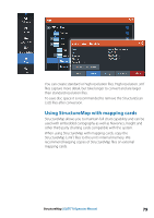
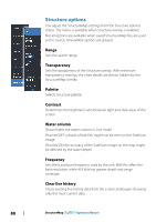
area are required, the maps should be put on separate memory cards. StructureMap tips • To get a picture of taller structures (a wreck, etc.) - do not drive over it, instead, steer the boat so the structure is on the left or right side of your vessel. • Do not use Autorange when using StructureScan. Set your structure range to a significantly greater level (two-to-three times) than the water depth to ensure a complete scan and to maximize conversion accuracy. • Do not overlap history trails when conducting a side-by-side scan of an area. Recording StructureScan data StructureScan data can be recorded from a chart panel with Structure overlay enabled. StructureScan recordings can also be started from a StructureScan panel. When StructureScan data is being recorded, there is a flashing red symbol and a message appears periodically at the bottom of the screen. Ú Note: The message includes information about file size. Keep the size of your logs to 100MB or less to allow for faster file conversion. The recording is stopped by re-selecting the record function. Converting StructureScan data to StructureMap format A StructureScan log file (.sl2) is converted to StructureMap format (.smf ) after recording from the recording dialog, or from the files browser. 78 StructureMap | ELITE Ti Operator Manual
-
 1
1 -
2
-
3
-
4
-
5
-
6
-
7
-
8
-
9
-
10
-
11
-
12
-
13
-
14
-
15
-
16
-
17
-
18
-
19
-
20
-
21
-
22
-
23
-
24
-
25
-
26
-
27
-
28
-
29
-
30
-
31
-
32
-
33
-
34
-
35
-
36
-
37
-
38
-
39
-
40
-
41
-
42
-
43
-
44
-
45
-
46
-
47
-
48
-
49
-
50
-
51
-
52
-
53
-
54
-
55
-
56
-
57
-
58
-
59
-
60
-
61
-
62
-
63
-
64
-
65
-
66
-
67
-
68
-
69
-
70
-
71
-
72
-
 73
73 -
 74
74 -
 75
75 -
 76
76 -
 77
77 -
 78
78 -
 79
79 -
 80
80 -
 81
81 -
 82
82 -
 83
83 -
84
-
85
-
86
-
87
-
88
-
89
-
90
-
91
-
92
-
93
-
94
-
95
-
96
-
97
-
98
-
99
-
100
-
101
-
102
-
103
-
104
-
105
-
106
-
107
-
108
-
109
-
110
-
111
-
112
-
113
-
114
-
115
-
116
-
117
-
118
-
119
-
120
-
121
-
122
-
123
-
124
-
125
-
126
-
127
-
128
-
129
-
130
 |
 |
