Pioneer AVIC-U250 Owner's Manual - Page 22
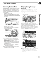
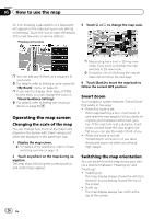
How to read the map screen, How to use the map
 |
View all Pioneer AVIC-U250 manuals
Add to My Manuals
Save this manual to your list of manuals |
Page 22 highlights
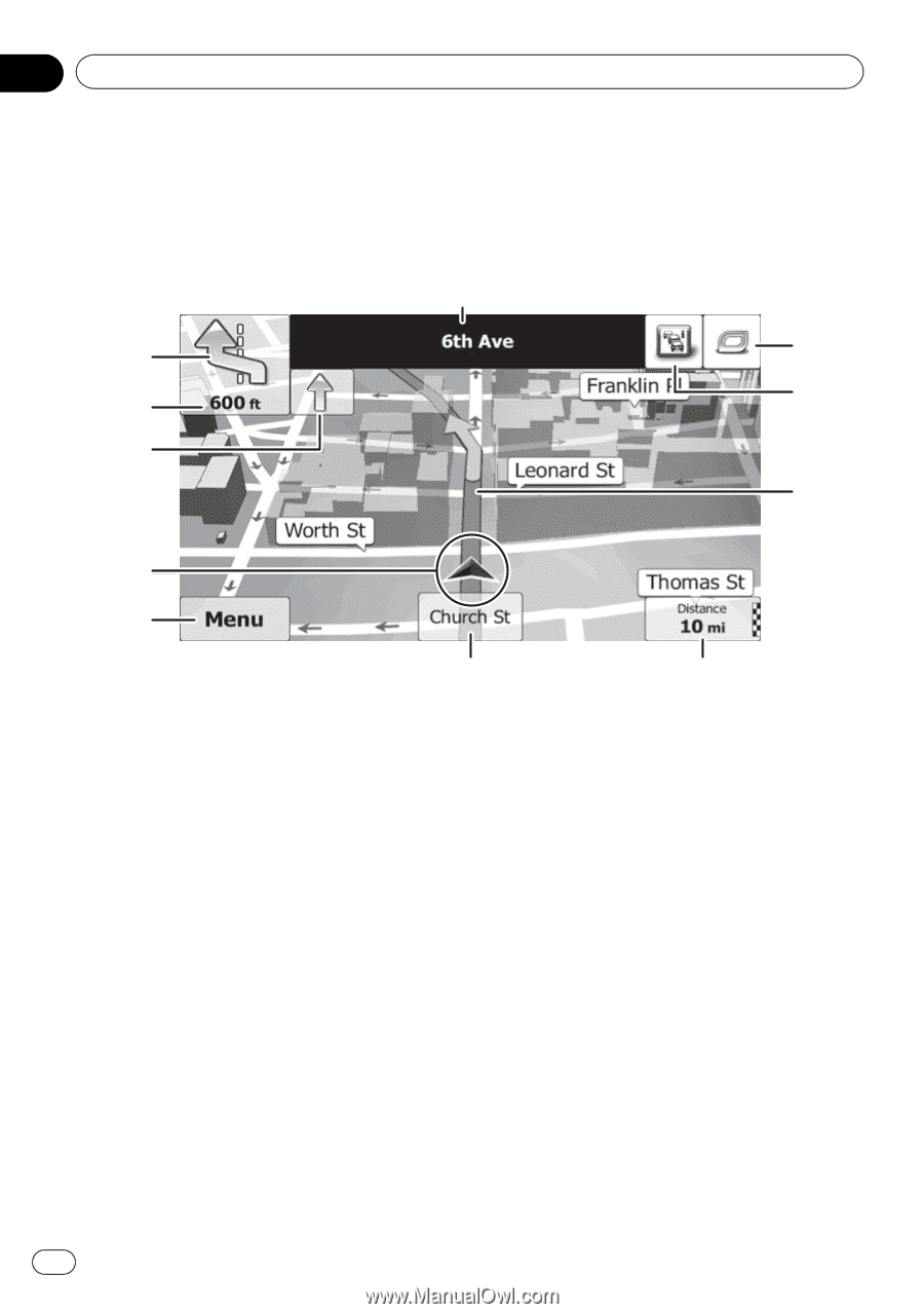
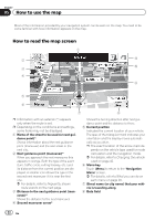
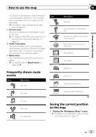
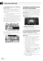
Chapter 05 How to use the map Most of the information provided by your navigation system can be seen on the map. You need to become familiar with how information appears on the map. How to read the map screen 1 2 b a 3 4 9 5 6 7 8 p Information with an asterisk (*) appears only when the route is set. p Depending on the conditions and settings, some items may not be displayed. 1 Name of the street to be used (or next guidance point)* Shows information about the next guidance point (maneuver) and the next street or the next city. 2 Next guidance point (maneuver)* When you approach the next maneuver, this appears in orange. Both the type of the event (turn, traffic circle, exiting freeway, etc.) and its distance from the current position are displayed. A smaller icon shows the type of the second next maneuver if it is near the first one. = For details, refer to Frequently shown route events on the next page. 3 Distance to the next guidance point (maneuver)* Shows the distance to the next maneuver. 4 Second maneuver arrow* Shows the turning direction after next guidance point and the distance to there. 5 Current position Indicates the current location of your vehicle. The apex of the triangular mark indicates your orientation and the display moves automatically as you drive. p The exact location of the arrow mark de- pends on the vehicle type used for route calculation and the navigation mode. = For details, refer to Changing the vehicle used on page 42. 6 Menu key Touch [Menu] to return to the "Navigation Menu" screen. = For details, refer to What you can do on each menu on page 20. 7 Street name (or city name) that your vehicle is traveling along 8 Data field 22 En
-
 1
1 -
2
-
3
-
4
-
5
-
6
-
7
-
8
-
9
-
10
-
11
-
12
-
13
-
14
-
15
-
16
-
 17
17 -
 18
18 -
 19
19 -
 20
20 -
 21
21 -
 22
22 -
 23
23 -
 24
24 -
 25
25 -
 26
26 -
 27
27 -
28
-
29
-
30
-
31
-
32
-
33
-
34
-
35
-
36
-
37
-
38
-
39
-
40
-
41
-
42
-
43
-
44
-
45
-
46
-
47
-
48
-
49
-
50
-
51
-
52
-
53
-
54
-
55
-
56
-
57
-
58
-
59
-
60
-
61
-
62
-
63
-
64
-
65
-
66
-
67
-
68
-
69
-
70
-
71
-
72
-
73
-
74
-
75
-
76
 |
 |