2011 Ford Explorer MyFord Touch/MyLincoln Touch Supplement 3rd Printing - Page 65
2011 Ford Explorer Manual

Page 65 highlights
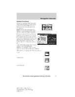
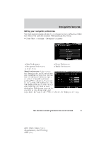
Navigation features Avoid Areas: Allows you to select areas which you would like the system to avoid when calculating a route for you. Press 'Add' to add a location from one of these categories to your avoid list My Home Favorites Previous Destinations Point of Interest (POI) Emergency Street Address Intersection City Center Map Once an avoid area is added, the system will try to avoid the area(s) if possible for all routes. To delete an avoid area, select its listing on the screen and when the screen changes to the Avoid Areas Edit screen (avoid area is displayed on a map) press the Delete button at the bottom right of the screen. MAP MODE To access map mode, press the green bar in the upper right area of the touchscreen. The map screen will display. Your system offers advanced map viewing comprised of both 2D city maps as well as 3D landmarks (when available). 2D city maps show detailed outlines of buildings, visible land use and land elements and detailed railway infrastructure for the most essential cities around the globe. These 2D city maps also contain primary features such as town blocks, building footprints, and railways. See End User License Agreement at the end of this book 65 2011 HMI-1 Gen 2 (fd1) Supplement, 3rd Printing USA (fus)
-
 1
1 -
2
-
3
-
4
-
5
-
6
-
7
-
8
-
9
-
10
-
11
-
12
-
13
-
14
-
15
-
16
-
17
-
18
-
19
-
20
-
21
-
22
-
23
-
24
-
25
-
26
-
27
-
28
-
29
-
30
-
31
-
32
-
33
-
34
-
35
-
36
-
37
-
38
-
39
-
40
-
41
-
42
-
43
-
44
-
45
-
46
-
47
-
48
-
49
-
50
-
51
-
52
-
53
-
54
-
55
-
56
-
57
-
58
-
59
-
 60
60 -
 61
61 -
 62
62 -
 63
63 -
 64
64 -
 65
65 -
 66
66 -
 67
67 -
 68
68 -
 69
69 -
 70
70 -
71
-
72
-
73
-
74
-
75
-
76
-
77
-
78
-
79
-
80
-
81
-
82
-
83
-
84
-
85
-
86
-
87
-
88
-
89
-
90
-
91
-
92
 |
 |
