Alpine M300 Om Nve-m300 En - Page 28
Updating Software, and Map Data - nve updates
 |
UPC - 793276100207
View all Alpine M300 manuals
Add to My Manuals
Save this manual to your list of manuals |
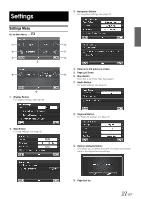
Page 28 highlights
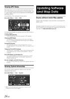
Viewing GPS Status This feature allows you to view GPS satellite signal information. You can view the dynamic location information received from satellite, such as, signal strength, compass (direction information), latitude/longitude, approximate altitude. An explanation of the messages is shown below. Go to Main Menu Info GPS Updating Software and Map Data Access software and/or Map updates Software and/or map updates can be accessed by connecting the NVEM300's to a PC. Download Update File and Tool to your PC from the Alpine web site. For details and the procedure for updating the software and map data, visit http://www.alpine-usa.com The following messages are displayed while the GPS receiver is tracking satellites: Locating GPS Satellites The NVE-M300 searches the sky looking for GPS satellites. Acquiring GPS Signal The NVE-M300 acquires positioning information transmitted from 1 to 3 tracked satellites while searching for more satellites (minimum 4 of needed). Fixing GPS Position The NVE-M300 requires continuous signals from 4 or more tracked satellites (for 30 seconds) in order to accurately fix your position. Temporary Poor GPS Coverage Thunderstorms, dense foliage or surrounding tall buildings may cause temporary loss of position fix (acceptable if under 30 seconds). Poor GPS Signal, Lost Position Fix You may have entered an area where consistently poor GPS signal (lasting 30 seconds or more) makes it impossible to maintain a position fix. No Line of Sight, Lost GPS Tracking You are in an area where line of sight to GPS satellites has been blocked. Viewing System Information You can check software application, database version, and other information on this screen. Go to Main Menu Info System • Make a note of this information and refer to it whenever you communicate with customer support. 26-EN
-
 1
1 -
2
-
3
-
4
-
5
-
6
-
7
-
8
-
9
-
10
-
11
-
12
-
13
-
14
-
15
-
16
-
17
-
18
-
19
-
20
-
21
-
22
-
 23
23 -
 24
24 -
 25
25 -
 26
26 -
 27
27 -
 28
28 -
 29
29 -
 30
30
 |
 |
