Garmin GPS 48 Owner's Manual - Page 28
Setup Windows
 |
UPC - 753759007553
View all Garmin GPS 48 manuals
Add to My Manuals
Save this manual to your list of manuals |
Page 28 highlights
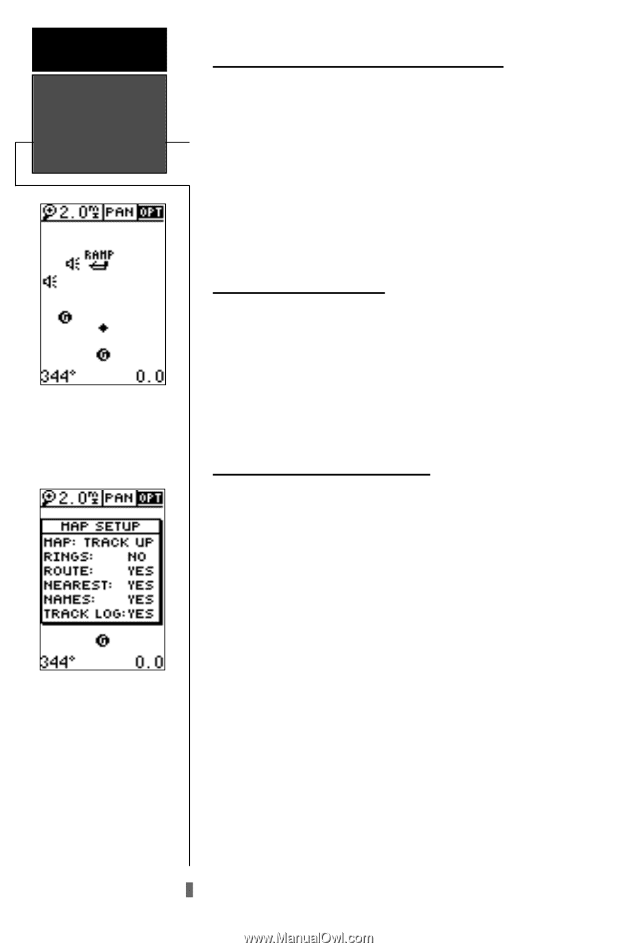
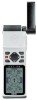
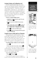
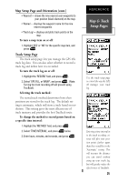
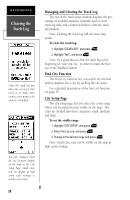
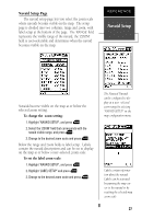
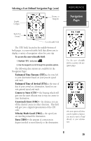
REFERENCE Setup Windows The 'OPT' field gives access to the map setup pages, right from the Map Page. The Map Page's default screen orientation is track up. "Track Up" means that your current direction of travel is always up (or towards the top of) the screen. It can also be set for north up or desired track up orientation. 24 Using the Cursor to Mark and Go to (cont.) You can activate a direct GOTO to any user waypoint or navaid displayed on the map. To GOTO a user waypoint or navaid: 1. Highlight the user waypoint or navaid by panning the map cursor to the point and press E. 2. Press Gthen Eto begin navigation. To stop the panning function: 1. Press Q. Accessing Setup Windows You can access five additional pages-the map setup, track setup, find city, city steup and the navaid steup pages-by highlighting the 'OPT' field at the top right of the Map Page, and pressing E. A menu will appear allowing you to select one of the features. To select a setup window: 1. Highlight the desired option, and press E. Map Setup Page and Orientation The map setup page lets you select the Map Page and satellite sky view (see pg. 14) orientation, as well as specify what items are displayed. The Map and Satellite Pages may be oriented to 'NORTH UP,' 'TRACK UP' (the direction of current travel), or 'DTK UP' (desired track up, or the direction of travel to stay on course). The default setting is track up. To change the map orientation: 1. Highlight the 'map' field, and press E. 2. Select the desired orientation, and press E. Note: Selecting the 'DTK UP' option will set the satellite sky view to track up orientation. The rest of the map setup page lets you specify what items are displayed or plotted on the Map Page by selecting 'YES' or 'NO' in the appropriate field. • 'Rings'- displays the three present position range rings on the map. • 'Route'- plots the straight-leg lines between waypoints of an active route and displays all route waypoint names.
-
 1
1 -
2
-
3
-
4
-
5
-
6
-
7
-
8
-
9
-
10
-
11
-
12
-
13
-
14
-
15
-
16
-
17
-
18
-
19
-
20
-
21
-
22
-
 23
23 -
 24
24 -
 25
25 -
 26
26 -
 27
27 -
 28
28 -
 29
29 -
 30
30 -
 31
31 -
 32
32 -
 33
33 -
34
-
35
-
36
-
37
-
38
-
39
-
40
-
41
-
42
-
43
-
44
-
45
-
46
-
47
-
48
-
49
-
50
-
51
-
52
-
53
-
54
-
55
-
56
-
57
-
58
-
59
-
60
-
61
-
62
-
63
-
64
-
65
-
66
-
67
-
68
-
69
-
70
-
71
-
72
-
73
-
74
 |
 |