Garmin GPS 48 Owner's Manual - Page 8
Navigation, Basics
 |
UPC - 753759007553
View all Garmin GPS 48 manuals
Add to My Manuals
Save this manual to your list of manuals |
Page 8 highlights
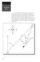
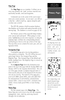
INTRODUCTION Navigation Basics The GPS 48 provides steering guidance and navigation information using degrees, a measurement measured in a clockwise direction from a north reference. North is described as 000º, east as 090º, south as 180º, and west as 270º. The diagram and compass rose below provide a graphic illustration of the navigation terms used by the GPS 48. More information on basic navigation and GPS are available at your local library or bookstore. "ACTIVE TO" WAYPOINT DISTANCE "ACTIVE LEG" GROUND SPEED NORTH DTK "ACTIVE FROM" WAYPOINT 4 CROSSTRACK ERROR NORTH BRG TRK
-
 1
1 -
2
-
 3
3 -
 4
4 -
 5
5 -
 6
6 -
 7
7 -
 8
8 -
 9
9 -
 10
10 -
 11
11 -
 12
12 -
 13
13 -
14
-
15
-
16
-
17
-
18
-
19
-
20
-
21
-
22
-
23
-
24
-
25
-
26
-
27
-
28
-
29
-
30
-
31
-
32
-
33
-
34
-
35
-
36
-
37
-
38
-
39
-
40
-
41
-
42
-
43
-
44
-
45
-
46
-
47
-
48
-
49
-
50
-
51
-
52
-
53
-
54
-
55
-
56
-
57
-
58
-
59
-
60
-
61
-
62
-
63
-
64
-
65
-
66
-
67
-
68
-
69
-
70
-
71
-
72
-
73
-
74
 |
 |
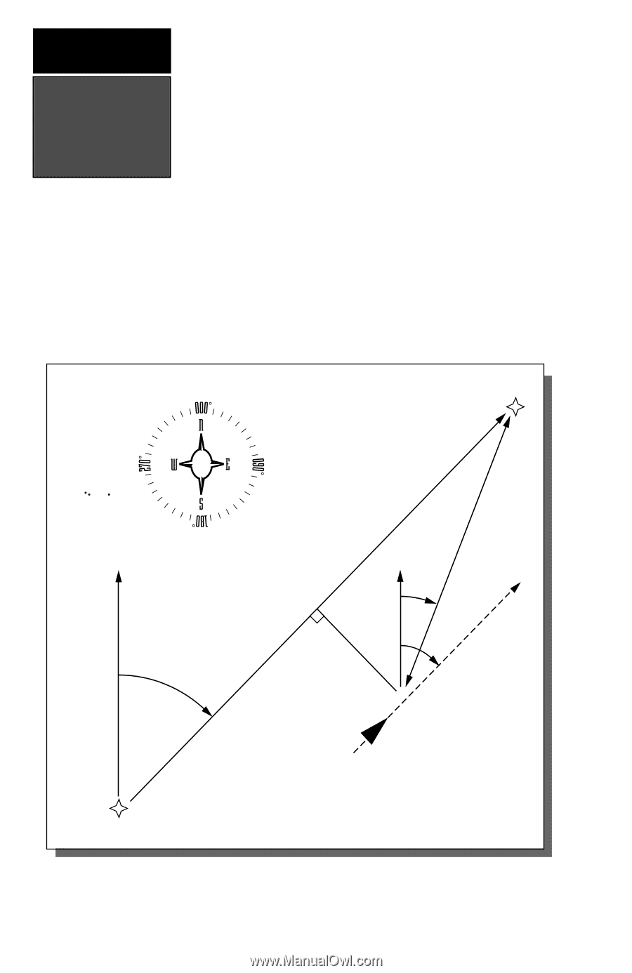
NORTH
“ACTIVE FROM”
WAYPOINT
NORTH
DTK
CROSSTRACK ERROR
BRG
TRK
GROUND SPEED
DISTANCE
“ACTIVE TO”
WAYPOINT
“ACTIVE LEG”
Navigation
Basics
INTRODUCTION
4
The GPS 48 provides steering guidance and navigation
information using degrees, a measurement measured in a
clockwise direction from a north reference. North is described
as 000º, east as 090º, south as 180º, and west as 270º. The
diagram and compass rose below provide a graphic illustration
of the navigation terms used by the GPS 48. More information
on basic navigation and GPS are available at your local library
or bookstore.