Garmin GPSMAP 4208 Owner's Manual - Page 66
Viewing Fishing Information, Understanding Surface Winds, Understanding Wave Height
 |
UPC - 753759066048
View all Garmin GPSMAP 4208 manuals
Add to My Manuals
Save this manual to your list of manuals |
Page 66 highlights
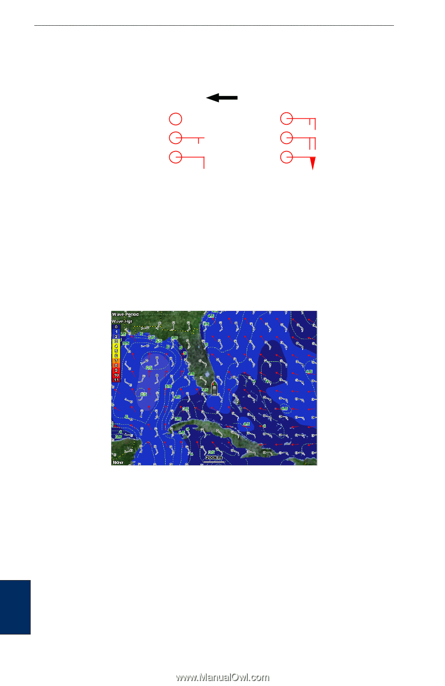
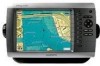
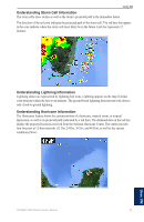
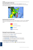
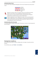
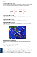
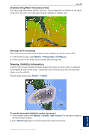
Using XM Understanding Surface Winds Wind barbs indicate from which direction the wind is coming. The wind barb is a circle with a tail. Wind speed is indicated by the different combination of flags that are attached to the tail. Wind Direction Calm 5 knots 10 knots 15 knots 20 knots 50 knots Understanding Wave Height The Wave Height feature shows wave heights. The wave heights for an area are shown in color intensities. Understanding Wave Period The Wave Period feature provides the time (in seconds) between successive waves. Understanding Wave Direction The Wave Direction feature shows the direction in which a wave is moving, as indicated by the direction of the red arrow. Viewing Fishing Information The Fishing view contains current water temperature, surface pressure conditions, and fishing forecasts. From the Home screen, select Weather > Fishing. Understanding Surface Pressure This feature shows pressure isobars and pressure centers. The isobars connect points of equal pressure. Pressure readings can help determine weather and wind conditions in an area. High pressure areas are generally associated with fair weather. Low pressure areas are generally associated with clouds and the chance of precipitation. Isobars packed closely together show a strong pressure gradient. Strong pressure gradients are associated with areas of stronger winds. Pressure units are shown in Millibars (mb), Inches of Mercury (in), and Hectopascals (hPa). 62 GPSMAP 4000 Series Owner's Manual Using XM
-
 1
1 -
2
-
3
-
4
-
5
-
6
-
7
-
8
-
9
-
10
-
11
-
12
-
13
-
14
-
15
-
16
-
17
-
18
-
19
-
20
-
21
-
22
-
23
-
24
-
25
-
26
-
27
-
28
-
29
-
30
-
31
-
32
-
33
-
34
-
35
-
36
-
37
-
38
-
39
-
40
-
41
-
42
-
43
-
44
-
45
-
46
-
47
-
48
-
49
-
50
-
51
-
52
-
53
-
54
-
55
-
56
-
57
-
58
-
59
-
60
-
 61
61 -
 62
62 -
 63
63 -
 64
64 -
 65
65 -
 66
66 -
 67
67 -
 68
68 -
 69
69 -
 70
70 -
 71
71 -
72
-
73
-
74
-
75
-
76
-
77
-
78
-
79
-
80
-
81
-
82
-
83
-
84
 |
 |