Garmin GPSMAP 5215 Owner's Manual - Page 40
Configuring the Device, Configuring System Settings, Changing the System Language - gps
 |
View all Garmin GPSMAP 5215 manuals
Add to My Manuals
Save this manual to your list of manuals |
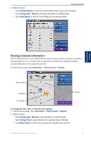
Page 40 highlights
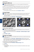
Configuring the Device Configuring the Device Use the Configure screen to configure chartplotter settings. Configuring System Settings From the Home screen, touch Configure > System. Simulator-turn Simulator Mode On or Off. Touch Setup to set Simulator options. (If you set the chartplotter into a Store Demonstration mode during the initial chartplotter setup, this setting is named Demo.) Auto Power Up (GPSMAP 5215 only)-turn Auto Power Up On or Off. When On is selected, the chartplotter automatically turns on whenever power is applied. When Off is selected, the chartplotter must be turned on with the Power key. Note: If Auto Power Up is On and the chartplotter is turned off using the Power key, and power is removed and then reapplied within less than 2 minutes, you may have to press the Power key to restart the chartplotter. Beeper/Display-set Beeper options, Backlight, and Color Mode. • Beeper-touch Beeper to set when the chartplotter makes audible sounds. The settings are Off, Alarms Only (default), and Key and Alarm (keys and alarms). • Backlight-touch Backlight to adjust the intensity of the backlight. Touch Auto to allow the chartplotter to automatically adjust the backlight based on ambient light. • Color Mode-touch Color Mode to select Day Colors or Night Colors, or touch Auto to allow the chartplotter to adjust the colors. • Screenshot Capture-turn the screenshot capture feature on or off (page 68). GPS-view GPS satellites. System Information-view system information, restore factory settings, view the status of networked devices (page 43), and display the event log. The event log displays a list of system events. Select the event to view additional information. The Save to Card option is provided as a troubleshooting tool; a Garmin Product Support representative may ask you to use this to retrieve data about the marine network. Radar Diagnostics (if radar is connected)-a troubleshooting tool used by installers. Configuring the Device Changing the System Language 1. From the Home screen, touch Configure > Preferences > Language. 2. Select the language. Configuring Navigation Preferences From the Home screen, touch Configure > Preferences > Navigation. Route Labels-for saved routes, this determines whether route turns are indicated by number (Turn 1, Turn 2, and so on) or by waypoint name, or whether the description of turns is hidden. Turn Transition-set how much time or how far before a turn in a route that you transition to the next leg. Raising this value can help improve the accuracy of the autopilot when navigating a route or automatic-guidance line with many frequent turns or at higher speeds. For straighter routes or slower speeds, lowering this value can improve autopilot accuracy. 36 GPSMAP 5000 Series Owner's Manual
-
 1
1 -
2
-
3
-
4
-
5
-
6
-
7
-
8
-
9
-
10
-
11
-
12
-
13
-
14
-
15
-
16
-
17
-
18
-
19
-
20
-
21
-
22
-
23
-
24
-
25
-
26
-
27
-
28
-
29
-
30
-
31
-
32
-
33
-
34
-
 35
35 -
 36
36 -
 37
37 -
 38
38 -
 39
39 -
 40
40 -
 41
41 -
 42
42 -
 43
43 -
 44
44 -
 45
45 -
46
-
47
-
48
-
49
-
50
-
51
-
52
-
53
-
54
-
55
-
56
-
57
-
58
-
59
-
60
-
61
-
62
-
63
-
64
-
65
-
66
-
67
-
68
-
69
-
70
-
71
-
72
-
73
-
74
-
75
-
76
-
77
-
78
-
79
-
80
-
81
-
82
-
83
-
84
 |
 |
