Garmin Oregon 450 Owner's Manual - Page 24
ShArinG InformAtion, Wirelessly - geocaching
 |
UPC - 753759100537
View all Garmin Oregon 450 manuals
Add to My Manuals
Save this manual to your list of manuals |
Page 24 highlights
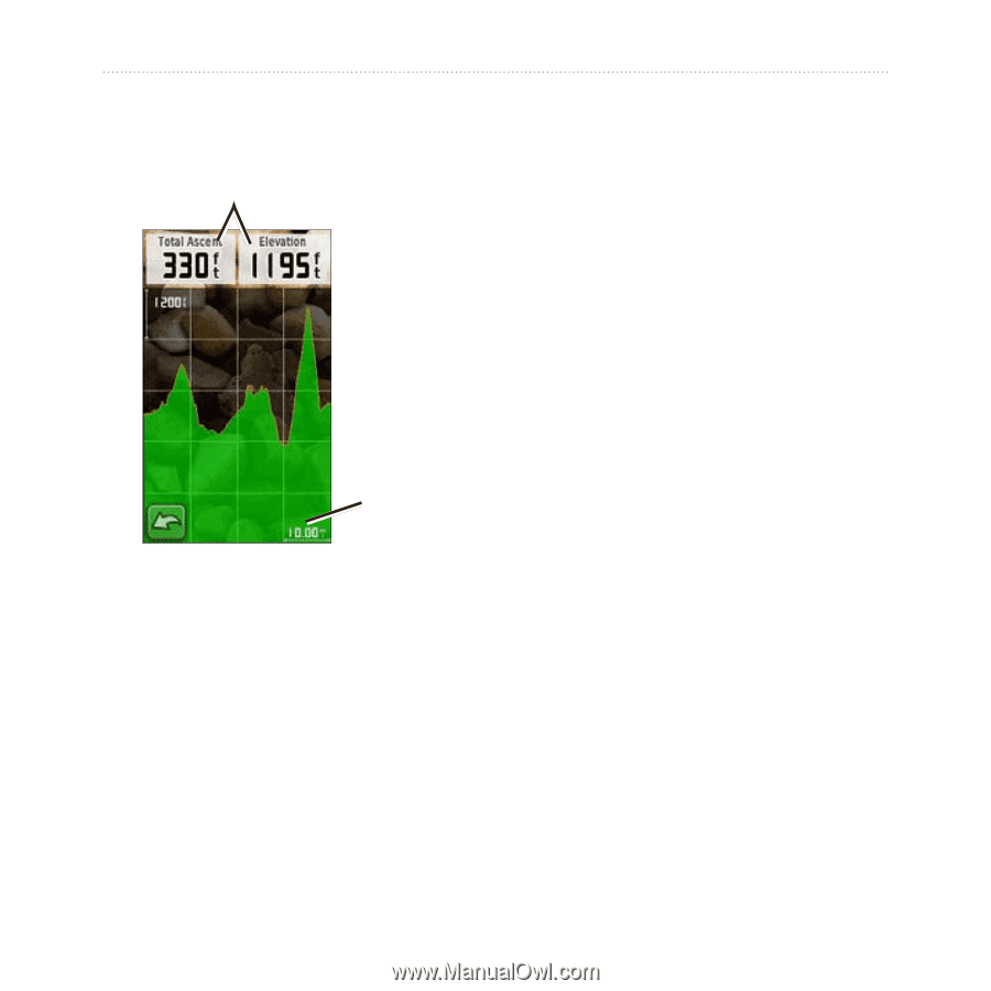
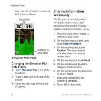
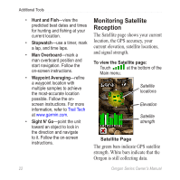
Additional Tools date, and the elevation recorded at that point are shown. Data fields Distance or time scale Elevation Plot Page Changing the Elevation Plot Data Fields 1. Touch Elevation Plot > one of the data fields. 2. Touch a data type at the top of the screen. 3. Select the data type from the list of options. Sharing Information Wirelessly The Oregon can wirelessly share waypoints, routes, tracks, and geocaches with another wirelessenabled Garmin recreational device. 1. Place the units within 10 feet (3 meters) of each other. 2. On the Main menu of both units, touch Share Wirelessly. 3. On the receiving unit, touch Receive. The receiving unit indicates when it is ready to receive data. 4. On the sending unit, touch Send. 5. On the sending unit, touch the category of data to send. 6. On the sending unit, touch an item to send > Send. 7. Both units indicate that the transfer is complete. 8. Touch OK on both units. 18 Oregon Series Owner's Manual
-
 1
1 -
2
-
3
-
4
-
5
-
6
-
7
-
8
-
9
-
10
-
11
-
12
-
13
-
14
-
15
-
16
-
17
-
18
-
 19
19 -
 20
20 -
 21
21 -
 22
22 -
 23
23 -
 24
24 -
 25
25 -
 26
26 -
 27
27 -
 28
28 -
 29
29 -
30
-
31
-
32
-
33
-
34
-
35
-
36
-
37
-
38
-
39
-
40
-
41
-
42
-
43
-
44
-
45
-
46
-
47
-
48
-
49
-
50
-
51
-
52
 |
 |