Garmin aera 560 Pilot's Guide - Page 187
Appendix J: Glossary
 |
View all Garmin aera 560 manuals
Add to My Manuals
Save this manual to your list of manuals |
Page 187 highlights
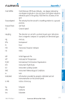
Overview Appendix J: Glossary ADIZ AGL AIRMET ARTCC ASOS ATC ATIS AWOS Air Defense Identification Zone Above Ground Level Airman's Meteorological Information Air Route Traffic Control Center Automated Surface Observing System Air Traffic Control Automatic Terminal Information Service Automated Weather Observing System Appendix J GPS Navigation Flight Planning Hazard Avoidance Additional Features Bearing The compass direction from the present position to a destination waypoint. ºC Calibrated Airspeed cm COM Course Course to Steer Crosstrack Error degrees Celsius Indicated airspeed corrected for installation and instrument errors. centimeter communication radio The line between two points to be followed by the aircraft. The recommended direction to steer in order to reduce course error or stay on course. Provides the most efficient heading to get back to the desired course and proceed along the flight plan. The distance the aircraft is off a desired course in either direction, left or right. Appendices Index dBZ deg Desired Track DIS 190-01117-02 Rev. A decibels 'Z' (radar return) degree The desired course between the active "from" and "to" waypoints. distance Garmin aera 500 Series Pilot's Guide 175
-
 1
1 -
2
-
3
-
4
-
5
-
6
-
7
-
8
-
9
-
10
-
11
-
12
-
13
-
14
-
15
-
16
-
17
-
18
-
19
-
20
-
21
-
22
-
23
-
24
-
25
-
26
-
27
-
28
-
29
-
30
-
31
-
32
-
33
-
34
-
35
-
36
-
37
-
38
-
39
-
40
-
41
-
42
-
43
-
44
-
45
-
46
-
47
-
48
-
49
-
50
-
51
-
52
-
53
-
54
-
55
-
56
-
57
-
58
-
59
-
60
-
61
-
62
-
63
-
64
-
65
-
66
-
67
-
68
-
69
-
70
-
71
-
72
-
73
-
74
-
75
-
76
-
77
-
78
-
79
-
80
-
81
-
82
-
83
-
84
-
85
-
86
-
87
-
88
-
89
-
90
-
91
-
92
-
93
-
94
-
95
-
96
-
97
-
98
-
99
-
100
-
101
-
102
-
103
-
104
-
105
-
106
-
107
-
108
-
109
-
110
-
111
-
112
-
113
-
114
-
115
-
116
-
117
-
118
-
119
-
120
-
121
-
122
-
123
-
124
-
125
-
126
-
127
-
128
-
129
-
130
-
131
-
132
-
133
-
134
-
135
-
136
-
137
-
138
-
139
-
140
-
141
-
142
-
143
-
144
-
145
-
146
-
147
-
148
-
149
-
150
-
151
-
152
-
153
-
154
-
155
-
156
-
157
-
158
-
159
-
160
-
161
-
162
-
163
-
164
-
165
-
166
-
167
-
168
-
169
-
170
-
171
-
172
-
173
-
174
-
175
-
176
-
177
-
178
-
179
-
180
-
181
-
 182
182 -
 183
183 -
 184
184 -
 185
185 -
 186
186 -
 187
187 -
 188
188 -
 189
189 -
 190
190 -
 191
191 -
 192
192 -
193
-
194
-
195
-
196
-
197
-
198
-
199
-
200
-
201
-
202
 |
 |
