Kenwood DNX875S Navigation - Page 13
Customizing the Map, Viewing Route Activity
 |
View all Kenwood DNX875S manuals
Add to My Manuals
Save this manual to your list of manuals |
Page 13 highlights
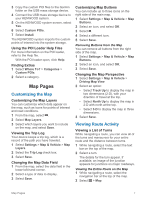
3 Copy the custom POI files to the Garmin folder on the USB mass storage device. 4 Connect the USB mass storage device to your KENWOOD system. 5 On the KENWOOD system screen, select Yes. 6 Select Custom POIs. 7 Select Install. The KENWOOD system imports the custom points of interest into the system storage. Using the POI Loader Help Files For more information on the POI loader, refer to the Help file. With the POI loader open, click Help. Finding Extras 1 Select Where To? > Categories > Custom POIs. 2 Select a category. Map Pages Customizing the Map Customizing the Map Layers You can customize which data appear on the map, such as icons for points of interest and road conditions. 1 From the map, select . 2 Select Map Layers. 3 Select which layers you want to include on the map, and select Save. Viewing the Trip Log Your device keeps a trip log, which is a record of the path you have traveled. 1 Select Settings > Map & Vehicle > Map Layers. 2 Select the Trip Log check box. 3 Select Save. Changing the Map Data Field 1 From the map, select the data field in the lower left-hand corner. 2 Select a type of data to display. 3 Select Save. Customizing Map Buttons You can include up to three icons on the right side of the main map. 1 Select Settings > Map & Vehicle > Map Buttons. 2 Select an icon, and select OK. 3 Select . 4 Select a different icon. 5 Select Save. Removing Buttons from the Map You can remove all buttons from the right side of the map. 1 Select Settings > Map & Vehicle > Map Buttons. 2 Select an icon, and select OK. 3 Select Save. Changing the Map Perspective 1 Select Settings > Map & Vehicle > Driving Map View. 2 Select an option: • Select Track Up to display the map in two dimensions (2-D), with your direction of travel at the top. • Select North Up to display the map in 2-D with north at the top. • Select 3-D to display the map in three dimensions. 3 Select Save. Viewing Route Activity Viewing a List of Turns While navigating a route, you can view all of the turns and maneuvers for your entire route and the distance between turns. 1 While navigating a route, select the text bar on the top of the map. 2 Select a turn. The details for the turn appear. If available, an image of the junction appears for junctions on major roadways. Viewing the Entire Route on the Map 1 While navigating a route, select the navigation bar at the top of the map. 2 Select > Map. Map Pages 7
-
 1
1 -
2
-
3
-
4
-
5
-
6
-
7
-
 8
8 -
 9
9 -
 10
10 -
 11
11 -
 12
12 -
 13
13 -
 14
14 -
 15
15 -
 16
16 -
 17
17 -
 18
18 -
19
-
20
-
21
-
22
 |
 |