Lowrance Elite-12 Ti Getting Started EN - Page 20
Waypoints, Routes, and Tracks, and Trails dialogs, Tools panel
 |
View all Lowrance Elite-12 Ti manuals
Add to My Manuals
Save this manual to your list of manuals |
Page 20 highlights
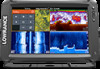
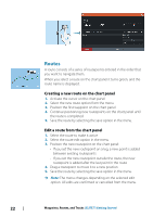
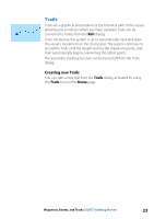
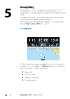
4 Waypoints, Routes, and Tracks Waypoints, Routes, and Trails dialogs The Waypoints, Routes, and Trails dialogs give access to advanced edit functions and settings for these items. The dialogs are accessed from the Tools panel on the Home page. Waypoints A waypoint is a user generated mark positioned on a chart, or on the Sonar image. Each waypoint has an exact position with latitude and longitude coordinates. A waypoint positioned on the Sonar image has a depth value, in addition to position information. A waypoint is used to mark a position you later may want to return to. Two or more waypoints can also be combined to create a route. 20 Waypoints, Routes, and Tracks | ELITE Ti Getting Started
-
 1
1 -
2
-
3
-
4
-
5
-
6
-
7
-
8
-
9
-
10
-
11
-
12
-
13
-
14
-
 15
15 -
 16
16 -
 17
17 -
 18
18 -
 19
19 -
 20
20 -
 21
21 -
 22
22 -
 23
23 -
 24
24 -
 25
25 -
26
-
27
-
28
-
29
-
30
-
31
-
32
-
33
-
34
-
35
-
36
-
37
-
38
-
39
-
40
-
41
-
42
-
43
-
44
-
45
-
46
-
47
-
48
 |
 |

Waypoints, Routes, and Tracks
Waypoints, Routes, and Trails dialogs
The Waypoints, Routes, and Trails dialogs give access to advanced
edit functions and settings for these items.
The dialogs are accessed from the
Tools panel
on the
Home
page.
Waypoints
A waypoint is a user generated mark positioned on a chart, or on
the Sonar image. Each waypoint has an exact position with latitude
and longitude coordinates. A waypoint positioned on the Sonar
image has a depth value, in addition to position information. A
waypoint is used to mark a position you later may want to return to.
Two or more waypoints can also be combined to create a route.
4
20
Waypoints, Routes, and Tracks
| ELITE Ti Getting Started